Photographs of early Kitimat and Alcan smelter. Souvenir photobook with five photos.
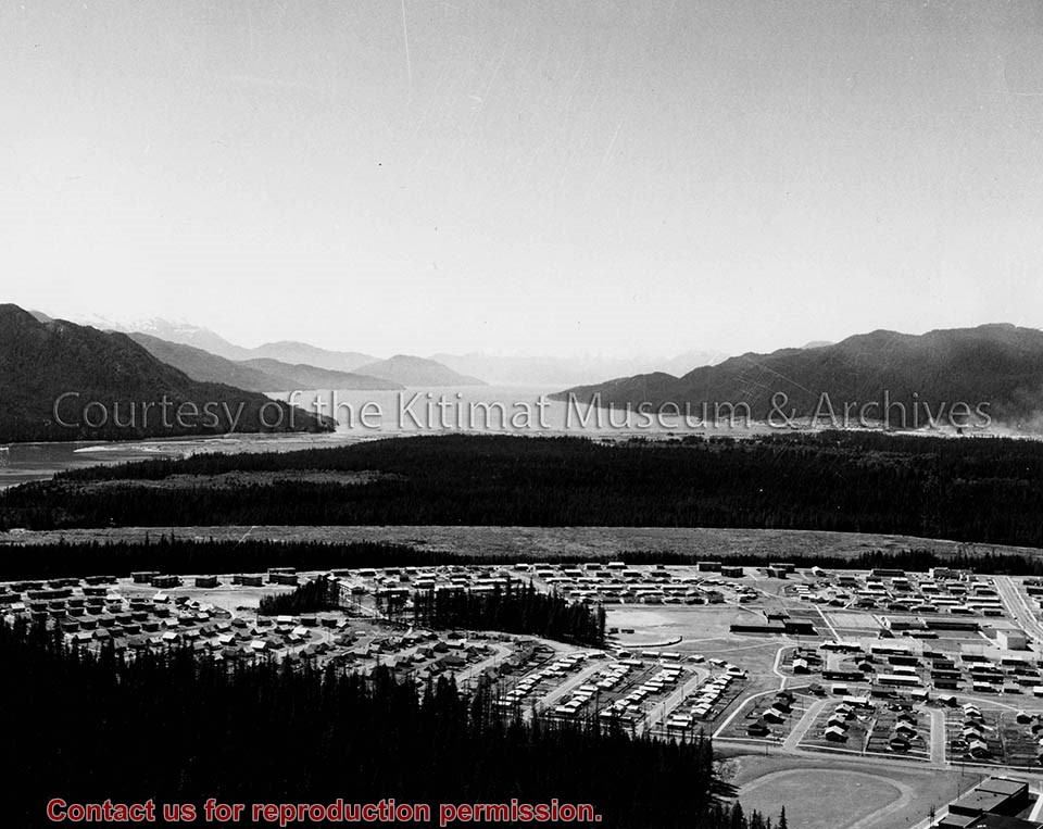
Townsite with Mount Elizabeth in background. Smoke is visible beyond townsite in the forest. May 15, 1956.
Townsite with sandhill visible in background. May 15, 1956.
Main Road - Motel - Townsite. View of road leading from service centre into town. Kildala area cleared but not much is built. Kitimat River bridge visible at bottom. Aug 1955.
Kitimat Valley. View of Alcan site, hospital beach, and pier. Looking north.
Smeltersite. View of Alcan smelter and smeltersite.
Donated by Carol Larson. Originally belonged to her mother, Lydia Strecheniuk.
Scope and Content
Photographs of early Kitimat and Alcan smelter. Souvenir photobook with five photos.
Townsite with Mount Elizabeth in background. Smoke is visible beyond townsite in the forest. May 15, 1956.
Townsite with sandhill visible in background. May 15, 1956.
Main Road - Motel - Townsite. View of road leading from service centre into town. Kildala area cleared but not much is built. Kitimat River bridge visible at bottom. Aug 1955.
Kitimat Valley. View of Alcan site, hospital beach, and pier. Looking north.
Smeltersite. View of Alcan smelter and smeltersite.
Black covered book titled "Kitimat Townsite Report". No. A-33 Mr. J.E. Dudley. Contains info about early Kitimat and planning. Inside front cover are some loose pages with town plans.
Bud Powell is a longtime resident of Kitimat and former smeltersite resident. He worked for Alcan.
Custodial History
Donated by Bud Powell.
Scope and Content
Black covered book titled "Kitimat Townsite Report". No. A-33 Mr. J.E. Dudley. Contains info about early Kitimat and planning. Inside front cover are some loose pages with town plans.
Photo depicts an aerial view of a portion of the Nechako neighbourhood showing the Hullah prototype area, Pintail and Partridge streets, in the foreground.
Photo depicts an aerial view of a portion of the Nechako neighbourhood showing the Hullah prototype area, Pintail and Partridge streets, in the foreground.
Notes
Title based on content of photograph. District of Kitimat Collection
Alice Dicker's father, Benard, came to Canada to work in 1955. He was a forman D-shift for Alcan. He married Anna in 1959. Alice and her sister Claudia were born in Kitimat and the family lived here until 1969, at which time they returned to Germany.
Scope and Content
Photograph of view of City Centre and Kildala neighbourhood.
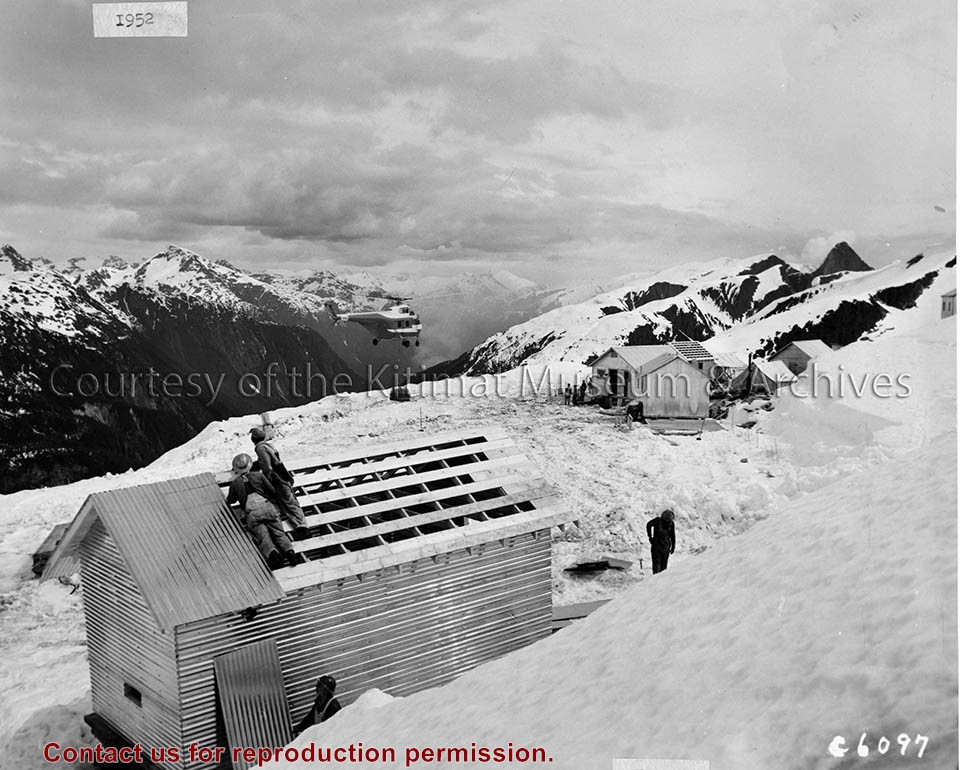
Photo depicts two workers looking on as a Sikorsky S-55 helicopter brings in a load of supplies to the transmission line camp atop Kildala Pass.
Notes
Photographed by the International Harverster Company, manufacturers of construction equipment purchased for the Project. Hal Whiting Collection 985.65.82
Alice Dicker's father, Benard, came to Canada to work in 1955. He was a foreman D-shift for Alcan. He married Anna in 1959. Alice and her sister Claudia were born in Kitimat and the family lived here until 1969, at which time they returned to Germany.
Scope and Content
Photograph of a man in a car, possibly Benard Dicker. Kitimat Townhomes in the background.
Photograph of possibly line 1 potline left where carbon paste plant is today. Recreational facilities + a bit of the hill on the right where the homes were. Also, water tower.
Photograph of possibly line 1 potline left where carbon paste plant is today. Recreational facilities + a bit of the hill on the right where the homes were. Also, water tower.
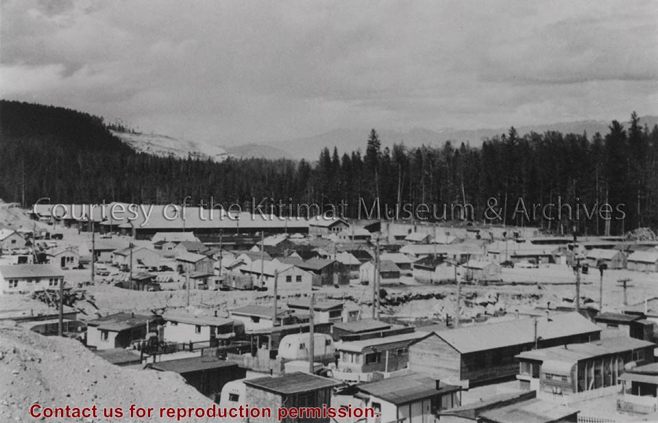
Photo depicts Nechako Neighbourhood, swath of land cleared for Neighbourhood "D", and Douglas Channel in the background, smelter on the right.
Notes
Famed Canadian documentary photographer Malak Karsh was hired in the 1950s by Alcan to take photographs of Arvida and Kitimat. Many were published in Alcan literature and textbooks on Canada. A colourized version of this photograph appears on the cover of the Canadian Geographical Journal, November 1959, Vol. LIX No.5. Northern Sentinel Press Collection
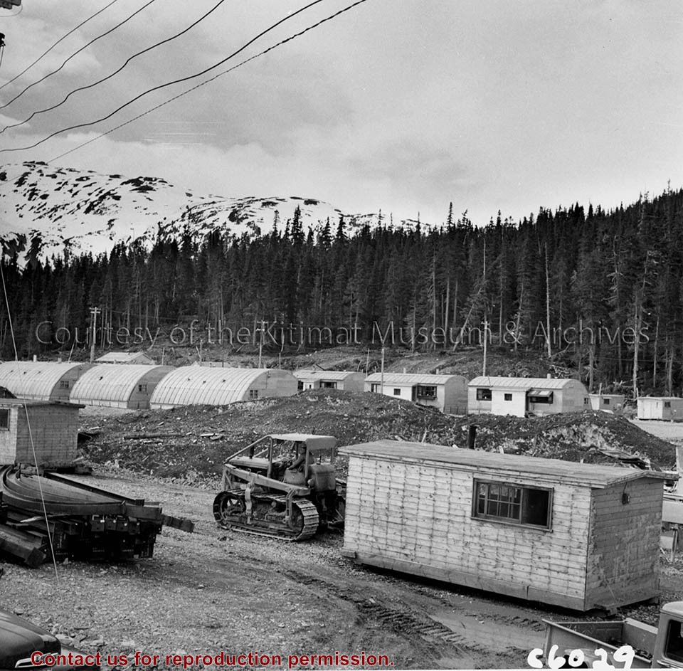
Photo depicts an International crawler hauling one of the temporary living quarters at Camp No. 5 in Kemano.
Notes
Title based on content of photograph. -- The International Harvester Company were manufacturers of construction equipment purchased for the Project. Hal Whiting Collection 985.65.77
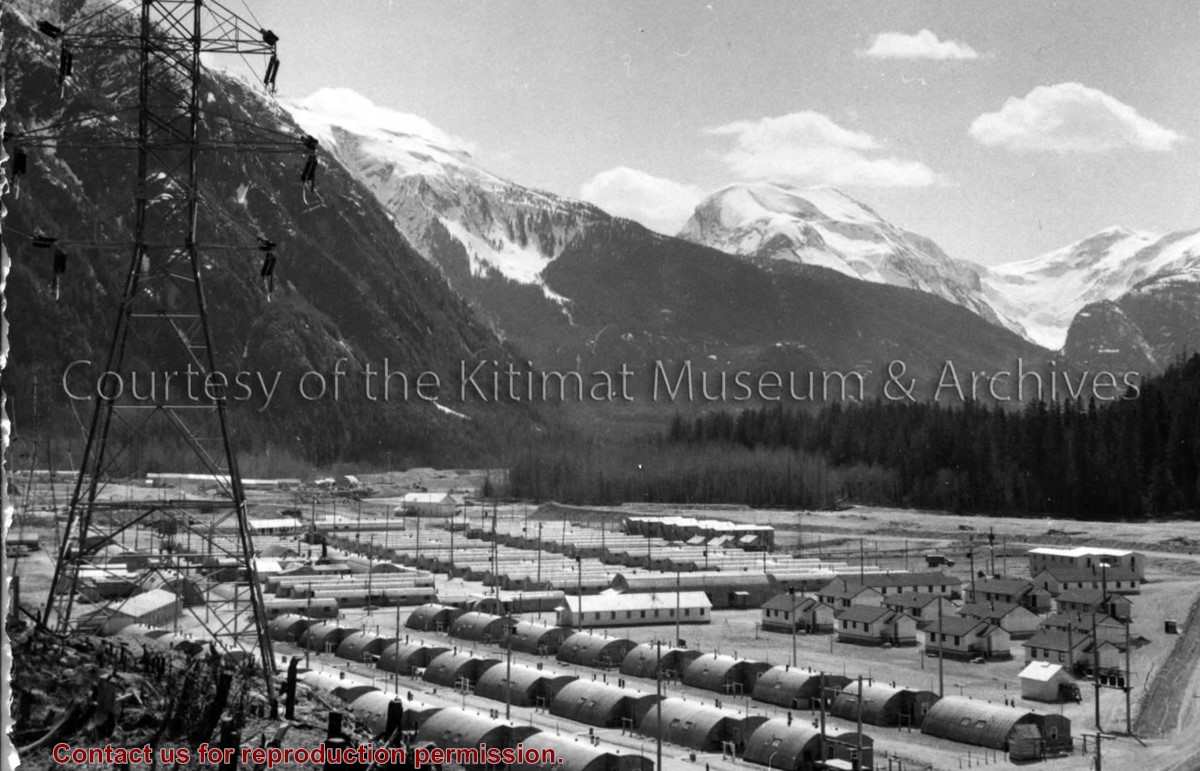
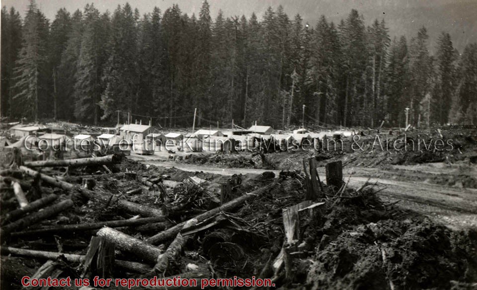
Photo depicts buildings at Anderson Hill Camp. Trailers and wash houses are in the foreground. The men's bunkhouses of Anderson Creek Camp are in the background.
Photo depicts buildings at Anderson Hill Camp. Trailers and wash houses are in the foreground. The men's bunkhouses of Anderson Creek Camp are in the background.
Notes
Title based on content of photograph. John Manders Collection
Base map of statistical area 6. The map shows Kitimat and surrounding coastal area. This map is a partial reproduction of the West Central British Columbia Base Map by Geographic Division, Surveys & Mapping Branch, Department of Lands, Forests, & Water Resources, Victoria, B.C. 1955-56.
Base map of statistical area 6. The map shows Kitimat and surrounding coastal area. This map is a partial reproduction of the West Central British Columbia Base Map by Geographic Division, Surveys & Mapping Branch, Department of Lands, Forests, & Water Resources, Victoria, B.C. 1955-56.