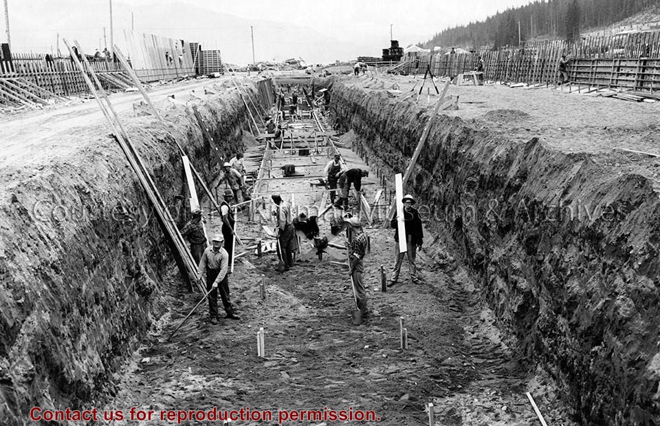
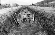
Photo depicts workers excavating for the construction of the alumina storage building.
Notes
Title based on content of photograph. -- Alcan ID No. BC-2-451. -- Sloping sides avoided cave-ins. -- Hal Whiting was Project Manager, Kitimat Constructors, for smelter and town construction. Hal Whiting Collection 985.65.267
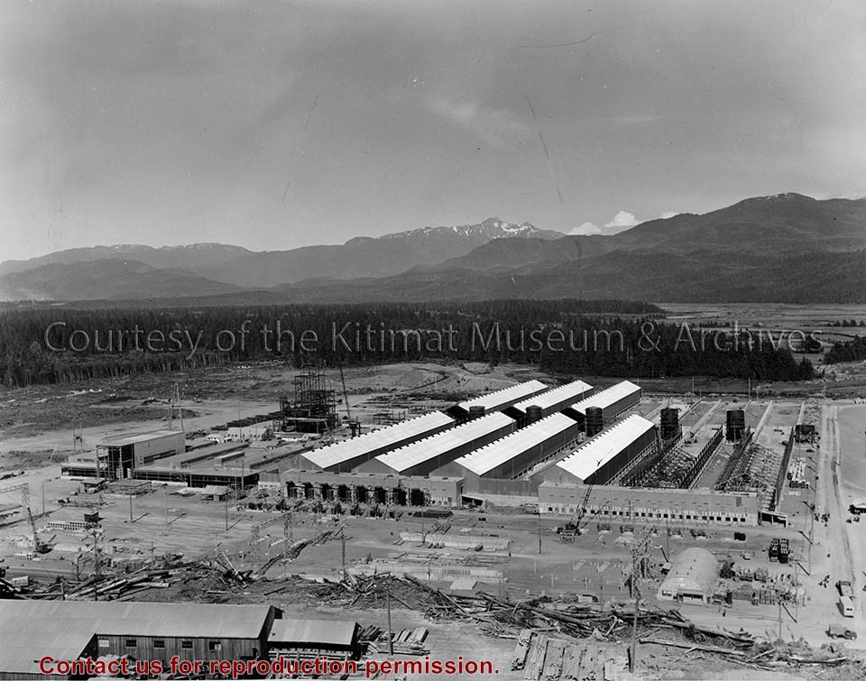
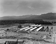
Photograph of smeltersite looking northeast, showing service buildings at left, rectifier building #102 and potline #2, pre-cast concrete yard in foreground.
Bud Powell is a longtime resident of Kitimat and former smeltersite resident. He worked for Alcan.
Custodial History
Donated by Bud Powell.
Scope and Content
Photograph of smeltersite looking northeast, showing service buildings at left, rectifier building #102 and potline #2, pre-cast concrete yard in foreground.
Photograph of view looking east showing progress of potline 2, alumina storage bins and sub-station 2. Area under construction, construction material in foreground.
Bud Powell is a longtime resident of Kitimat and former smeltersite resident. He worked for Alcan.
Custodial History
Donated by Bud Powell.
Scope and Content
Photograph of view looking east showing progress of potline 2, alumina storage bins and sub-station 2. Area under construction, construction material in foreground.
Photograph of showing the framing almost completed in Guest House No.2. Two men are visible working on it. Apartments visible behind, and townsite camp is to the left.
Donated by Jackie Worboys. Given to the Jackie Mufford Worboys family by Wally Melville.
Scope and Content
Photograph of showing the framing almost completed in Guest House No.2. Two men are visible working on it. Apartments visible behind, and townsite camp is to the left.
Photograph of gully crossing #2 showing the clearing contractor placing the dead and diseased trees at the base of the gully to stop any further earth slippage and improve the appearance of the area. Houses visble on hill behind.
Land clearing of Kitimat. All aerials for development.
Custodial History
From the files of Ray Hunstone. Photos from an Alcan binder, have Alcan numbers.
Scope and Content
Photograph of gully crossing #2 showing the clearing contractor placing the dead and diseased trees at the base of the gully to stop any further earth slippage and improve the appearance of the area. Houses visble on hill behind.
Photograph of linemen stringing cable on road 2 in neighbourhood A-II. Two men are working below and two other men are up on the pole. Another man is on the ground to the right. There are houses around, and a machine on the left.
Donated by Jackie Worboys. Given to the Jackie Mufford Worboys family by Wally Melville.
Scope and Content
Photograph of linemen stringing cable on road 2 in neighbourhood A-II. Two men are working below and two other men are up on the pole. Another man is on the ground to the right. There are houses around, and a machine on the left.
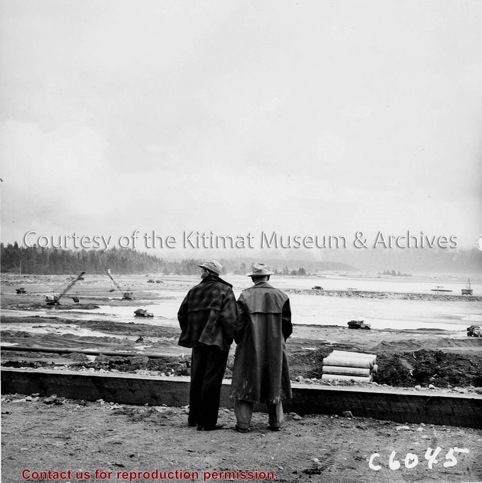
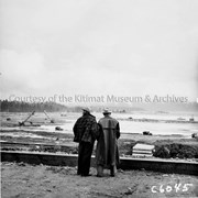
Photo depicts Kitimat Constructors Project Manager Hal Whiting on right, standing beside a unidentified man. Both watch the construction activity occurring down on the tidal flats in front of them, site for the smelter.
Photo depicts Kitimat Constructors Project Manager Hal Whiting on right, standing beside a unidentified man. Both watch the construction activity occurring down on the tidal flats in front of them, site for the smelter.
Notes
Title based on content of photograph. -- Photographed by the International Harvester Company, manufacturers of construction equipment purchased for the Project. Hal Whiting Collection 985.65.99
Photograph of view looking north-east over initial area cleared for smelter service building construction. Light area has been gravel filled, dark area overburden to be stripped. Trucks and machinery visible at work.
Bud Powell is a longtime resident of Kitimat and former smeltersite resident. He worked for Alcan.
Custodial History
Donated by Bud Powell.
Scope and Content
Photograph of view looking north-east over initial area cleared for smelter service building construction. Light area has been gravel filled, dark area overburden to be stripped. Trucks and machinery visible at work.
Photograph of aerial of hauling, levelling, and compacting of the fill in the smelter area. Looking South. Trucks and machines visible along with wheel tracks in the dirt.
Bud Powell is a longtime resident of Kitimat and former smeltersite resident. He worked for Alcan.
Custodial History
Donated by Bud Powell.
Scope and Content
Photograph of aerial of hauling, levelling, and compacting of the fill in the smelter area. Looking South. Trucks and machines visible along with wheel tracks in the dirt.
Photograph of #2 guest house showing installation of amdeck roofing. Three men visible working on the roof, one man is going down on a ladder, and another man is on the ground below. Building material is piled on the ground. Ground is very wet.
Donated by Jackie Worboys. Given to the Jackie Mufford Worboys family by Wally Melville.
Scope and Content
Photograph of #2 guest house showing installation of amdeck roofing. Three men visible working on the roof, one man is going down on a ladder, and another man is on the ground below. Building material is piled on the ground. Ground is very wet.
Photograph of one of the bridges on the No.2 electrical transmission line to the townsite. This bridge was swept away on the night of the 22nd and 23rd of Novemeber. Bridge is sitting in the river.
Donated by Jackie Worboys. Given to the Jackie Mufford Worboys family by Wally Melville.
Scope and Content
Photograph of one of the bridges on the No.2 electrical transmission line to the townsite. This bridge was swept away on the night of the 22nd and 23rd of Novemeber. Bridge is sitting in the river.
Photograph of looking east from highway showing site of laboratory bldg 273 with stake set at co-ordinates N 13550, E 3300. Coordinate stake? is circled in red. Area is clearcut. Boardwalk runs in front of cleared area.
Bud Powell is a longtime resident of Kitimat and former smeltersite resident. He worked for Alcan.
Custodial History
Donated by Bud Powell.
Scope and Content
Photograph of looking east from highway showing site of laboratory bldg 273 with stake set at co-ordinates N 13550, E 3300. Coordinate stake? is circled in red. Area is clearcut. Boardwalk runs in front of cleared area.