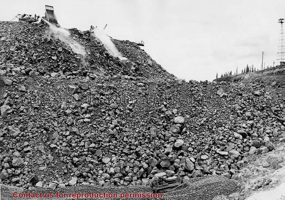
Photo depicts a International diesel TD-24 spreading a layer of large stones at the base of the Nechako Dam.
Notes
ID no. C 5927. -- Title based on content of photo. -- These layers of various size rock stone and clay will all slope towards the rock fill at about a 45 degree pitch. Official naming ceremony renamed dam the Kenney Dam. Hal Whiting Collection 985.65.56
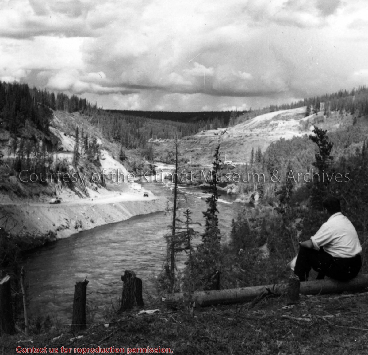
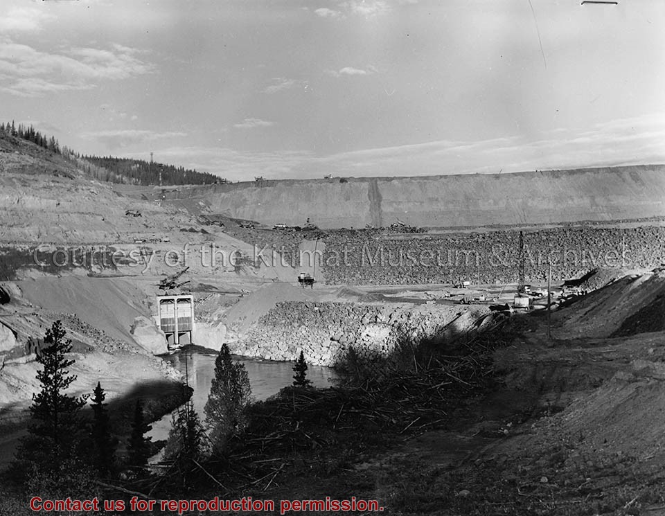
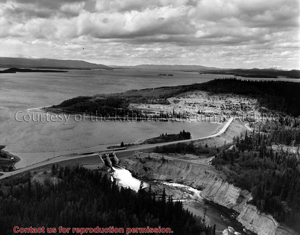
Photo depicts a unidentified man sitting on the Nechako River bank watching the the activities of construction of the dam at the canyon. Right bank stripping and left bank tunnel haul road shown.
Photo depicts a unidentified man sitting on the Nechako River bank watching the the activities of construction of the dam at the canyon. Right bank stripping and left bank tunnel haul road shown.
Notes
Title based on content of photo. -- A rock dam was chosen for its ability to withstand earthquakes. Morrison-Knudsen Company Collection
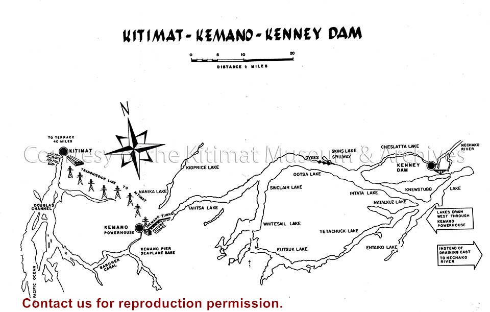
Illustration depicts the extent of the Project, from the Kenney Dam and reservoir area to the transmission line and smelter. The future tunnel or the Kemano Completion Project is also included.
Illustration depicts the extent of the Project, from the Kenney Dam and reservoir area to the transmission line and smelter. The future tunnel or the Kemano Completion Project is also included.
Notes
Illustration from Alcan's publication "Kitimat-Kemano, Five Years of Operation, 1954-1959". Alcan Collection
Photograph of fill material being placed on Lahakas Blvd. just north of Gyrfalcon St. This is part of the neighbourhood A-II major roads and is a minicipality responsibility. Dump truck dumping fill is on the left, and the driver has the door open and is looking out to the back.
Donated by Jackie Worboys. Given to the Jackie Mufford Worboys family by Wally Melville.
Scope and Content
Photograph of fill material being placed on Lahakas Blvd. just north of Gyrfalcon St. This is part of the neighbourhood A-II major roads and is a minicipality responsibility. Dump truck dumping fill is on the left, and the driver has the door open and is looking out to the back.
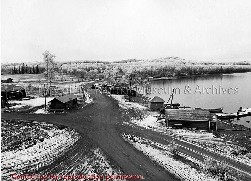
Photograph of looking N.E. at storage building area of hydraulic fill showing west half of area filled to elavation 20 feet. Stripping sarted again in pond area at right centre.
Bill was one of the superintendents with Saguenay Kitimat.
Custodial History
Donated by Joanna Gallacher
Scope and Content
Photograph of looking N.E. at storage building area of hydraulic fill showing west half of area filled to elavation 20 feet. Stripping sarted again in pond area at right centre.