Construction happening at city centre with a huge hole beside the Bank of Commerce. There is also a lot of construction equipment. The area in front of City Centre mall is boarded off and out of limits. City Centre Mall expansion construction.
1 photograph : b&w ; 10.4 x 12.6 cm
1 negative : b&w ; 9.9 x 12.5 cm
Scope and Content
Construction happening at city centre with a huge hole beside the Bank of Commerce. There is also a lot of construction equipment. The area in front of City Centre mall is boarded off and out of limits. City Centre Mall expansion construction.
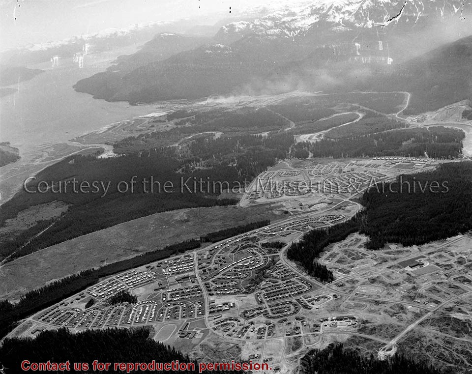
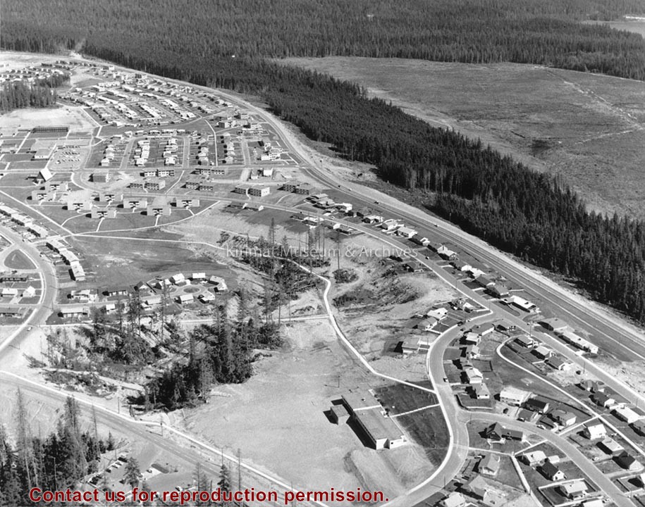
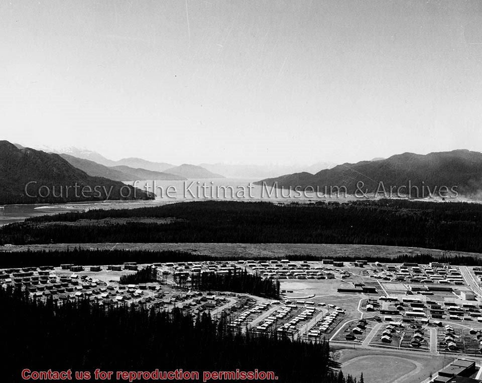
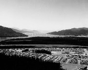
Photo depicts an aerial view of Kitimat, seen is land cleared for Neighbourhood "D" and the Whitesail neighbourhood under construction, right foreground. The Alcan smelter and channel are in the background.
Photo depicts an aerial view of Kitimat, seen is land cleared for Neighbourhood "D" and the Whitesail neighbourhood under construction, right foreground. The Alcan smelter and channel are in the background.
Notes
Title based on content of photograph. Max Patzelt Collection - 1998.1.8351
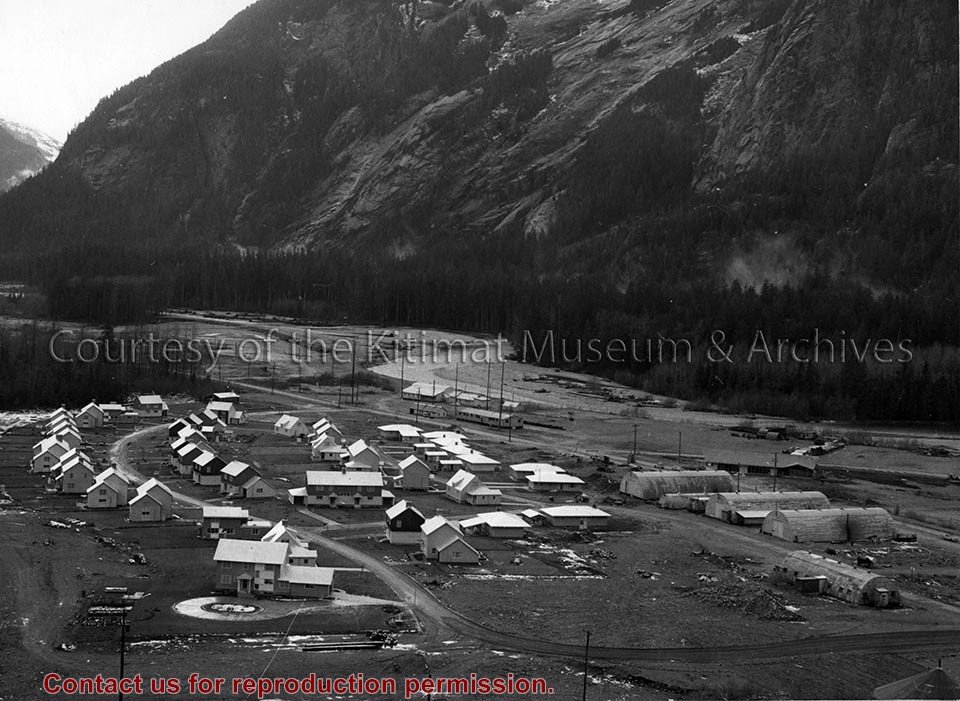
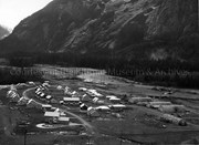
Photo depicts the permanent Kemano townsite at Camp No. 5. View is looking towards beach. Seen on the left are permanent homes for powerhouse staff. On the right are the temporary buildings known as quonset huts used during the construction years as crew quarters.
Photo depicts the permanent Kemano townsite at Camp No. 5. View is looking towards beach. Seen on the left are permanent homes for powerhouse staff. On the right are the temporary buildings known as quonset huts used during the construction years as crew quarters.
Notes
Title based on content of photograph. -- Alcan ID No. 2KR-298. -- Permanent housing construction began in 1957. Alcan Collection
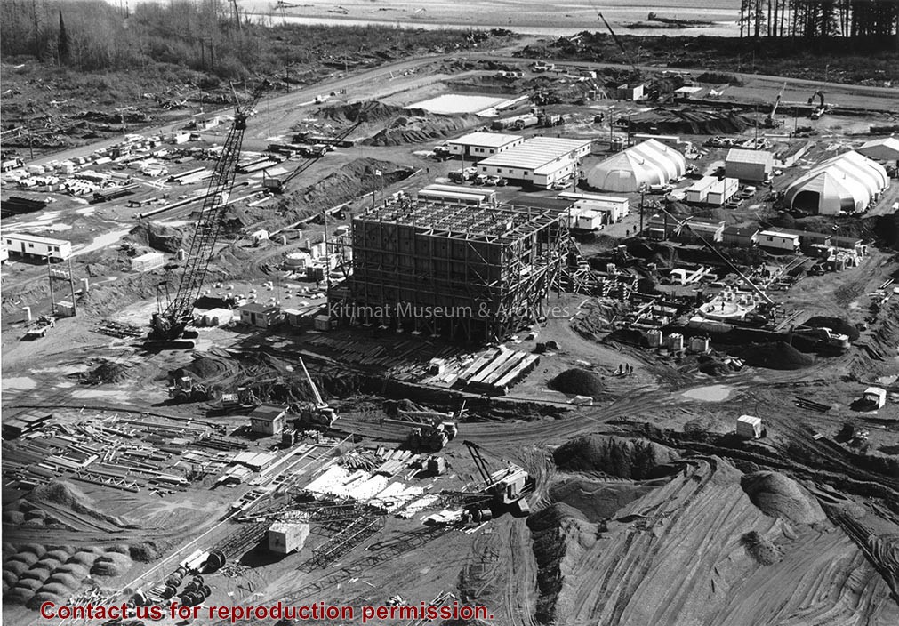
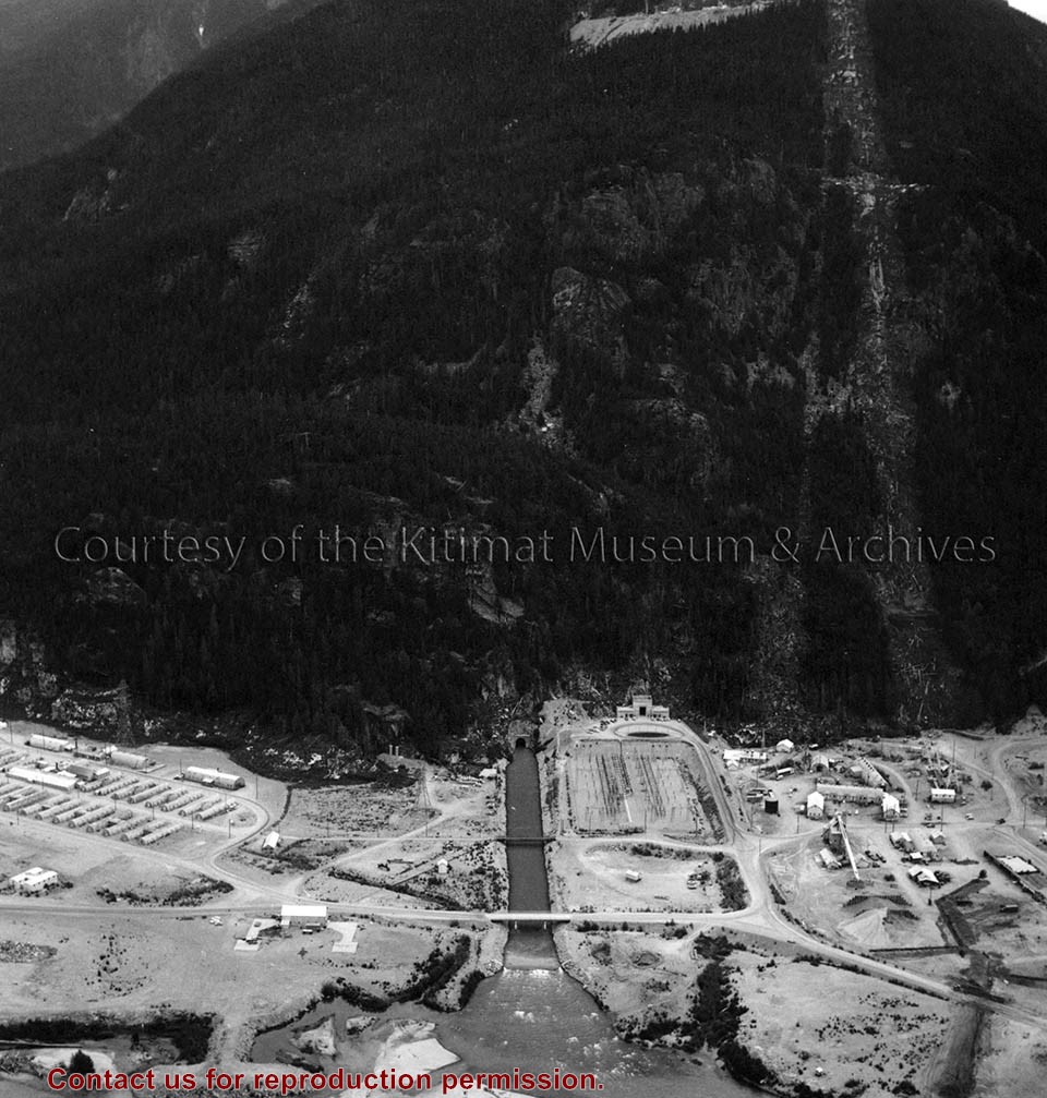
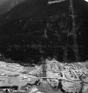
Photo depicts an aerial view of the powerhouse switchyard and entrance up to the 1600' level. The wide clearing on the right is the tram right-of-way. The powerhouse tailrace tunnel and channel and the access tunnel portal are in the centre, and the construction camp is on the left. Alcan Collection
Photo depicts an aerial view of the powerhouse switchyard and entrance up to the 1600' level. The wide clearing on the right is the tram right-of-way. The powerhouse tailrace tunnel and channel and the access tunnel portal are in the centre, and the construction camp is on the left. Alcan Collection
Rotary Club Soap Box Entry shows boy wearing a hard hat, seated in an aluminum foil covered Soap Box Cart 'Kitimat Rotary' is written on the side of cart. Station wagon and houses in background. Shop Easy in Nechako Centre.
1 photograph : b&w ; 25.4 x 20.3 cm
1 negative : b&w ; 5.9 x 6.1 cm
Scope and Content
Rotary Club Soap Box Entry shows boy wearing a hard hat, seated in an aluminum foil covered Soap Box Cart 'Kitimat Rotary' is written on the side of cart. Station wagon and houses in background. Shop Easy in Nechako Centre.
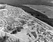
Photo depicts Nechako Neighbourhood, swath of land cleared for Neighbourhood "D", and Douglas Channel in the background, smelter on the right.
Notes
Famed Canadian documentary photographer Malak Karsh was hired in the 1950s by Alcan to take photographs of Arvida and Kitimat. Many were published in Alcan literature and textbooks on Canada. A colourized version of this photograph appears on the cover of the Canadian Geographical Journal, November 1959, Vol. LIX No.5. Northern Sentinel Press Collection
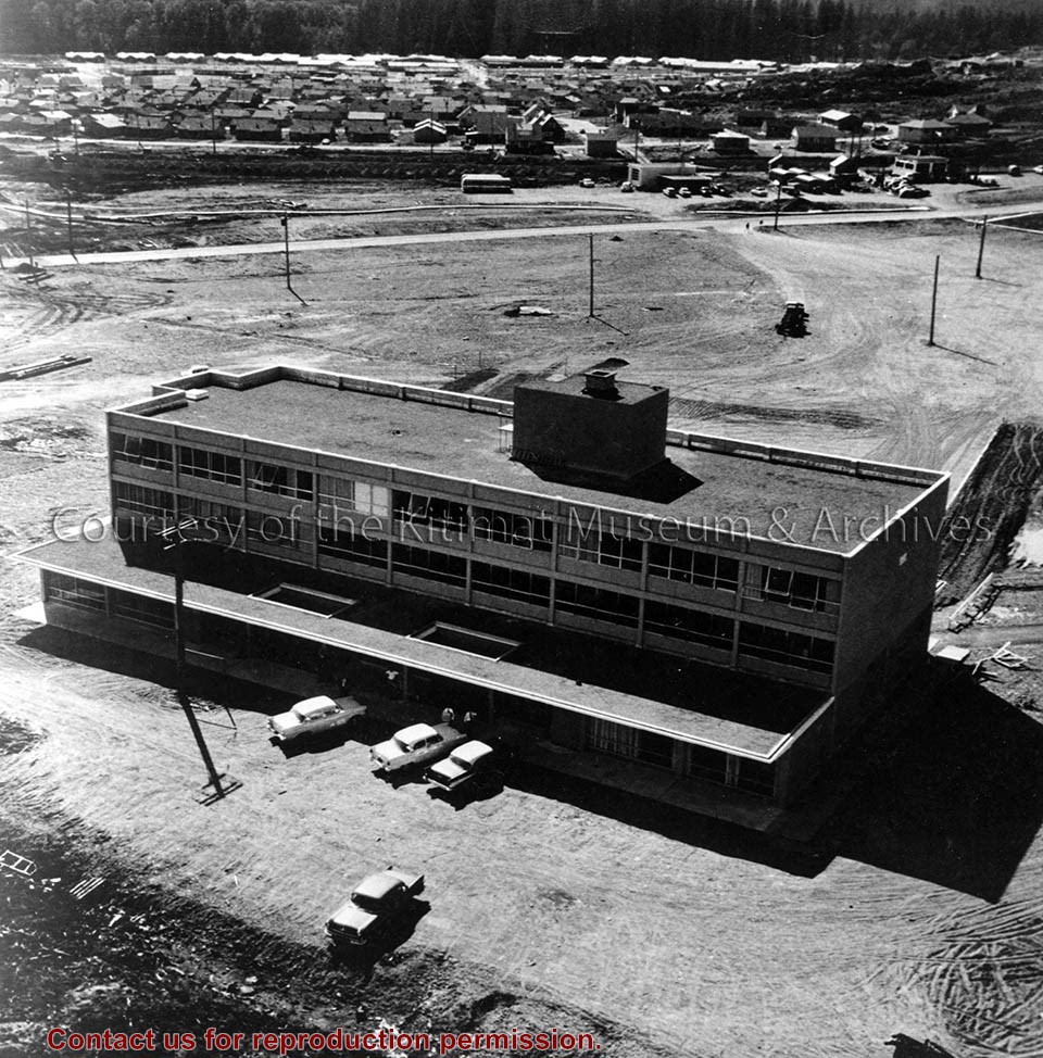
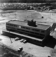
Aerial of Kitimat's office building in the downtown area. The Royal Bank of Canada occupied the main floor, and Property and Power Operations for the Aluminum Company of Canada occupied an upper floor. Kildala Neighbourhood is shown in the background.
Aerial of Kitimat's office building in the downtown area. The Royal Bank of Canada occupied the main floor, and Property and Power Operations for the Aluminum Company of Canada occupied an upper floor. Kildala Neighbourhood is shown in the background.
Notes
Title based on content of photograph. Alcan Collection. Negative found in 2014.14 collection.
Photo depicts an aerial view looking northwest of Smeltersite housing, the hospital on the beach, the school in the centre, and the seaplane landing ramp.
Photo depicts an aerial view looking northwest of Smeltersite housing, the hospital on the beach, the school in the centre, and the seaplane landing ramp.
Notes
Title based on content of photograph. -- Alcan ID No. J-43-1837. Kitimat Heritage Advisory Commission Collection. KMA No. P00209.jpg