Photo depicts an aerial view looking northwest of Smeltersite housing, the hospital on the beach, the school in the centre, and the seaplane landing ramp.
Photo depicts an aerial view looking northwest of Smeltersite housing, the hospital on the beach, the school in the centre, and the seaplane landing ramp.
Notes
Title based on content of photograph. -- Alcan ID No. J-43-1837. Kitimat Heritage Advisory Commission Collection. KMA No. P00209.jpg
Photo depicts an aerial view of a portion of the Nechako neighbourhood showing the Hullah prototype area, Pintail and Partridge streets, in the foreground.
Photo depicts an aerial view of a portion of the Nechako neighbourhood showing the Hullah prototype area, Pintail and Partridge streets, in the foreground.
Notes
Title based on content of photograph. District of Kitimat Collection
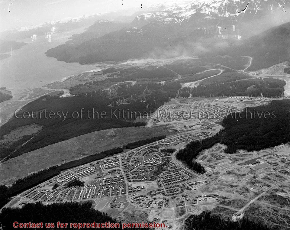
Photo depicts an aerial view of Kitimat, seen is land cleared for Neighbourhood "D" and the Whitesail neighbourhood under construction, right foreground. The Alcan smelter and channel are in the background.
Photo depicts an aerial view of Kitimat, seen is land cleared for Neighbourhood "D" and the Whitesail neighbourhood under construction, right foreground. The Alcan smelter and channel are in the background.
Notes
Title based on content of photograph. Max Patzelt Collection - 1998.1.8351