Photograph of clearing for machine shop site and storage yard, Moore Creek camp in background, looking east. Wood and debris being burned in centre. Truck parked in foreground.
Bud Powell is a longtime resident of Kitimat and former smeltersite resident. He worked for Alcan.
Custodial History
Donated by Bud Powell.
Scope and Content
Photograph of clearing for machine shop site and storage yard, Moore Creek camp in background, looking east. Wood and debris being burned in centre. Truck parked in foreground.
Photograph of looking northeast at utility buildings area showing placing of compacted fill in foreground and in background the building forms being erected. Multiple trucks and machinery visible. Some trucks are actively dumping the fill.
Bud Powell is a longtime resident of Kitimat and former smeltersite resident. He worked for Alcan.
Custodial History
Donated by Bud Powell.
Scope and Content
Photograph of looking northeast at utility buildings area showing placing of compacted fill in foreground and in background the building forms being erected. Multiple trucks and machinery visible. Some trucks are actively dumping the fill.
Photograph of clearing of site for machine shop and plant yard, Moore Creek, looking north. Wood and debris being burned in centre. Truck and other machinery in front of that.
Bud Powell is a longtime resident of Kitimat and former smeltersite resident. He worked for Alcan.
Custodial History
Donated by Bud Powell.
Scope and Content
Photograph of clearing of site for machine shop and plant yard, Moore Creek, looking north. Wood and debris being burned in centre. Truck and other machinery in front of that.
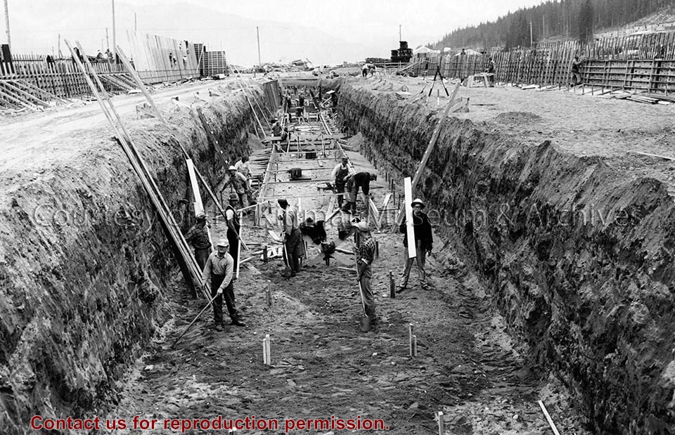
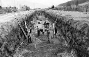
Photo depicts workers excavating for the construction of the alumina storage building.
Notes
Title based on content of photograph. -- Alcan ID No. BC-2-451. -- Sloping sides avoided cave-ins. -- Hal Whiting was Project Manager, Kitimat Constructors, for smelter and town construction. Hal Whiting Collection 985.65.267
Photograph of aerial photograph looking east toward neighbourhood A with the City Centre clearing in the right-hand foreground and neighbourhood A-IV clearing in the centre foreground.
Donated by Jackie Worboys. Given to the Jackie Mufford Worboys family by Wally Melville.
Scope and Content
Photograph of aerial photograph looking east toward neighbourhood A with the City Centre clearing in the right-hand foreground and neighbourhood A-IV clearing in the centre foreground.
Photograph of aerial looking south-east across neighbourhood A with neighbourhood A-II clearing in foreground and Minette Bay in the background. Nechako Centre and School are visible.
Donated by Jackie Worboys. Given to the Jackie Mufford Worboys family by Wally Melville.
Scope and Content
Photograph of aerial looking south-east across neighbourhood A with neighbourhood A-II clearing in foreground and Minette Bay in the background. Nechako Centre and School are visible.
Photograph of aerial view looking towards the west of the Kitimat Townsite with neighbourhood A-I in the foreground. City Centre clearing in background with slash burning smoke.
Donated by Jackie Worboys. Given to the Jackie Mufford Worboys family by Wally Melville.
Scope and Content
Photograph of aerial view looking towards the west of the Kitimat Townsite with neighbourhood A-I in the foreground. City Centre clearing in background with slash burning smoke.
Photograph of aerial view looking southeast across neighbourhood A-I towards Minette Bay. Note timber felled for the B-I High School site in the foreground.
Donated by Jackie Worboys. Given to the Jackie Mufford Worboys family by Wally Melville.
Scope and Content
Photograph of aerial view looking southeast across neighbourhood A-I towards Minette Bay. Note timber felled for the B-I High School site in the foreground.
Photograph of general construction's crushing plant set up at the north end of the sandhill. Their paving plant can be seen in the right hand extremity of the picture. Truck visible on site, and the railway is on the right.
Donated by Jackie Worboys. Given to the Jackie Mufford Worboys family by Wally Melville.
Scope and Content
Photograph of general construction's crushing plant set up at the north end of the sandhill. Their paving plant can be seen in the right hand extremity of the picture. Truck visible on site, and the railway is on the right.
Photograph of view of the 11 man bunkhouses at the back of the motel site. Roofing is now being placed. These are prefab. units - went up in 6 days from dockside. Logs are laid in the foreground.
Donated by Jackie Worboys. Given to the Jackie Mufford Worboys family by Wally Melville.
Scope and Content
Photograph of view of the 11 man bunkhouses at the back of the motel site. Roofing is now being placed. These are prefab. units - went up in 6 days from dockside. Logs are laid in the foreground.
Photograph of general construction's crushing plant set up at the north end of the sandhill. Their paving plant can be seen in the right hand extremity of the picture. Railway also on right side.
Donated by Jackie Worboys. Given to the Jackie Mufford Worboys family by Wally Melville.
Scope and Content
Photograph of general construction's crushing plant set up at the north end of the sandhill. Their paving plant can be seen in the right hand extremity of the picture. Railway also on right side.
Photograph of view looking northeast across the west end of neighbourhood C-1. Please note the new eleven-man bunkhouses at the back of the motel site.
Donated by Jackie Worboys. Given to the Jackie Mufford Worboys family by Wally Melville.
Scope and Content
Photograph of view looking northeast across the west end of neighbourhood C-1. Please note the new eleven-man bunkhouses at the back of the motel site.
Photograph of the temporary housing site in neighbourhood C-1. Note the sections of the 210 units arriving in the building area. Crane at work on left.
Donated by Jackie Worboys. Given to the Jackie Mufford Worboys family by Wally Melville.
Scope and Content
Photograph of the temporary housing site in neighbourhood C-1. Note the sections of the 210 units arriving in the building area. Crane at work on left.
Photograph of aerial view of west end of neighbourhood C-I and motel site A. Please note temporary housing units in left centre of photograph. Clearing shown in lower left corner is that for neighbourhood C Dyke.
Donated by Jackie Worboys. Given to the Jackie Mufford Worboys family by Wally Melville.
Scope and Content
Photograph of aerial view of west end of neighbourhood C-I and motel site A. Please note temporary housing units in left centre of photograph. Clearing shown in lower left corner is that for neighbourhood C Dyke.
Photograph of aerial view looking east across neighbourhood A-III and A-I. Note in upper left centre a portion of the concrete walks already constructed, which eventually will lead to Kingfisher underpass. Also note contrast between landscaped areas and those surrounding the houses now under construction. Gyrfaclon street in centre. Nechako Centre and School visible at upper left. Nechako school has protables outside.
Donated by Jackie Worboys. Given to the Jackie Mufford Worboys family by Wally Melville.
Scope and Content
Photograph of aerial view looking east across neighbourhood A-III and A-I. Note in upper left centre a portion of the concrete walks already constructed, which eventually will lead to Kingfisher underpass. Also note contrast between landscaped areas and those surrounding the houses now under construction. Gyrfaclon street in centre. Nechako Centre and School visible at upper left. Nechako school has protables outside.
Photograph of aerial view looking north-east across neighbourhood A-I with Petrel and Oriole Streets in the foreground. Nechako Centre and School visible behind.
Donated by Jackie Worboys. Given to the Jackie Mufford Worboys family by Wally Melville.
Scope and Content
Photograph of aerial view looking north-east across neighbourhood A-I with Petrel and Oriole Streets in the foreground. Nechako Centre and School visible behind.