Subdivision plan of part of district lots 6038, 6039 and part of block 29, plan 3435 range 5, Coast District. District Municipality of Kitimat. Plan 4228. November 5, 1961.
Plan of subdivision of parts of D.L. 6046 & west half of D.L. 6045, and parcel. "X" (former block 78 and adjoining road plan 3549) range 5, Coast District. District Municipality of Kitimat. Plan 4639. August 27, 1963.
Plan of portions of block 29 map 3435 district lots 6038, 6039, 6042 & 6043 range 5, Coast District. District Municipality of Kitimat. Plan 3743. November 4, 1957.
Donated by Rick Wozney. Aluminum Company of Canada, Limited (Registered Owner).
Scope and Content
District of Kitimat lot and block plans.
Subdivision plan of part of district lots 6038, 6039 and part of block 29, plan 3435 range 5, Coast District. District Municipality of Kitimat. Plan 4228. November 5, 1961.
Plan of subdivision of parts of D.L. 6046 & west half of D.L. 6045, and parcel. "X" (former block 78 and adjoining road plan 3549) range 5, Coast District. District Municipality of Kitimat. Plan 4639. August 27, 1963.
Plan of portions of block 29 map 3435 district lots 6038, 6039, 6042 & 6043 range 5, Coast District. District Municipality of Kitimat. Plan 3743. November 4, 1957.
John Ware was a past employee of the Kitimat Town Planning Department (1957-1959). He was hired by Hollister Kent, Planning Director for Kitimat. During his two years here, Dr. ware designed the first Kitimat street signs, the Haisla Boulevard overpass, and the Hirsch Creek Park shelter centennial project (1858-1958). He was layed off when Alcan lost major Aluminum buyers and the town expansion halted, resulting in a cut back of Kirtimat employees. He then moved to the USA.
Custodial History
Donated by John Ware.
Scope and Content
Photographs of Kitimat street and information signs. Aluminum and wooden mock-ups.
Six signs. Black & white. Bus Stop, Walkway, Taxi, W Capilano, Capilano S, and Osprey.
Six signs. Colour. Bus Stop, Walkway, Taxi, W Capilano, Capilano S, and Osprey.
Three signs with directional arrows. Black and white. City Centre, Nechako Centre, and Service Centre.
Three signs with directional arrows, installed. Black & white. Nechako Centre, City Centre, and Service Centre.
Six signs. Black and white. Parcel Pickup 3 Min Parking, Taxi, Commercial Loading No Parking, City Centre, Nechako Centre, and Service Centre.
Six signs. Colour. Parcel Pickup 3 Min Parking, Taxi, Commercial Loading No Parking, City Centre, Nechako Centre, and Service Centre.
Two signs, installed. Colour. Egret and Finch street signs installed.
Two signs, installed. Black & white. E Fourth, and Industrial S.
Photo showing Crawley Films who produced motion picture of Kitimat Development. Jack Ammon (at wheel of car) - Vancouver Actor - plays part of Town Planner.
Photo showing Crawley Films who produced motion picture of Kitimat Development. Jack Ammon (at wheel of car) - Vancouver Actor - plays part of Town Planner.
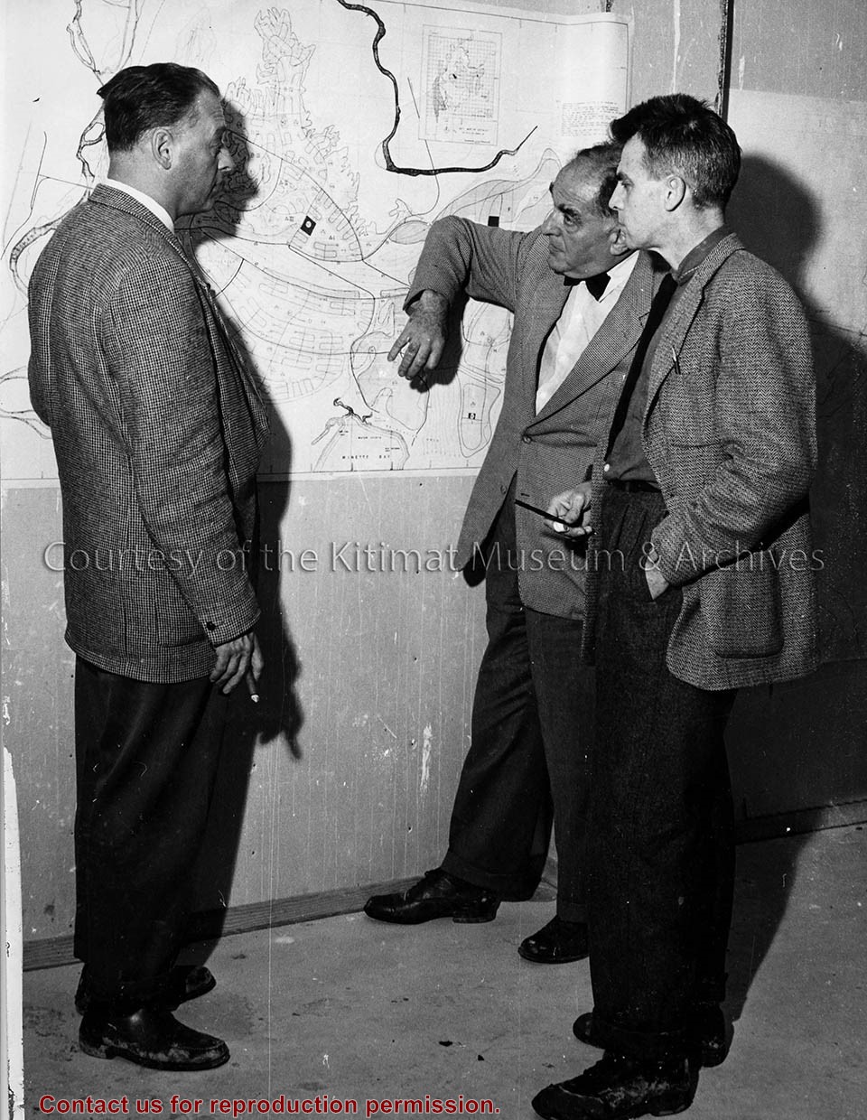
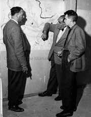
Photo depicts three men examining a map. From left is Alcan's Chief Planner James Dudley from Vancouver; Town Planner Albert Mayer; Julian Whittlesey of New York.
Photo depicts three men examining a map. From left is Alcan's Chief Planner James Dudley from Vancouver; Town Planner Albert Mayer; Julian Whittlesey of New York.
Photograph of aerial view looking north-west across the east of neighbourhood A showing house construction on Wren, Teal and Swallow streets. Many houses still are only foundations. Streets further back are more complete.
Donated by Jackie Worboys. Given to the Jackie Mufford Worboys family by Wally Melville.
Scope and Content
Photograph of aerial view looking north-west across the east of neighbourhood A showing house construction on Wren, Teal and Swallow streets. Many houses still are only foundations. Streets further back are more complete.
Photograph of aerial of east side of Nechako area. Widgeon, Wren, Apartments, Partridge, and Pintail in foreground with more streets behind. Houses are built.
Donated by Jackie Worboys. Given to the Jackie Mufford Worboys family by Wally Melville.
Scope and Content
Photograph of aerial of east side of Nechako area. Widgeon, Wren, Apartments, Partridge, and Pintail in foreground with more streets behind. Houses are built.
Photograph of aerial of west side of Nechako area. Petrel, Plover, Aprtments, Osprey and Oriole in foreground with more streets behind. Houses are built. Fire station, United Church, Nechako Centre and School are visible.
Donated by Jackie Worboys. Given to the Jackie Mufford Worboys family by Wally Melville.
Scope and Content
Photograph of aerial of west side of Nechako area. Petrel, Plover, Aprtments, Osprey and Oriole in foreground with more streets behind. Houses are built. Fire station, United Church, Nechako Centre and School are visible.