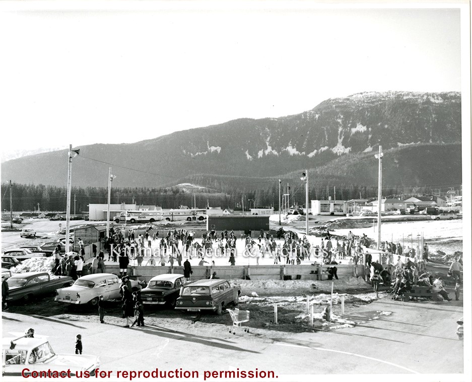
Kitimat Skates was a local component that supplemented the Canadian Museum of History's traveling exhibition, 'Lace Up! Canada's Passion for Skating'. The Kitimat Museum and Archives supplemented the national museum exhibition with sixty years of Kitimat skating history. Did you know that the first skating rink was created when the municipality annually flooded the tennis courts at Nechako Centre? And, that the inventor of Marsh Pegs used by the NHL was a long-time Kitimat resident?
Kitimat Skates was a local component that supplemented the Canadian Museum of History's traveling exhibition, 'Lace Up! Canada's Passion for Skating'. The Kitimat Museum and Archives supplemented the national museum exhibition with sixty years of Kitimat skating history. Did you know that the first skating rink was created when the municipality annually flooded the tennis courts at Nechako Centre? And, that the inventor of Marsh Pegs used by the NHL was a long-time Kitimat resident?
Printed map of Kitimat from 1959. The old hospital is in place but the Museum isn't. Angle St. is identified as Alger St., and Gwyn St. is Faraday St. Riverlodge Camp is still in place.
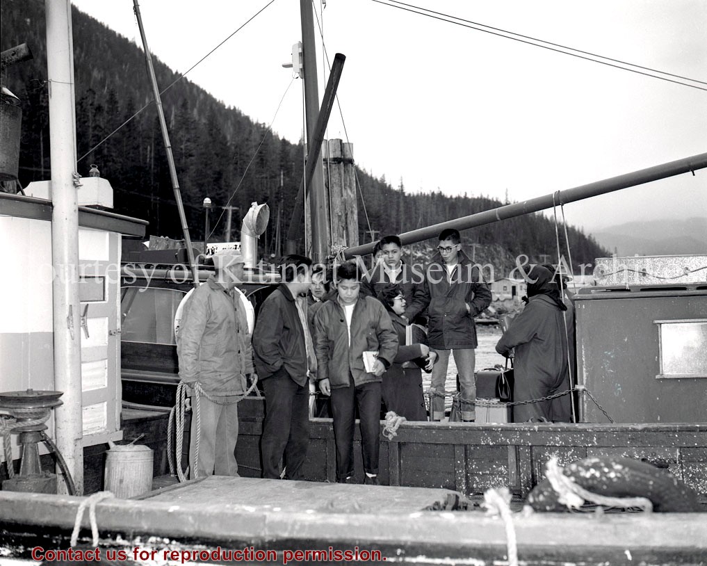
Pat Lean was the Provincial Government Agent in Kitimat from Dec 1 1969 to April 1 1970.
Scope and Content
Printed map of Kitimat from 1959. The old hospital is in place but the Museum isn't. Angle St. is identified as Alger St., and Gwyn St. is Faraday St. Riverlodge Camp is still in place.
23 maps of northwestern British Columbia, from the Seven Sisters westward to Port Essington.
2018.9.1a-b – Seven Sisters / Dorreen
2018.9.2a-c – Usk / Chist Creek
2018.9.3a-c – Lakelse / Terrace
2018.9.4a-b – Alastair Lake
2018.9.5a-b – Salvus, Coast District Range 5
2018.9.6a-d – Ecstall River / Port Essington
2018.9.7a-g – Kitimat Arm, Kildala River, Mt. Aetna, Mount Elizabeth, Mount Davies, private logging roads
Maps were collected and annotated by Gisela Mendel throughout her time in northwest BC and donated to the Museum in 2018.
Scope and Content
23 maps of northwestern British Columbia, from the Seven Sisters westward to Port Essington.
2018.9.1a-b – Seven Sisters / Dorreen
2018.9.2a-c – Usk / Chist Creek
2018.9.3a-c – Lakelse / Terrace
2018.9.4a-b – Alastair Lake
2018.9.5a-b – Salvus, Coast District Range 5
2018.9.6a-d – Ecstall River / Port Essington
2018.9.7a-g – Kitimat Arm, Kildala River, Mt. Aetna, Mount Elizabeth, Mount Davies, private logging roads
Photocopies of a triangulation survey from 1925 showing the Kitimat Arm, Skeena River and upper Kitimat River area. R.G.5.. Coast District B.C. Photocopy has 3 parts.
Donated by Margaret Vanderberg from the Ministry of Transportation + Highways on February 11, 2000.
Scope and Content
Photocopies of a triangulation survey from 1925 showing the Kitimat Arm, Skeena River and upper Kitimat River area. R.G.5.. Coast District B.C. Photocopy has 3 parts.
A Map of the District Municipality of Kitimat British Columbia. Drawn by G.V. Laurenson for the Hudson's Bay Company. 1st edition. Scale: 40 chains or 1/2 mile to an inch. Map shows Kitimat area map on one side, and close up sections including Service Center, City Centre, Nechako Centre, and Nechako Neighbourhood on the other.
A Map of the District Municipality of Kitimat British Columbia. Drawn by G.V. Laurenson for the Hudson's Bay Company. 1st edition. Scale: 40 chains or 1/2 mile to an inch. Map shows Kitimat area map on one side, and close up sections including Service Center, City Centre, Nechako Centre, and Nechako Neighbourhood on the other.
Topographical map of the Kitimat-Kitsumgallum area. Scale: 1:12670 or 1 inch equals 2 miles. Map shows the trail from Terrace to Kitimat and other trails used by settlers. Zymoetz wagon trail is also marked. Locations of all cabins are indicated.
Topographical map of the Kitimat-Kitsumgallum area. Scale: 1:12670 or 1 inch equals 2 miles. Map shows the trail from Terrace to Kitimat and other trails used by settlers. Zymoetz wagon trail is also marked. Locations of all cabins are indicated.
Subdivision plan of part of district lots 6038, 6039 and part of block 29, plan 3435 range 5, Coast District. District Municipality of Kitimat. Plan 4228. November 5, 1961.
Plan of subdivision of parts of D.L. 6046 & west half of D.L. 6045, and parcel. "X" (former block 78 and adjoining road plan 3549) range 5, Coast District. District Municipality of Kitimat. Plan 4639. August 27, 1963.
Plan of portions of block 29 map 3435 district lots 6038, 6039, 6042 & 6043 range 5, Coast District. District Municipality of Kitimat. Plan 3743. November 4, 1957.
Donated by Rick Wozney. Aluminum Company of Canada, Limited (Registered Owner).
Scope and Content
District of Kitimat lot and block plans.
Subdivision plan of part of district lots 6038, 6039 and part of block 29, plan 3435 range 5, Coast District. District Municipality of Kitimat. Plan 4228. November 5, 1961.
Plan of subdivision of parts of D.L. 6046 & west half of D.L. 6045, and parcel. "X" (former block 78 and adjoining road plan 3549) range 5, Coast District. District Municipality of Kitimat. Plan 4639. August 27, 1963.
Plan of portions of block 29 map 3435 district lots 6038, 6039, 6042 & 6043 range 5, Coast District. District Municipality of Kitimat. Plan 3743. November 4, 1957.
Settling In: Highlighting 50 Years of Kitimat's History Exhibition, was shown at the Kitimat Museum and Archives in 2003. "To the youngsters, Kitimat presents a pleasing blend of modern, urban, recreational facilities in a wild-west, wilderness setting. To the adults, it offers physical grandeur, unexcelled hunting and fishing, neighbourliness, dependence, and the genuine friendships of a new community." Canadian Geographical Journal 1959 What makes a town? What makes Kitimat unique? In the final analysis, Kitimat citizens have made the community. This exhibition attempts to show the public face of Kitimat.
Settling In: Highlighting 50 Years of Kitimat's History Exhibition, was shown at the Kitimat Museum and Archives in 2003. "To the youngsters, Kitimat presents a pleasing blend of modern, urban, recreational facilities in a wild-west, wilderness setting. To the adults, it offers physical grandeur, unexcelled hunting and fishing, neighbourliness, dependence, and the genuine friendships of a new community." Canadian Geographical Journal 1959 What makes a town? What makes Kitimat unique? In the final analysis, Kitimat citizens have made the community. This exhibition attempts to show the public face of Kitimat.
In 2013, the Kitimat Museum and Archives worked with the District of Kitimat, and the Recreation Department, to select images commemorating 60 years of Community in the town of Kitimat. The display can physically be seen on display in the hallway of Riverlodge Recreation Centre.
In 2013, the Kitimat Museum and Archives worked with the District of Kitimat, and the Recreation Department, to select images commemorating 60 years of Community in the town of Kitimat. The display can physically be seen on display in the hallway of Riverlodge Recreation Centre.