Photo showing aerial view of the Townsite - Flat Tops, Riverlodge Area includes Post Office, Cafeteria, Bunkhouses, etc., also single houses on the left.
Photo showing aerial view of the Townsite - Flat Tops, Riverlodge Area includes Post Office, Cafeteria, Bunkhouses, etc., also single houses on the left.
Photo showing an aerial view of the construction site of the proposed Smeltersite. Aerials were taken on a regular basis, monitoring the project process.
Photo showing an aerial view of the construction site of the proposed Smeltersite. Aerials were taken on a regular basis, monitoring the project process.
Photo showing The Kenney Dam, also the construction site. The Nechako Reservoir started to fill in October 1952, and with completion of the Kenney Dam in 1954 a 145 mile long expanse of water covering 339 sq. miles was created.
Photo showing The Kenney Dam, also the construction site. The Nechako Reservoir started to fill in October 1952, and with completion of the Kenney Dam in 1954 a 145 mile long expanse of water covering 339 sq. miles was created.
Photo showing Aerial View - Nechako Area (aerial shots were taken at different intervals all through the Alcan Project - Nechako, Kildala, Whitesaile Areas)
Photo showing Aerial View - Nechako Area (aerial shots were taken at different intervals all through the Alcan Project - Nechako, Kildala, Whitesaile Areas)
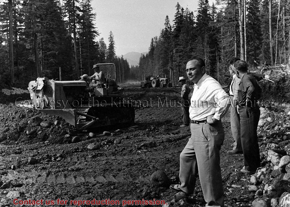
Photo showing the "Big Boss" of B.C Highways Hon. Phil Gaglardi (foreground at right) surveying the construction work being done on the highway. Bulldozer in middleground and tractor in background.
-Construction of Hwy 25
-Opened 28 November 1957
Photo showing the "Big Boss" of B.C Highways Hon. Phil Gaglardi (foreground at right) surveying the construction work being done on the highway. Bulldozer in middleground and tractor in background.
-Construction of Hwy 25
-Opened 28 November 1957