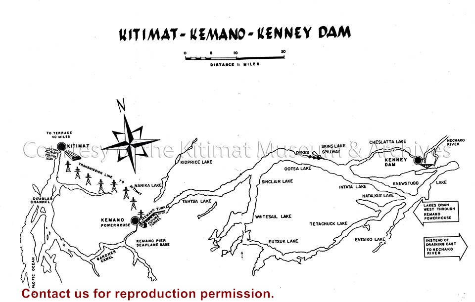
Illustration depicts the extent of the Project, from the Kenney Dam and reservoir area to the transmission line and smelter. The future tunnel or the Kemano Completion Project is also included.
Illustration depicts the extent of the Project, from the Kenney Dam and reservoir area to the transmission line and smelter. The future tunnel or the Kemano Completion Project is also included.
Notes
Illustration from Alcan's publication "Kitimat-Kemano, Five Years of Operation, 1954-1959". Alcan Collection
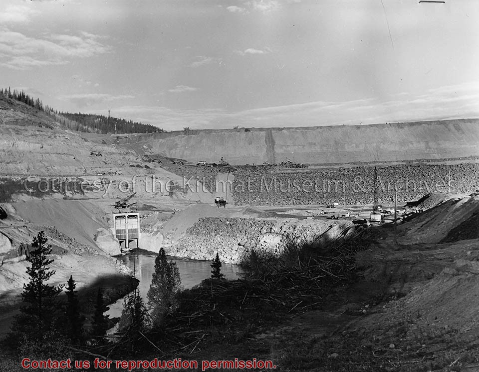
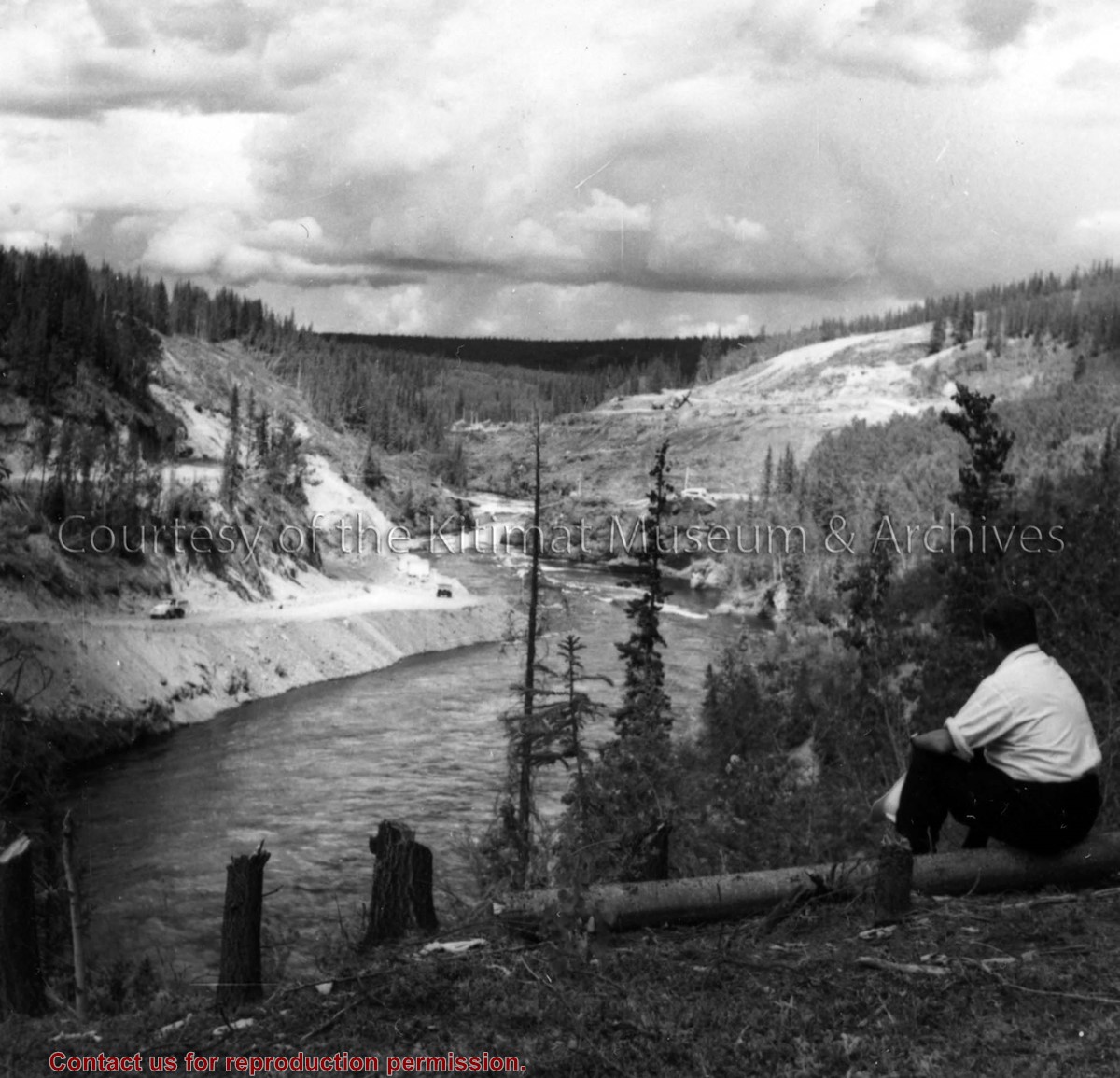
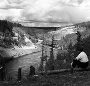
Photo depicts a unidentified man sitting on the Nechako River bank watching the the activities of construction of the dam at the canyon. Right bank stripping and left bank tunnel haul road shown.
Photo depicts a unidentified man sitting on the Nechako River bank watching the the activities of construction of the dam at the canyon. Right bank stripping and left bank tunnel haul road shown.
Notes
Title based on content of photo. -- A rock dam was chosen for its ability to withstand earthquakes. Morrison-Knudsen Company Collection
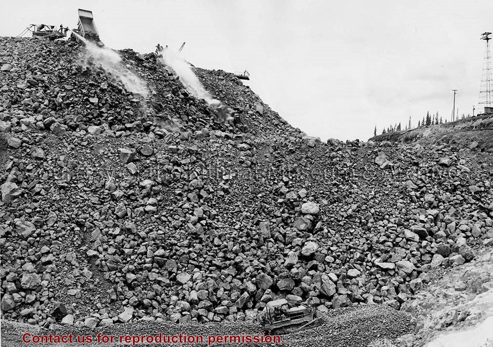
Photo depicts a International diesel TD-24 spreading a layer of large stones at the base of the Nechako Dam.
Notes
ID no. C 5927. -- Title based on content of photo. -- These layers of various size rock stone and clay will all slope towards the rock fill at about a 45 degree pitch. Official naming ceremony renamed dam the Kenney Dam. Hal Whiting Collection 985.65.56
Photo depicts an aerial view looking northwest of Smeltersite housing, the hospital on the beach, the school in the centre, and the seaplane landing ramp.
Photo depicts an aerial view looking northwest of Smeltersite housing, the hospital on the beach, the school in the centre, and the seaplane landing ramp.
Notes
Title based on content of photograph. -- Alcan ID No. J-43-1837. Kitimat Heritage Advisory Commission Collection. KMA No. P00209.jpg
Aerial view of the smelter area looking north. Note rectifier buildings mainly closed in and roofing nearing completion. Potline footings are begining to extend east of the centre passageway.
Aerial view of the smelter area looking north. Note rectifier buildings mainly closed in and roofing nearing completion. Potline footings are begining to extend east of the centre passageway.
Aerial view of Graving Dock showing rough outline of excavation, Access Road into Dock at North West corner, and shovels, double handling base material.
Aerial view of Graving Dock showing rough outline of excavation, Access Road into Dock at North West corner, and shovels, double handling base material.
Aerial view South showing older section of Kitamaat Village at low tide. Upper left is community hall below which is Village Council Building and in centre of picture Village United Church.
1 photograph : b&w ; 19 x 19 cm
1 photograph : b&w ; 12 x 17 cm
1 photograph : b&w ; 22 x 27.5 cm
Scope and Content
Aerial view South showing older section of Kitamaat Village at low tide. Upper left is community hall below which is Village Council Building and in centre of picture Village United Church.
Aerial view of the townsite clearing looking North. Note, City Centre in left foreground with clearing for main sewer outfall extending across to the lower right hand corner of photograph
Aerial view of the townsite clearing looking North. Note, City Centre in left foreground with clearing for main sewer outfall extending across to the lower right hand corner of photograph