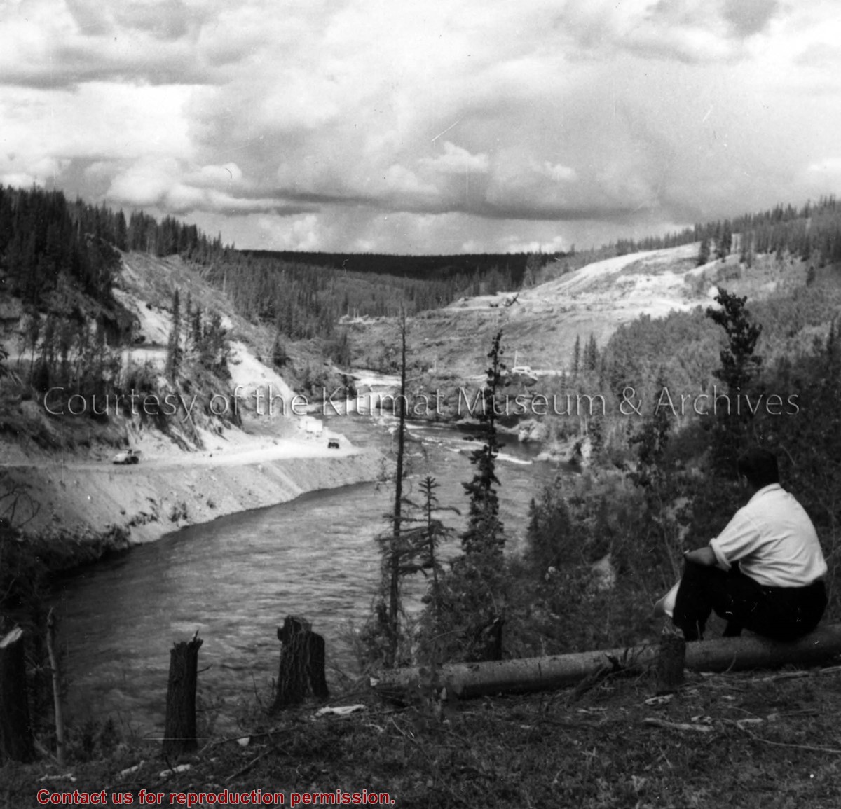
Photo depicts a unidentified man sitting on the Nechako River bank watching the the activities of construction of the dam at the canyon. Right bank stripping and left bank tunnel haul road shown.
Photo depicts a unidentified man sitting on the Nechako River bank watching the the activities of construction of the dam at the canyon. Right bank stripping and left bank tunnel haul road shown.
Notes
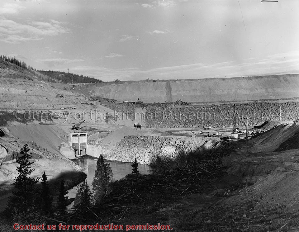
Title based on content of photo. -- A rock dam was chosen for its ability to withstand earthquakes. Morrison-Knudsen Company Collection
Photograph of aerial photograph looking east toward neighbourhood A with the City Centre clearing in the right-hand foreground and neighbourhood A-IV clearing in the centre foreground.
Donated by Jackie Worboys. Given to the Jackie Mufford Worboys family by Wally Melville.
Scope and Content
Photograph of aerial photograph looking east toward neighbourhood A with the City Centre clearing in the right-hand foreground and neighbourhood A-IV clearing in the centre foreground.
Photograph of aerial view looking east across neighbourhood A-III and A-I. Note in upper left centre a portion of the concrete walks already constructed, which eventually will lead to Kingfisher underpass. Also note contrast between landscaped areas and those surrounding the houses now under construction. Gyrfaclon street in centre. Nechako Centre and School visible at upper left. Nechako school has protables outside.
Donated by Jackie Worboys. Given to the Jackie Mufford Worboys family by Wally Melville.
Scope and Content
Photograph of aerial view looking east across neighbourhood A-III and A-I. Note in upper left centre a portion of the concrete walks already constructed, which eventually will lead to Kingfisher underpass. Also note contrast between landscaped areas and those surrounding the houses now under construction. Gyrfaclon street in centre. Nechako Centre and School visible at upper left. Nechako school has protables outside.
Aerial view of a portion of Neighbourhood B-I with Road "C" in the foreground. Note small timber fire near Hirsch Creek in upper left hand side of the photograph.
Aerial view of a portion of Neighbourhood B-I with Road "C" in the foreground. Note small timber fire near Hirsch Creek in upper left hand side of the photograph.