Photo depicts an aerial view of a portion of the Nechako neighbourhood showing the Hullah prototype area, Pintail and Partridge streets, in the foreground.
Photo depicts an aerial view of a portion of the Nechako neighbourhood showing the Hullah prototype area, Pintail and Partridge streets, in the foreground.
Notes
Title based on content of photograph. District of Kitimat Collection
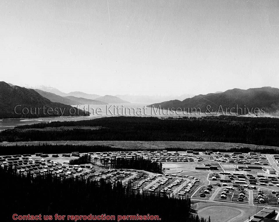
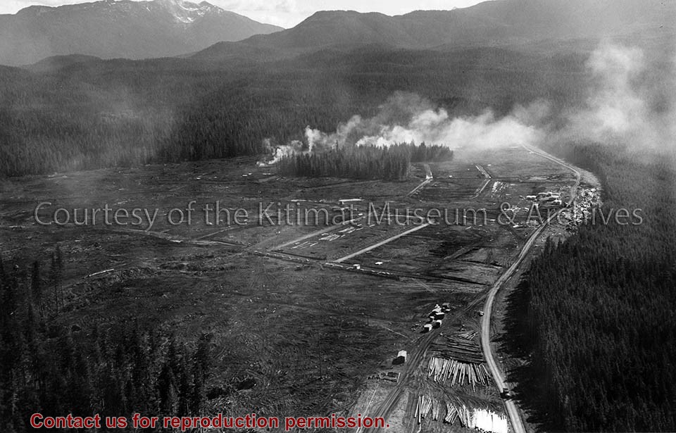
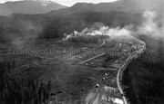
Photo depicts Nechako Neighbourhood, swath of land cleared for Neighbourhood "D", and Douglas Channel in the background, smelter on the right.
Notes
Famed Canadian documentary photographer Malak Karsh was hired in the 1950s by Alcan to take photographs of Arvida and Kitimat. Many were published in Alcan literature and textbooks on Canada. A colourized version of this photograph appears on the cover of the Canadian Geographical Journal, November 1959, Vol. LIX No.5. Northern Sentinel Press Collection
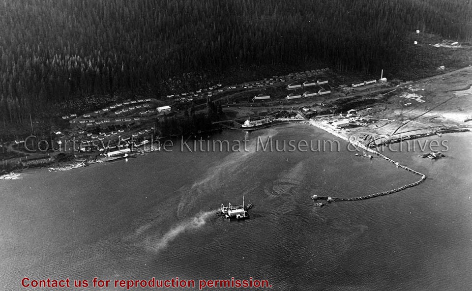
Photo depicts an aerial view of the smeltersite main camp showing married quarters, sternwheeler Delta King, hydraulic fill in progress, recreation building, hospital, power plant, sawmill and water tank.
Photo depicts an aerial view of the smeltersite main camp showing married quarters, sternwheeler Delta King, hydraulic fill in progress, recreation building, hospital, power plant, sawmill and water tank.
Notes
Title based on content of photograph. -- Alcan ID Numbers BC-2-243 and ACM-24311. Alcan Collection 78.11.32
Photo depicts an aerial view looking northwest of Smeltersite housing, the hospital on the beach, the school in the centre, and the seaplane landing ramp.
Photo depicts an aerial view looking northwest of Smeltersite housing, the hospital on the beach, the school in the centre, and the seaplane landing ramp.
Notes
Title based on content of photograph. -- Alcan ID No. J-43-1837. Kitimat Heritage Advisory Commission Collection. KMA No. P00209.jpg
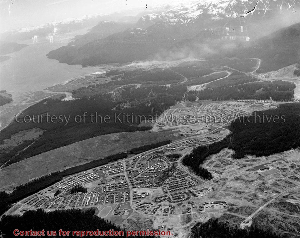
Photo depicts an aerial view of Kitimat, seen is land cleared for Neighbourhood "D" and the Whitesail neighbourhood under construction, right foreground. The Alcan smelter and channel are in the background.
Photo depicts an aerial view of Kitimat, seen is land cleared for Neighbourhood "D" and the Whitesail neighbourhood under construction, right foreground. The Alcan smelter and channel are in the background.
Notes
Title based on content of photograph. Max Patzelt Collection - 1998.1.8351
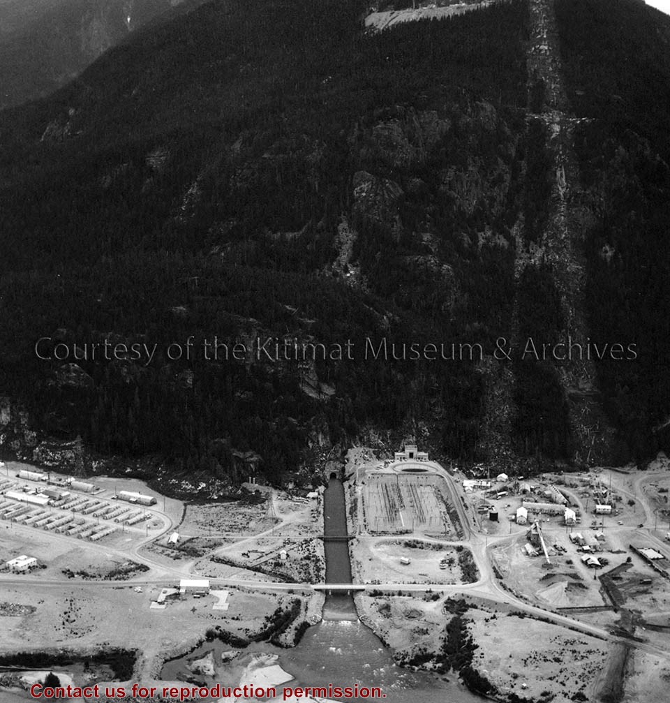
Photo depicts an aerial view of the powerhouse switchyard and entrance up to the 1600' level. The wide clearing on the right is the tram right-of-way. The powerhouse tailrace tunnel and channel and the access tunnel portal are in the centre, and the construction camp is on the left. Alcan Collection
Photo depicts an aerial view of the powerhouse switchyard and entrance up to the 1600' level. The wide clearing on the right is the tram right-of-way. The powerhouse tailrace tunnel and channel and the access tunnel portal are in the centre, and the construction camp is on the left. Alcan Collection
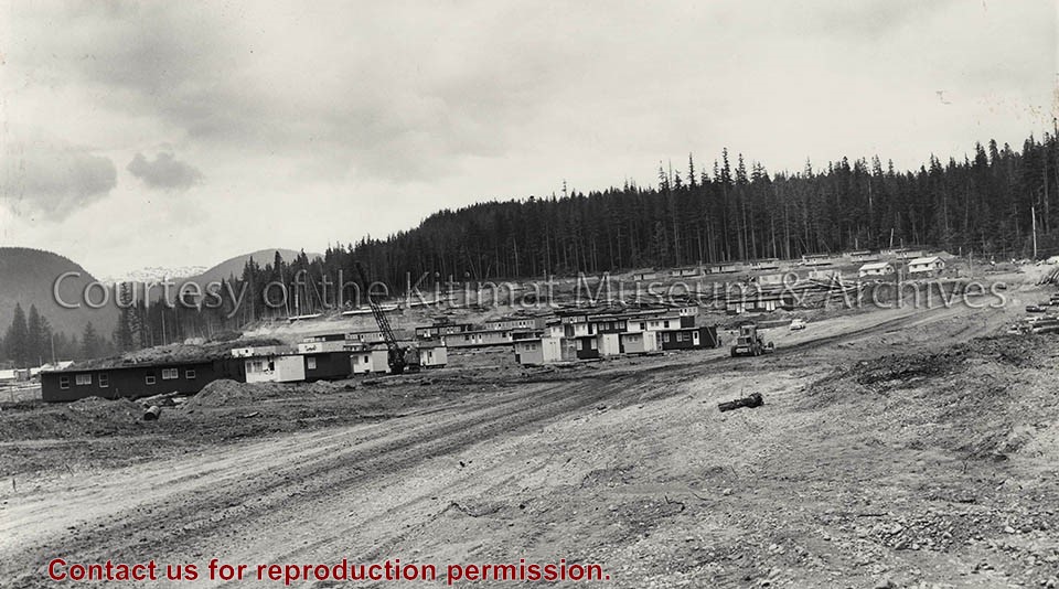
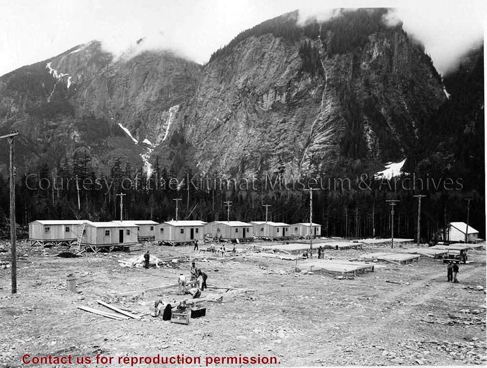
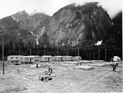
Photo depicts flat-top temporary housing lining the hillside up to the Aluminum City Motel at the treeline. View is northwest. Grader on Kuldo Boulevard.
Photo depicts flat-top temporary housing lining the hillside up to the Aluminum City Motel at the treeline. View is northwest. Grader on Kuldo Boulevard.
Notes
Title based on content of photograph. -- Alcan Negative No. 29337. -- The circus tent assembly line was erected . Temporary housing destined for Kitimat was assembled at Vancouver Tug and Barge below the Lion's Gate Bridge in three sections, then barged to Kitimat - 10 houses or 30 sections on each barge. -- Electrician Bill Frahler wired approximately 2,000 houses in Kitimat camps and townsite between 1954 and 1958, working first for Johnson-Crooks then Straits Construction, both U.S. contractors. 73.3.6.6
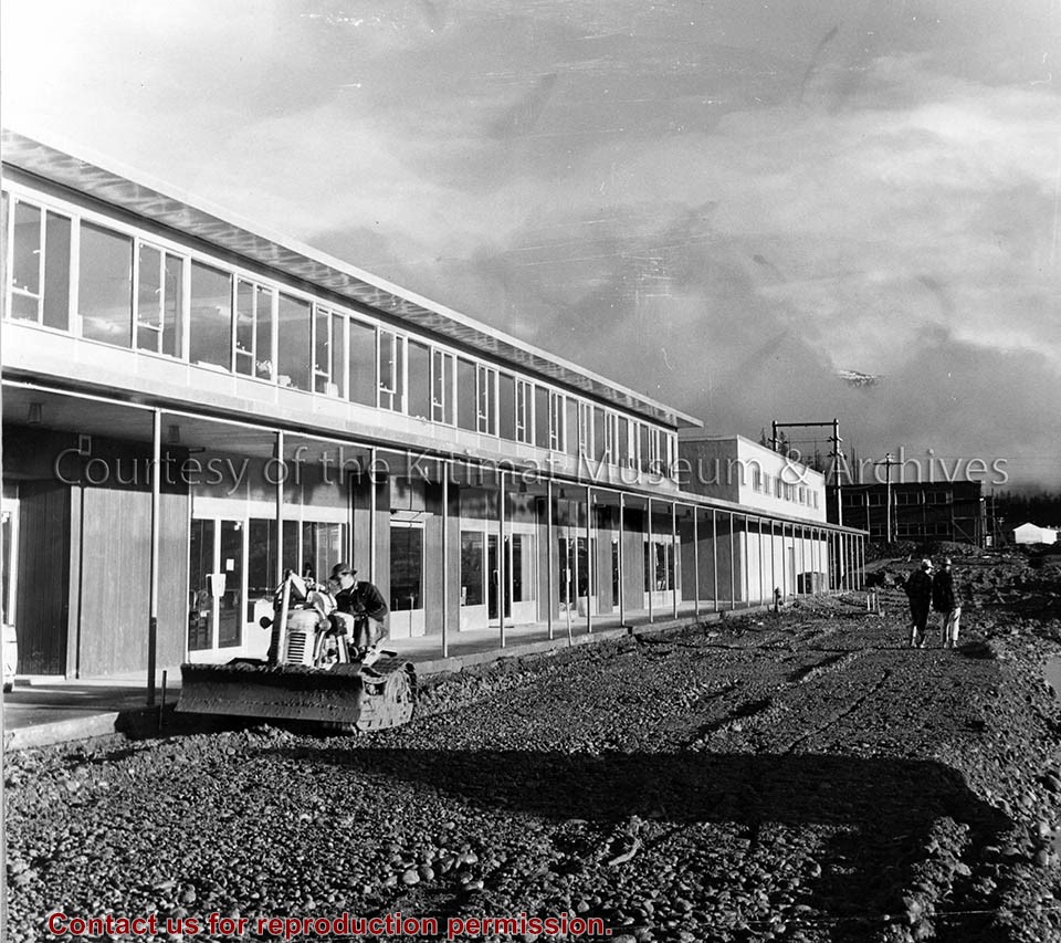
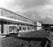
Photo depicts the exterior of the newly completed Nechako Centre in Kitimat, Shop Easy at the end of the complex. A bulldozer compacts the gravel - site preparation for the parking lot.
Photo depicts the exterior of the newly completed Nechako Centre in Kitimat, Shop Easy at the end of the complex. A bulldozer compacts the gravel - site preparation for the parking lot.
Notes
Title based on content of photograph. Part of Board of School Trustees Collection 982.91
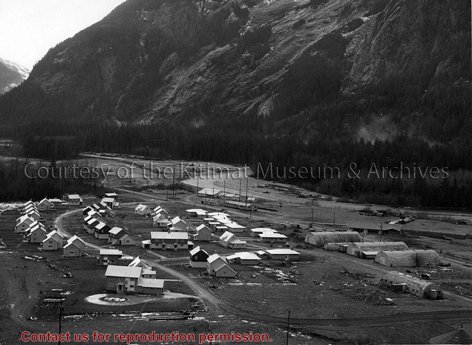
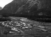
Photo depicts the permanent Kemano townsite at Camp No. 5. View is looking towards beach. Seen on the left are permanent homes for powerhouse staff. On the right are the temporary buildings known as quonset huts used during the construction years as crew quarters.
Photo depicts the permanent Kemano townsite at Camp No. 5. View is looking towards beach. Seen on the left are permanent homes for powerhouse staff. On the right are the temporary buildings known as quonset huts used during the construction years as crew quarters.
Notes
Title based on content of photograph. -- Alcan ID No. 2KR-298. -- Permanent housing construction began in 1957. Alcan Collection
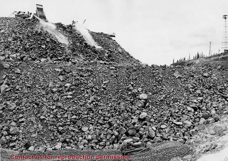
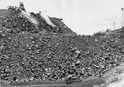
Photo depicts a International diesel TD-24 spreading a layer of large stones at the base of the Nechako Dam.
Notes
ID no. C 5927. -- Title based on content of photo. -- These layers of various size rock stone and clay will all slope towards the rock fill at about a 45 degree pitch. Official naming ceremony renamed dam the Kenney Dam. Hal Whiting Collection 985.65.56