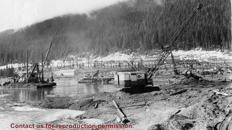
Photo depicts the dredge and dragline excavating the channel from the dock to deep water, a truck dumping gravel for the foundation blanket into the bottom of a dump scow. The view looks toward the construction site for the permanent wharf from the south dike of the graving dock, crew bunkhouses of Smeltersite in the background.
Photo depicts the dredge and dragline excavating the channel from the dock to deep water, a truck dumping gravel for the foundation blanket into the bottom of a dump scow. The view looks toward the construction site for the permanent wharf from the south dike of the graving dock, crew bunkhouses of Smeltersite in the background.
Notes
Title based on content of photograph. -- Alcan ID No. BC-2-320. Hal Whiting Collection 985.65.211
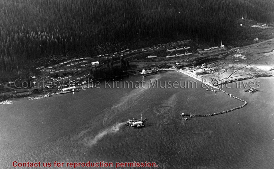
Photo depicts an aerial view of the smeltersite main camp showing married quarters, sternwheeler Delta King, hydraulic fill in progress, recreation building, hospital, power plant, sawmill and water tank.
Photo depicts an aerial view of the smeltersite main camp showing married quarters, sternwheeler Delta King, hydraulic fill in progress, recreation building, hospital, power plant, sawmill and water tank.
Notes
Title based on content of photograph. -- Alcan ID Numbers BC-2-243 and ACM-24311. Alcan Collection 78.11.32
Photo depicts an aerial view looking northwest of Smeltersite housing, the hospital on the beach, the school in the centre, and the seaplane landing ramp.
Photo depicts an aerial view looking northwest of Smeltersite housing, the hospital on the beach, the school in the centre, and the seaplane landing ramp.
Notes
Title based on content of photograph. -- Alcan ID No. J-43-1837. Kitimat Heritage Advisory Commission Collection. KMA No. P00209.jpg
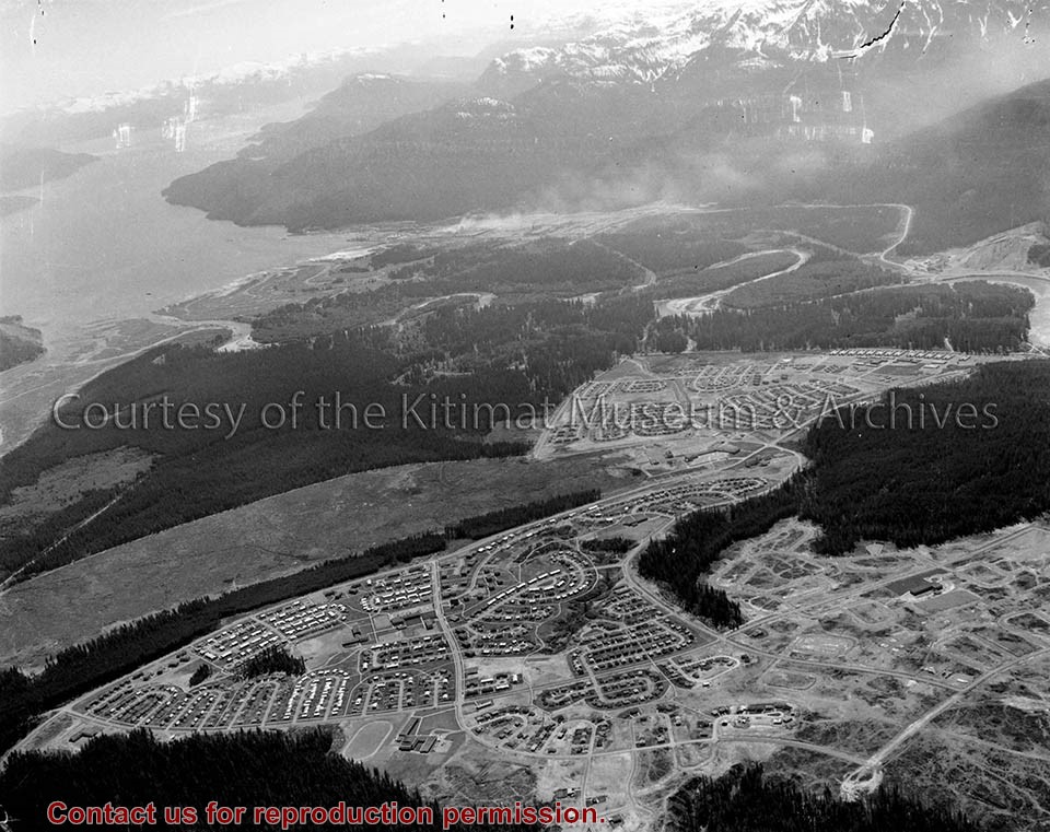
Photo depicts an aerial view of Kitimat, seen is land cleared for Neighbourhood "D" and the Whitesail neighbourhood under construction, right foreground. The Alcan smelter and channel are in the background.
Photo depicts an aerial view of Kitimat, seen is land cleared for Neighbourhood "D" and the Whitesail neighbourhood under construction, right foreground. The Alcan smelter and channel are in the background.
Notes
Title based on content of photograph. Max Patzelt Collection - 1998.1.8351
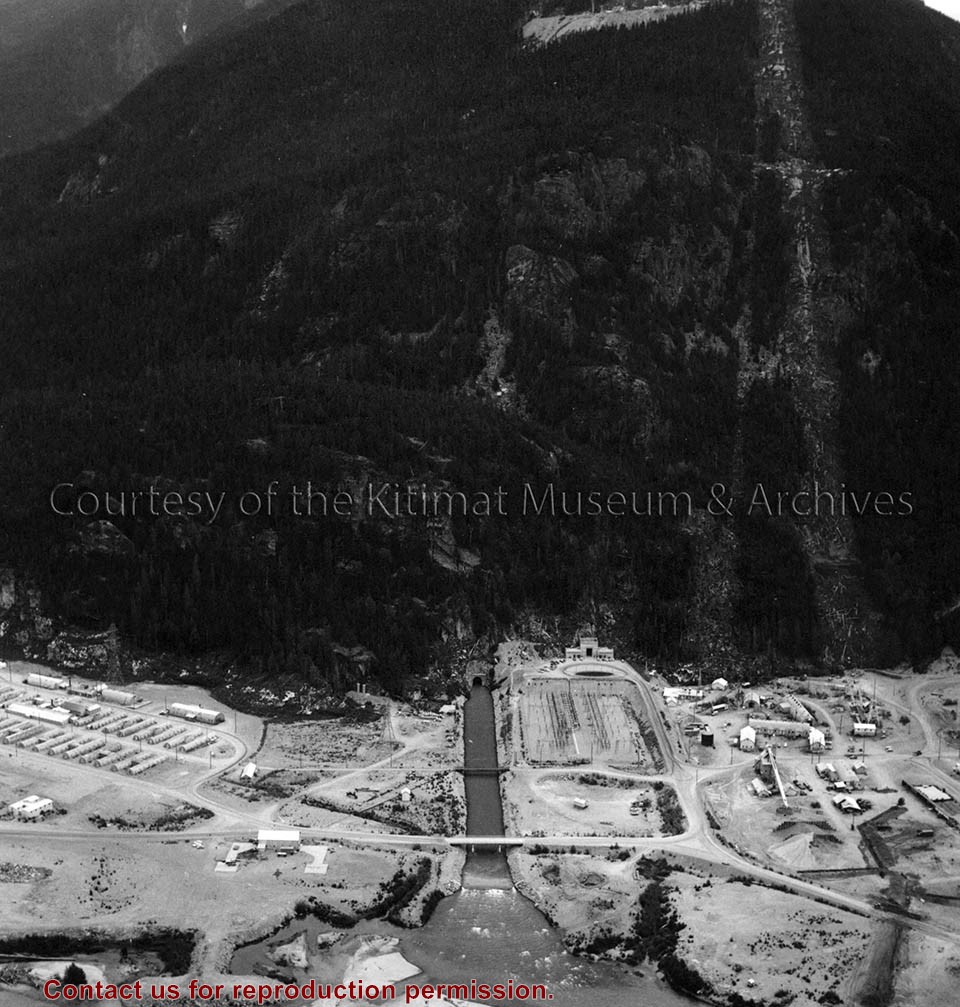
Photo depicts an aerial view of the powerhouse switchyard and entrance up to the 1600' level. The wide clearing on the right is the tram right-of-way. The powerhouse tailrace tunnel and channel and the access tunnel portal are in the centre, and the construction camp is on the left. Alcan Collection
Photo depicts an aerial view of the powerhouse switchyard and entrance up to the 1600' level. The wide clearing on the right is the tram right-of-way. The powerhouse tailrace tunnel and channel and the access tunnel portal are in the centre, and the construction camp is on the left. Alcan Collection
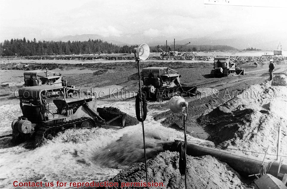
Photo depicts bulldozers placing fill in the south-west corner of the storage area, to the final elevation of 28.5 ft. View is looking north-east at storage area of hydraulic fill.
Photo depicts bulldozers placing fill in the south-west corner of the storage area, to the final elevation of 28.5 ft. View is looking north-east at storage area of hydraulic fill.
Notes
Title based on content of photograph. Alcan Collection 79.31.7
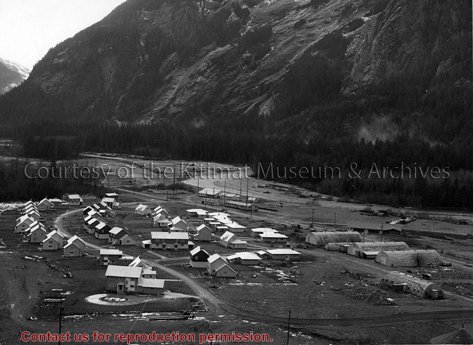
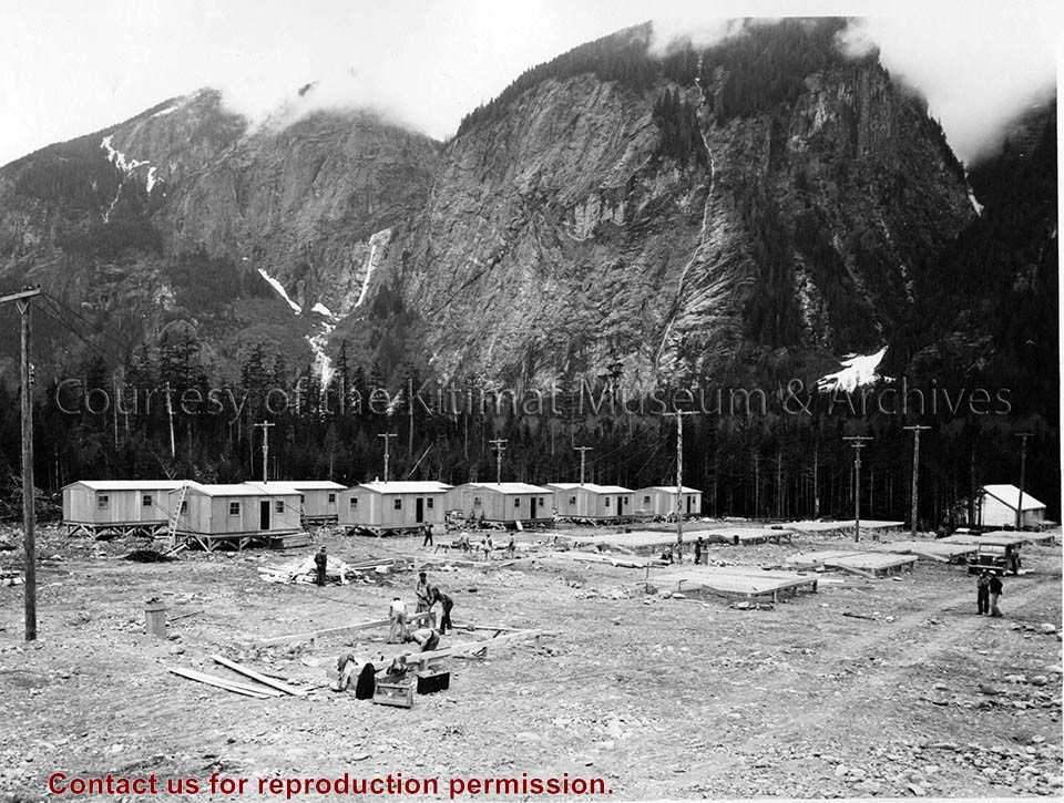
Photo depicts the permanent Kemano townsite at Camp No. 5. View is looking towards beach. Seen on the left are permanent homes for powerhouse staff. On the right are the temporary buildings known as quonset huts used during the construction years as crew quarters.
Photo depicts the permanent Kemano townsite at Camp No. 5. View is looking towards beach. Seen on the left are permanent homes for powerhouse staff. On the right are the temporary buildings known as quonset huts used during the construction years as crew quarters.
Notes
Title based on content of photograph. -- Alcan ID No. 2KR-298. -- Permanent housing construction began in 1957. Alcan Collection
Photo depicts an aerial view of a portion of the Nechako neighbourhood showing the Hullah prototype area, Pintail and Partridge streets, in the foreground.
Photo depicts an aerial view of a portion of the Nechako neighbourhood showing the Hullah prototype area, Pintail and Partridge streets, in the foreground.
Notes
Title based on content of photograph. District of Kitimat Collection
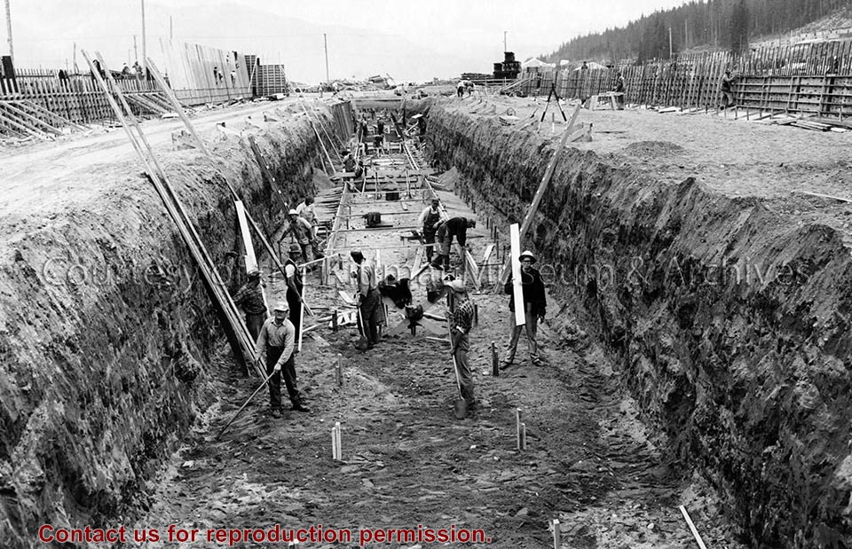
Photo depicts workers excavating for the construction of the alumina storage building.
Notes
Title based on content of photograph. -- Alcan ID No. BC-2-451. -- Sloping sides avoided cave-ins. -- Hal Whiting was Project Manager, Kitimat Constructors, for smelter and town construction. Hal Whiting Collection 985.65.267
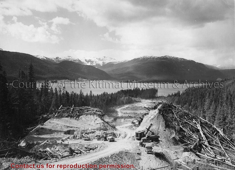
Photo depicts a general view along the transmission line. A shovel is excavating sand for the backfill, in the vicinity of Tower No. 352. Kitimat Bay and Valley are in the background.
Photo depicts a general view along the transmission line. A shovel is excavating sand for the backfill, in the vicinity of Tower No. 352. Kitimat Bay and Valley are in the background.
Notes
Title based on content of photograph. -- Alcan ID No. KR-962. Alcan Collection