Photograph of an aerial of the Kitimat Townsite. View is looking across the full town towards Douglas Channel. Hirsch Creek is visible in front of the town.
Photograph of an aerial of the Kitimat Townsite. View is looking across the full town towards Douglas Channel. Hirsch Creek is visible in front of the town.
Photograph of an aerial of the Kitimat Townsite. View is looking across the full town towards Douglas Channel. Hirsch Creek and Cable Car are visible in the foreground.
Photograph of an aerial of the Kitimat Townsite. View is looking across the full town towards Douglas Channel. Hirsch Creek and Cable Car are visible in the foreground.
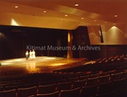
View of the audience and a portion of the Vancouver Symphony as they performed in the Mount Elizabeth Secondary School gym. Shows audience on gym floor as well as those in the bleachers.
1 photograph : b&w ; 25.3 x 20.3 cm
1 negative : b&w ; 12.6 x 10 cm
Scope and Content
View of the audience and a portion of the Vancouver Symphony as they performed in the Mount Elizabeth Secondary School gym. Shows audience on gym floor as well as those in the bleachers.
Photograph of Mckeown, Brian, a teacher at Mount Elizabeth Secondary School.
Notes
A graduate of West Vancouver Sr. Highschool and U.B.C., Mr. Mckeown preffered subjects are Math and Biology which he teaches at Mount Elizabeth. Mr. Mceown and his wife, Merrily both began teaching in Kitimat in September of 1963. His hobbies are photography, skiing, scooba diving, hunting and fishing. The Mceowns live at 1590 Albatross Ave.
Photo depicts an aerial view of Kitimat. Seen is land cleared for Neighbourhood "D" and the Whitesail Neighbourhood under construction, right foreground. The Alcan smelter and channel are in the background.
Photo depicts an aerial view of Kitimat. Seen is land cleared for Neighbourhood "D" and the Whitesail Neighbourhood under construction, right foreground. The Alcan smelter and channel are in the background.
Notes
Title based on content of photograph. -- On the official "Town Plan for Kitimat, B.C." by Stein and Mayer & Whittlesey, Neighbourhood "D", the cleared area in the photo, was to have three elementary schools, and one junior and one senior high school. This neighbourhood was never constructed and was returned to bush.