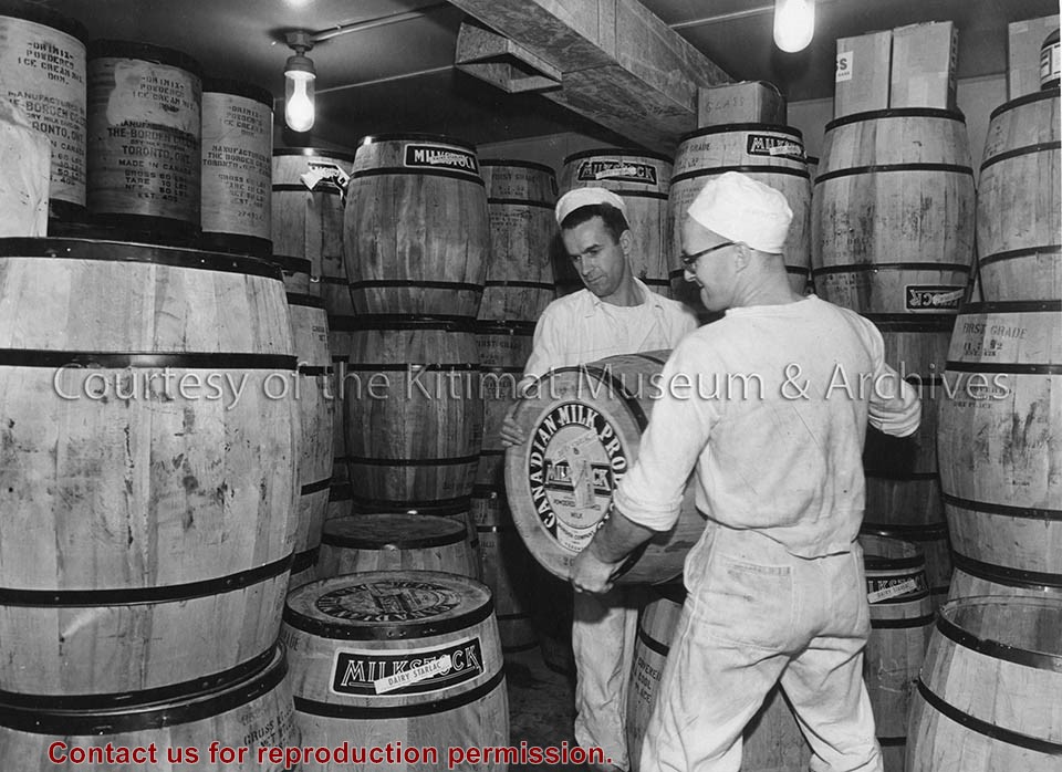
Photo depicts a month's supply of powdered milk inside the dairy at Camp No. 5, Kemano. Two dairy workers are lifting a barrel to stack it onto another.
Photo depicts a month's supply of powdered milk inside the dairy at Camp No. 5, Kemano. Two dairy workers are lifting a barrel to stack it onto another.
Notes
Title based on content of photograph. -- Alcan ID No. KR-651.
Aerial view looking north across Neighbourhood C. showing Dyke and drainage ditch in the foreground. Note rock for cobble lining stock - piled along ditch.
Aerial view looking north across Neighbourhood C. showing Dyke and drainage ditch in the foreground. Note rock for cobble lining stock - piled along ditch.
Aerial view of a portion of Neighbourhood B-I with Road "C" in the foreground. Note small timber fire near Hirsch Creek in upper left hand side of the photograph.
Aerial view of a portion of Neighbourhood B-I with Road "C" in the foreground. Note small timber fire near Hirsch Creek in upper left hand side of the photograph.
Aerial picture showing Riverlodge under construction. Note piles in place for Mess Hall and single room dormitories and grading being undertaken on Rec. Hall and Rec. Field sites
Aerial picture showing Riverlodge under construction. Note piles in place for Mess Hall and single room dormitories and grading being undertaken on Rec. Hall and Rec. Field sites
Aerial view South showing older section of Kitamaat Village at low tide. Upper left is community hall below which is Village Council Building and in centre of picture Village United Church.
1 photograph : b&w ; 19 x 19 cm
1 photograph : b&w ; 12 x 17 cm
1 photograph : b&w ; 22 x 27.5 cm
Scope and Content
Aerial view South showing older section of Kitamaat Village at low tide. Upper left is community hall below which is Village Council Building and in centre of picture Village United Church.
Aerial view of the townsite clearing looking North. Note, City Centre in left foreground with clearing for main sewer outfall extending across to the lower right hand corner of photograph
Aerial view of the townsite clearing looking North. Note, City Centre in left foreground with clearing for main sewer outfall extending across to the lower right hand corner of photograph
Aerial view of the smelter area looking north. Note rectifier buildings mainly closed in and roofing nearing completion. Potline footings are begining to extend east of the centre passageway.
Aerial view of the smelter area looking north. Note rectifier buildings mainly closed in and roofing nearing completion. Potline footings are begining to extend east of the centre passageway.