Aerial view South showing older section of Kitamaat Village at low tide. Upper left is community hall below which is Village Council Building and in centre of picture Village United Church.
1 photograph : b&w ; 19 x 19 cm
1 photograph : b&w ; 12 x 17 cm
1 photograph : b&w ; 22 x 27.5 cm
Scope and Content
Aerial view South showing older section of Kitamaat Village at low tide. Upper left is community hall below which is Village Council Building and in centre of picture Village United Church.
Aerial view of Kitamaat Village looking South. New houses in foreground leave extreme Southern tip of Village with sheltered point upper centre. At extreme right, Douglas Channel
1 photograph : b&w ; 19 x 19 cm
1 photograph : b&w ; 12 x 18 cm
1 photograhp : b&w ; 22 x 27.5 cm
Scope and Content
Aerial view of Kitamaat Village looking South. New houses in foreground leave extreme Southern tip of Village with sheltered point upper centre. At extreme right, Douglas Channel
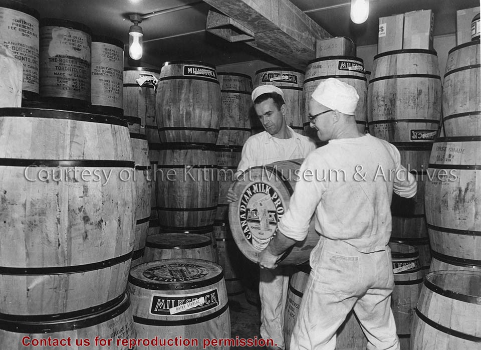
Photo depicts a month's supply of powdered milk inside the dairy at Camp No. 5, Kemano. Two dairy workers are lifting a barrel to stack it onto another.
Photo depicts a month's supply of powdered milk inside the dairy at Camp No. 5, Kemano. Two dairy workers are lifting a barrel to stack it onto another.
Notes
Title based on content of photograph. -- Alcan ID No. KR-651.
Aerial view looking north across Neighbourhood C. showing Dyke and drainage ditch in the foreground. Note rock for cobble lining stock - piled along ditch.
Aerial view looking north across Neighbourhood C. showing Dyke and drainage ditch in the foreground. Note rock for cobble lining stock - piled along ditch.
Aerial view of Nechako Neighbourhood looking east. looking east. Note clearing for B-III on left side of picture and clearing for City Centre and Neighbourhood D on the right side.
Aerial view of Nechako Neighbourhood looking east. looking east. Note clearing for B-III on left side of picture and clearing for City Centre and Neighbourhood D on the right side.