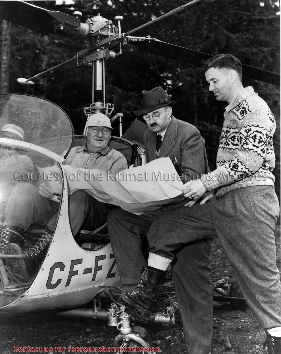
Photo depicts the men in charge of operations. From left is Vice President A.W. Whitaker Jr. seen sitting in a helicopter; Project Manager Percy E. Radley; Chief Resident Engineer John Kendrick. The three men are all taking a look at what could be a map.
Photo depicts the men in charge of operations. From left is Vice President A.W. Whitaker Jr. seen sitting in a helicopter; Project Manager Percy E. Radley; Chief Resident Engineer John Kendrick. The three men are all taking a look at what could be a map.
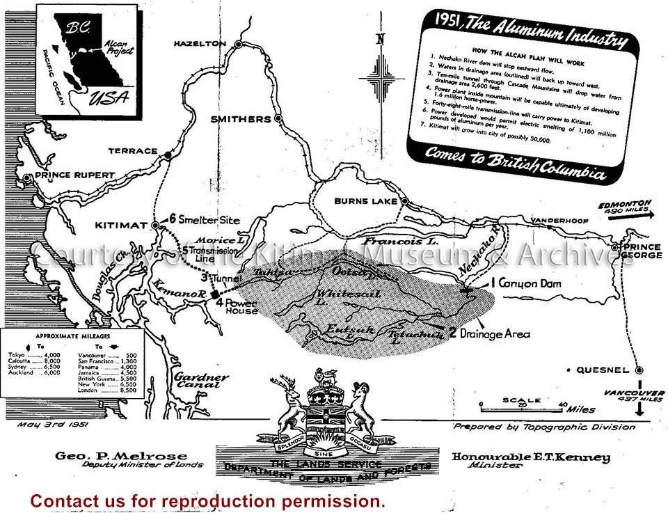
Illustration depicts a map of the Alcan project area, reaching from Prince Rupert to Kenney Dam. Seen is the transmission line, Kemano power plant and the lakes of the region.
Illustration depicts a map of the Alcan project area, reaching from Prince Rupert to Kenney Dam. Seen is the transmission line, Kemano power plant and the lakes of the region.
Notes
Clipping origin unknown. Fritz Wurster Collection. 2002.32
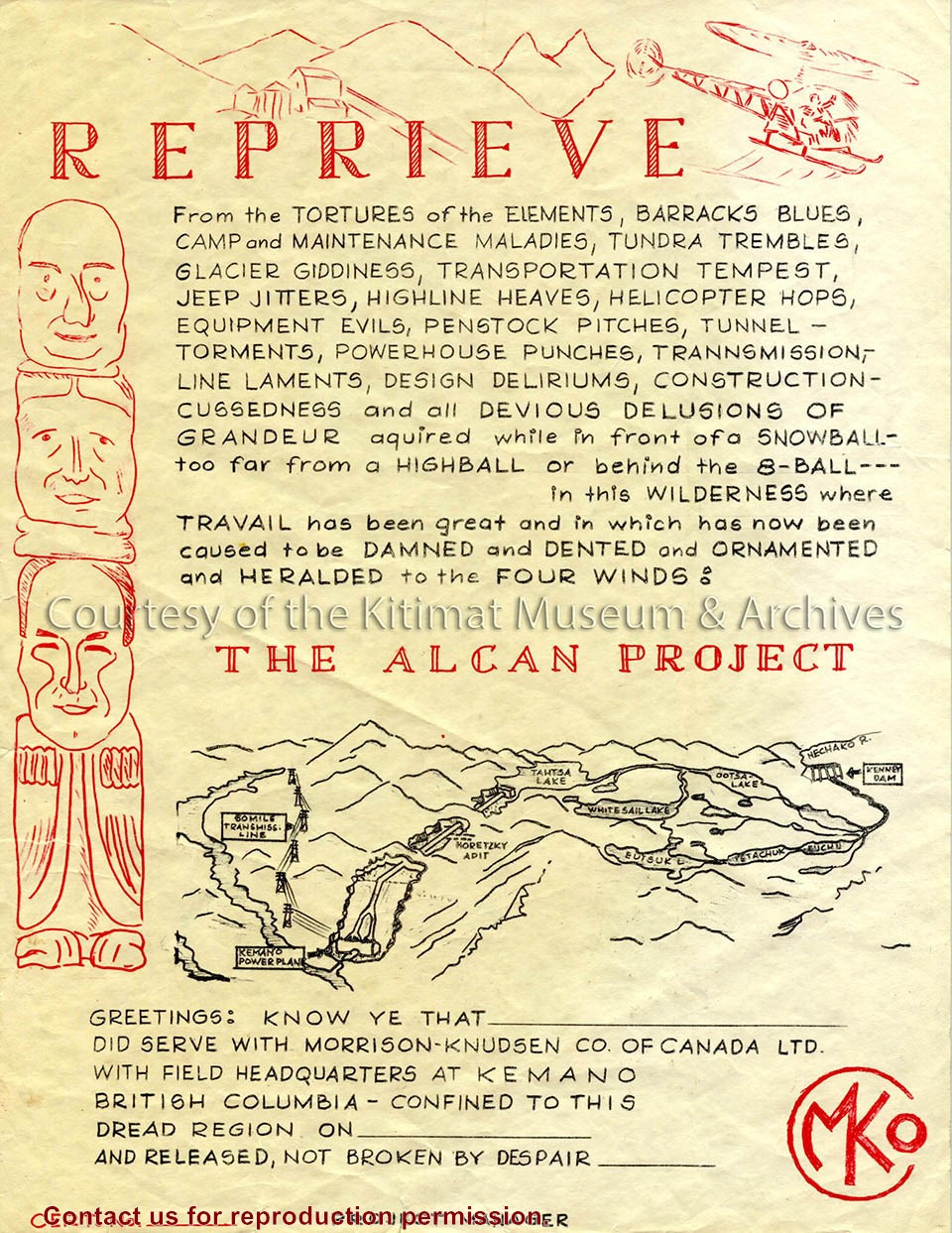
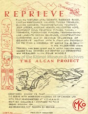
Image depicts a humorous reprieve certificate given to employees of the Alcan Project. The content also implies the hardships endured by the Morrison-Knudsen Company workers in Kemano.
Image depicts a humorous reprieve certificate given to employees of the Alcan Project. The content also implies the hardships endured by the Morrison-Knudsen Company workers in Kemano.
Notes
Title based on contents of text. Ernie Archer Collection
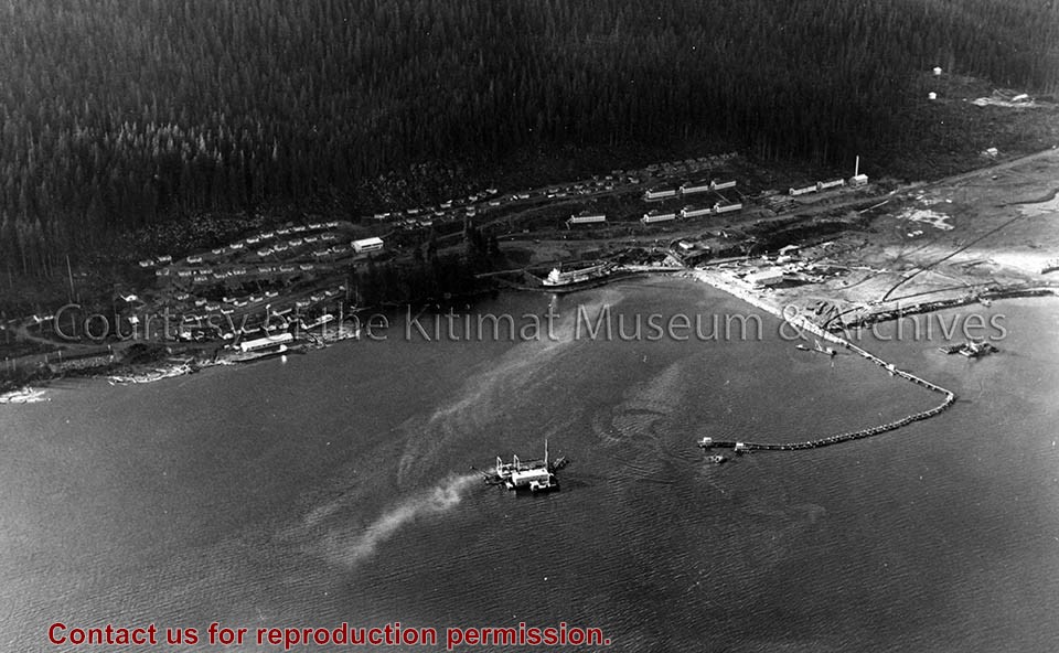
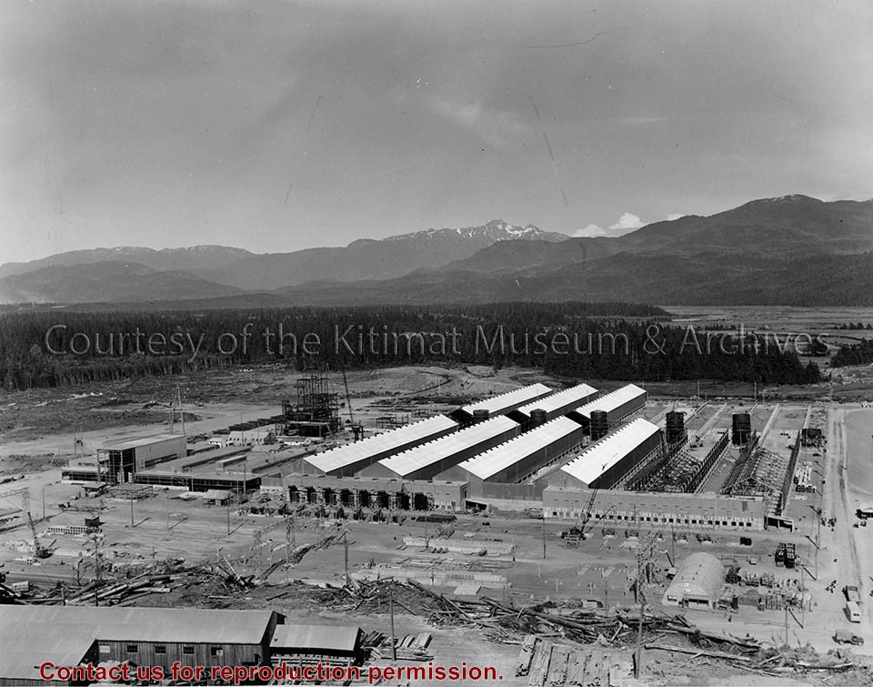
Photo depicts an aerial view of the smeltersite main camp showing married quarters, sternwheeler Delta King, hydraulic fill in progress, recreation building, hospital, power plant, sawmill and water tank.
Photo depicts an aerial view of the smeltersite main camp showing married quarters, sternwheeler Delta King, hydraulic fill in progress, recreation building, hospital, power plant, sawmill and water tank.
Notes
Title based on content of photograph. -- Alcan ID Numbers BC-2-243 and ACM-24311. Alcan Collection 78.11.32
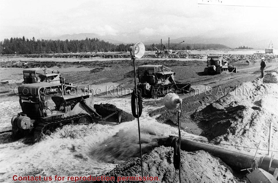
Photo depicts bulldozers placing fill in the south-west corner of the storage area, to the final elevation of 28.5 ft. View is looking north-east at storage area of hydraulic fill.
Photo depicts bulldozers placing fill in the south-west corner of the storage area, to the final elevation of 28.5 ft. View is looking north-east at storage area of hydraulic fill.
Notes
Title based on content of photograph. Alcan Collection 79.31.7
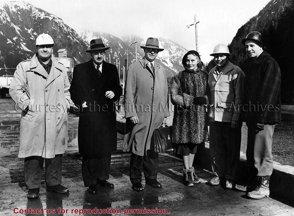
Photo depicts six people standing on the Kemano Wharf. From left is Mr. K. Roestad; Mr. Percy E. Radley; Mr. McNeely DuBose; Mrs. McNeely DuBose; Mr. M.K. Madsen, M.K. Assistant Project Manager and Mr. R.E. Reed, M.K. Area Engineer.
Photo depicts six people standing on the Kemano Wharf. From left is Mr. K. Roestad; Mr. Percy E. Radley; Mr. McNeely DuBose; Mrs. McNeely DuBose; Mr. M.K. Madsen, M.K. Assistant Project Manager and Mr. R.E. Reed, M.K. Area Engineer.
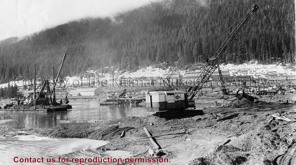
Photo depicts the dredge and dragline excavating the channel from the dock to deep water, a truck dumping gravel for the foundation blanket into the bottom of a dump scow. The view looks toward the construction site for the permanent wharf from the south dike of the graving dock, crew bunkhouses of Smeltersite in the background.
Photo depicts the dredge and dragline excavating the channel from the dock to deep water, a truck dumping gravel for the foundation blanket into the bottom of a dump scow. The view looks toward the construction site for the permanent wharf from the south dike of the graving dock, crew bunkhouses of Smeltersite in the background.
Notes
Title based on content of photograph. -- Alcan ID No. BC-2-320. Hal Whiting Collection 985.65.211
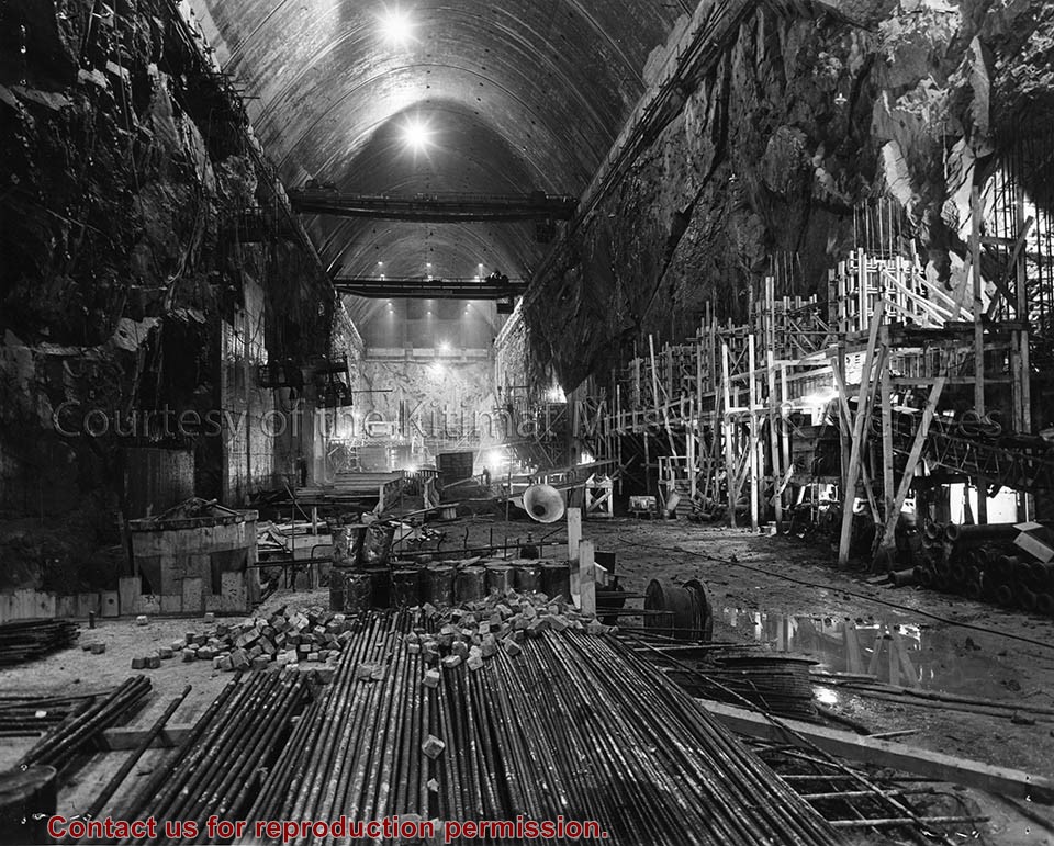
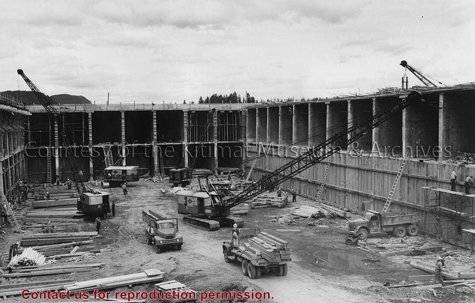
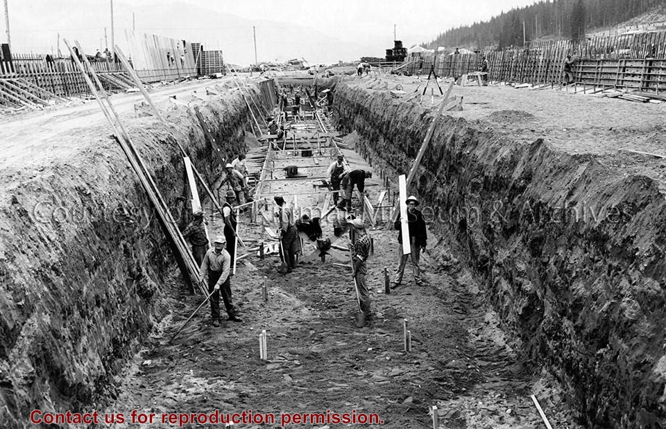
Photo depicts workers excavating for the construction of the alumina storage building.
Notes
Title based on content of photograph. -- Alcan ID No. BC-2-451. -- Sloping sides avoided cave-ins. -- Hal Whiting was Project Manager, Kitimat Constructors, for smelter and town construction. Hal Whiting Collection 985.65.267
Photo depicts an aerial view of a portion of the Nechako neighbourhood showing the Hullah prototype area, Pintail and Partridge streets, in the foreground.
Photo depicts an aerial view of a portion of the Nechako neighbourhood showing the Hullah prototype area, Pintail and Partridge streets, in the foreground.
Notes
Title based on content of photograph. District of Kitimat Collection
Photo depicts an aerial view looking northwest of Smeltersite housing, the hospital on the beach, the school in the centre, and the seaplane landing ramp.
Photo depicts an aerial view looking northwest of Smeltersite housing, the hospital on the beach, the school in the centre, and the seaplane landing ramp.
Notes
Title based on content of photograph. -- Alcan ID No. J-43-1837. Kitimat Heritage Advisory Commission Collection. KMA No. P00209.jpg