2 sheets. Lot map and and demand for lots article, and map of Kitamaat area.
Physical Condition
Good
Material
paper
Height
56cm
Width
44cm
Inscriptions
Kitamaat. The coming North Pacific metropolis of Canada. Demand for Lots. location and advantages.
Plan Shewing Kitamaat Townsite at head of Kitimat Arm
Map of the Northern Coast part of British Columbia
Topographical map of the Kitimat-Kitsumgallum area. Scale: 1:12670 or 1 inch equals 2 miles. Map shows the trail from Terrace to Kitimat and other trails used by settlers. Zymoetz wagon trail is also marked. Locations of all cabins are indicated.
Topographical map of the Kitimat-Kitsumgallum area. Scale: 1:12670 or 1 inch equals 2 miles. Map shows the trail from Terrace to Kitimat and other trails used by settlers. Zymoetz wagon trail is also marked. Locations of all cabins are indicated.
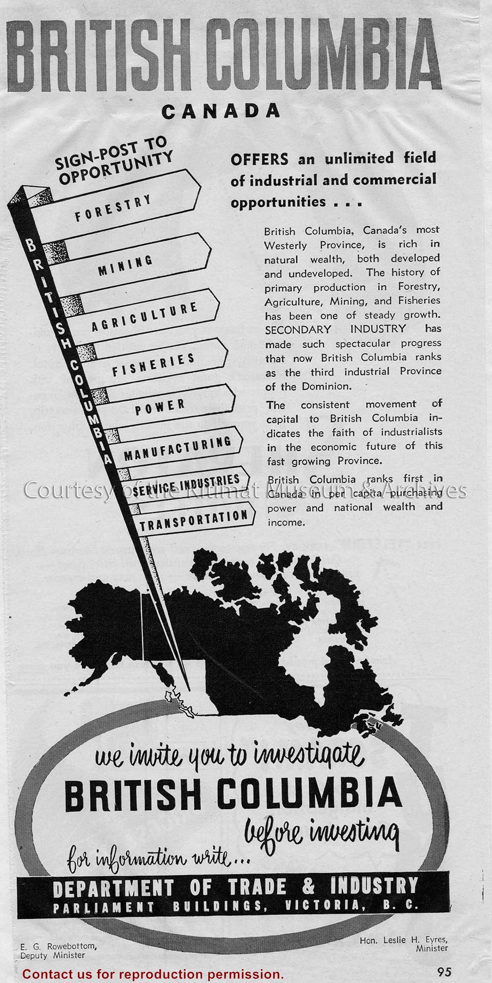
Clipping depicts a Provincial Government advertisement on the industrial and commercial opportunities in British Columbia focusing mostly on the natural resources such as forestry, mining, agriculture, fisheries and power.
Clipping depicts a Provincial Government advertisement on the industrial and commercial opportunities in British Columbia focusing mostly on the natural resources such as forestry, mining, agriculture, fisheries and power.
Notes
Clipping origin unknown. District of Kitimat Collection
Jamieson came to Kitimat from Vancouver to work on the Alcan project in 1952. With his first pay cheque he bought a small "Pony Kodak" camera at the local store (Hudson Bay?), and started taking coloured slides of the Kitimat from 1952-1953. Left Kitimat at the end of August 1953 to move to Montreal.
Base map of statistical area 6. The map shows Kitimat and surrounding coastal area. This map is a partial reproduction of the West Central British Columbia Base Map by Geographic Division, Surveys & Mapping Branch, Department of Lands, Forests, & Water Resources, Victoria, B.C. 1955-56.
Base map of statistical area 6. The map shows Kitimat and surrounding coastal area. This map is a partial reproduction of the West Central British Columbia Base Map by Geographic Division, Surveys & Mapping Branch, Department of Lands, Forests, & Water Resources, Victoria, B.C. 1955-56.
A Map of the District Municipality of Kitimat British Columbia. Drawn by G.V. Laurenson for the Hudson's Bay Company. 1st edition. Scale: 40 chains or 1/2 mile to an inch. Map shows Kitimat area map on one side, and close up sections including Service Center, City Centre, Nechako Centre, and Nechako Neighbourhood on the other.
A Map of the District Municipality of Kitimat British Columbia. Drawn by G.V. Laurenson for the Hudson's Bay Company. 1st edition. Scale: 40 chains or 1/2 mile to an inch. Map shows Kitimat area map on one side, and close up sections including Service Center, City Centre, Nechako Centre, and Nechako Neighbourhood on the other.