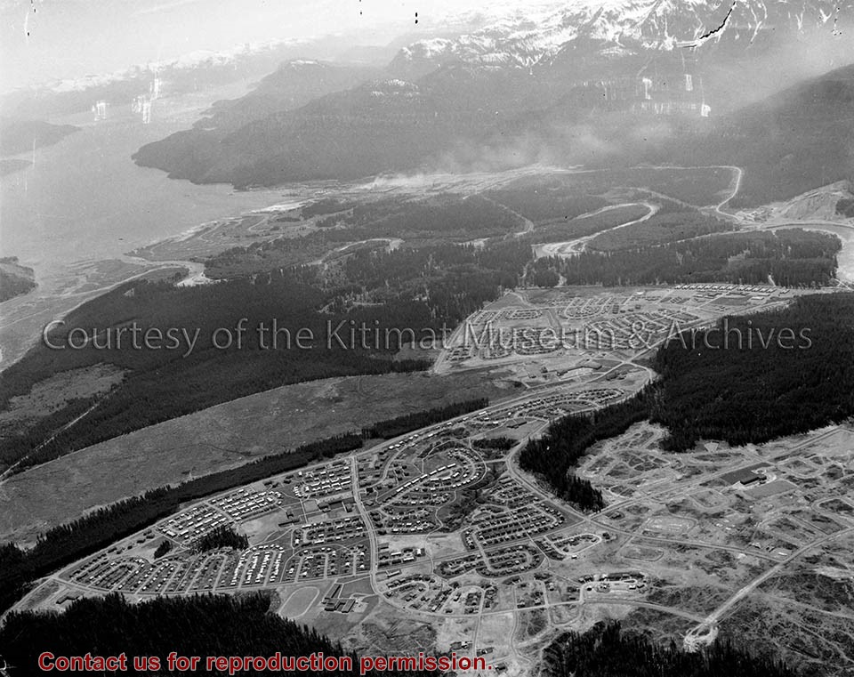
Photo depicts an aerial view of Kitimat, seen is land cleared for Neighbourhood "D" and the Whitesail neighbourhood under construction, right foreground. The Alcan smelter and channel are in the background.
Photo depicts an aerial view of Kitimat, seen is land cleared for Neighbourhood "D" and the Whitesail neighbourhood under construction, right foreground. The Alcan smelter and channel are in the background.
Notes
Title based on content of photograph. Max Patzelt Collection - 1998.1.8351
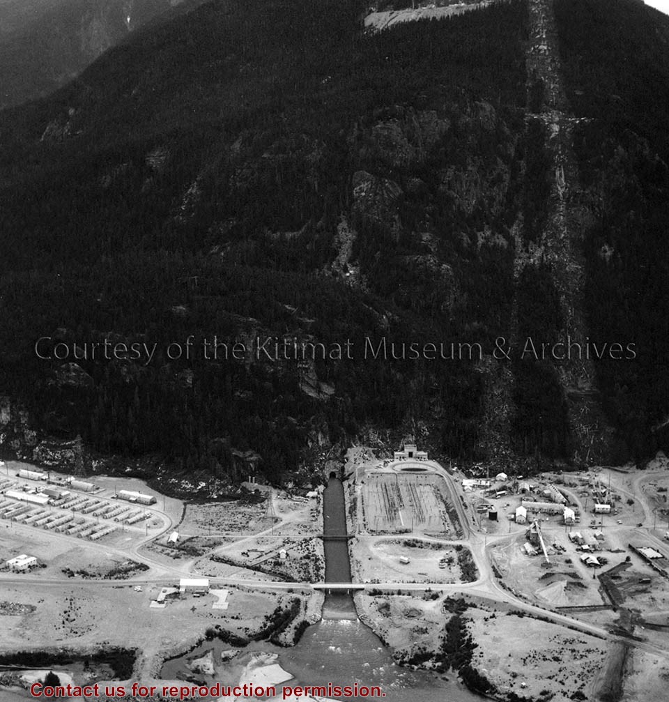
Photo depicts an aerial view of the powerhouse switchyard and entrance up to the 1600' level. The wide clearing on the right is the tram right-of-way. The powerhouse tailrace tunnel and channel and the access tunnel portal are in the centre, and the construction camp is on the left. Alcan Collection
Photo depicts an aerial view of the powerhouse switchyard and entrance up to the 1600' level. The wide clearing on the right is the tram right-of-way. The powerhouse tailrace tunnel and channel and the access tunnel portal are in the centre, and the construction camp is on the left. Alcan Collection
Photo depicts Nechako Neighbourhood, swath of land cleared for Neighbourhood "D", and Douglas Channel in the background, smelter on the right.
Notes
Famed Canadian documentary photographer Malak Karsh was hired in the 1950s by Alcan to take photographs of Arvida and Kitimat. Many were published in Alcan literature and textbooks on Canada. A colourized version of this photograph appears on the cover of the Canadian Geographical Journal, November 1959, Vol. LIX No.5. Northern Sentinel Press Collection
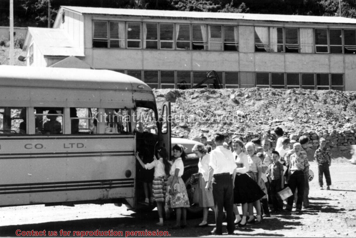
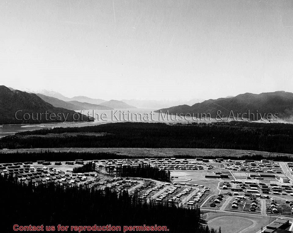
Photo depicts an aerial view looking northwest of Smeltersite housing, the hospital on the beach, the school in the centre, and the seaplane landing ramp.
Photo depicts an aerial view looking northwest of Smeltersite housing, the hospital on the beach, the school in the centre, and the seaplane landing ramp.
Notes
Title based on content of photograph. -- Alcan ID No. J-43-1837. Kitimat Heritage Advisory Commission Collection. KMA No. P00209.jpg
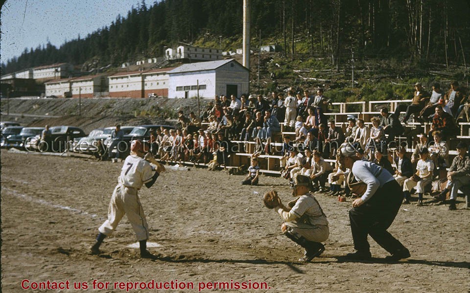
Photo depicts a youth softball game in full swing at the Smeltersite softball diamond, bleacher crowd watches the action. Crew bunkhouses on the hill slope in the background.
Photo depicts a youth softball game in full swing at the Smeltersite softball diamond, bleacher crowd watches the action. Crew bunkhouses on the hill slope in the background.
Notes
Title based on content of photograph. Mike Kinnear Collection
Photo depicts an aerial view of a portion of the Nechako neighbourhood showing the Hullah prototype area, Pintail and Partridge streets, in the foreground.
Photo depicts an aerial view of a portion of the Nechako neighbourhood showing the Hullah prototype area, Pintail and Partridge streets, in the foreground.
Notes
Title based on content of photograph. District of Kitimat Collection
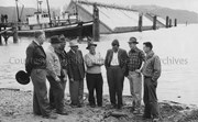
Photo depicts a group of men concerned with the caisson dock construction. From left is Messrs., Cam Jenkinson, George Malby, McCallum, Hal Whiting, J. B. Whitton, S. T. Wynne-Jones, Van Houten and Dick Hermann. View is of three floating caissons that were being towed into position for sinking, creating the smelter dock.
Photo depicts a group of men concerned with the caisson dock construction. From left is Messrs., Cam Jenkinson, George Malby, McCallum, Hal Whiting, J. B. Whitton, S. T. Wynne-Jones, Van Houten and Dick Hermann. View is of three floating caissons that were being towed into position for sinking, creating the smelter dock.
Notes
Title based on content of photograph. -- Alcan ID No. BC-2-362. -- Messrs. Jenkinson, Wynne-Jones, and Hermann all work for Alcan Engineering under the Resident Engineer George Malby. Messrs. J.B. Whitton and Van Houten work for the consulting firm of Frederick R. Harris & Co. of New York, N.Y. Hal Whiting was Project Manager, Kitimat Constructors, for smelter and town construction. Hal Whiting Collection 985.65.212