Photo showing Kitamaat Village - May Day celebrations. L/R May Day Queen Joyce Robinson, crowned by last's years' Queen, Mercy Grant. L/R: Velma Ross, Audrey Morrison, Joyce Robinson, Mercy Grant
Photo showing Kitamaat Village - May Day celebrations. L/R May Day Queen Joyce Robinson, crowned by last's years' Queen, Mercy Grant. L/R: Velma Ross, Audrey Morrison, Joyce Robinson, Mercy Grant
Photo showing Kitamaat Village's 1st missionary, Methodist Minister Rev. G.H. Raley, Returns to Kitamaat for a visit. Accompanied by his daughter. Mrs. A.H Charlton. Alcan guests stayed at the guest house. L/R Mrs. A.H. Charlton, Rev. G.H. Raley, Mr. &Mrs. Gordon Robinson.
Photo showing Kitamaat Village's 1st missionary, Methodist Minister Rev. G.H. Raley, Returns to Kitamaat for a visit. Accompanied by his daughter. Mrs. A.H Charlton. Alcan guests stayed at the guest house. L/R Mrs. A.H. Charlton, Rev. G.H. Raley, Mr. &Mrs. Gordon Robinson.
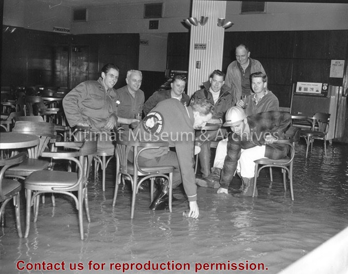
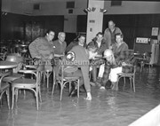
Hotel Manager George More is seen with some of the boys around 6 a.m. in the Gordon's main beverage room. Flood waters covered the tiled floor to a depth of several inches. Clean-up crews were on the job before noon and the hotel was back in business the same day, reflecting the swiftness with which the water dropped.
Hotel Manager George More is seen with some of the boys around 6 a.m. in the Gordon's main beverage room. Flood waters covered the tiled floor to a depth of several inches. Clean-up crews were on the job before noon and the hotel was back in business the same day, reflecting the swiftness with which the water dropped.
View of Haisla Hill (looking east) prior to the installation of the traffic lights. Kitimat General Hospital is tothe left. Note: no trees along the hill. Taken at the corner of Haisla and Lahakas.
View of Haisla Hill (looking east) prior to the installation of the traffic lights. Kitimat General Hospital is tothe left. Note: no trees along the hill. Taken at the corner of Haisla and Lahakas.
Aerial photo of the Kitimat river estuary showing Kitimat River, Kitimat Harbor, Minette Bay, and the Alcan company smelter site taken from the southwest looking northeast towards the Kitimat City Centre.
Aerial photo of the Kitimat river estuary showing Kitimat River, Kitimat Harbor, Minette Bay, and the Alcan company smelter site taken from the southwest looking northeast towards the Kitimat City Centre.
Aerial photo of the Kildala neighborhood, taken from the northeast looking southwest. On the left is the City Centre Mall and on the right is the Riverlodge construction camp. In the distance is Minette Bay.
Aerial photo of the Kildala neighborhood, taken from the northeast looking southwest. On the left is the City Centre Mall and on the right is the Riverlodge construction camp. In the distance is Minette Bay.