Skip header and navigation

Revise Search

20 records – page 1 of 1.

Topographical Map of Kitimat, 1957

https://collections.kitimatmuseum.ca/en/permalink/description15210
Part Of
Rick Wozney Collection
Description Level
Item
GMD
graphic material
Date Range
1957
Accession Number
2010.5.9
Scope and Content
Topographical Map of Kitimat, 1957. Part of the National Topographic Series. Scale 1:50,000. First Edition.
Part Of
Rick Wozney Collection
Creator
British Columbia Department of Lands and Forests
Description Level
Item
Accession Number
2010.5.9
GMD
graphic material
Responsibility
British Columbia Department of Lands and Forests
Date Range
1957
Physical Description
1 map : colour ; 74 x 57
Scope and Content
Topographical Map of Kitimat, 1957. Part of the National Topographic Series. Scale 1:50,000. First Edition.
Storage Location
Map Cabinet Drawer 8

Topographic Map of Kitimat Area

https://collections.kitimatmuseum.ca/en/permalink/description32379
Part Of
Arvid Hardin Collection
Description Level
Item
GMD
cartographic material
Date Range
1949
Accession Number
2009.15.40
Scope and Content
1949 topographic map of the Kitimat area. Planning for the Kitimat project.
Part Of
Arvid Hardin Collection
Description Level
Item
File Number
File 1
Accession Number
2009.15.40
GMD
cartographic material
Date Range
1949
Physical Description
1 map print
Custodial History
Donated by Arvid Hardin May 2009
Scope and Content
1949 topographic map of the Kitimat area. Planning for the Kitimat project.
Storage Location
Box 39

"D" Area On Map Of Kitimat

https://collections.kitimatmuseum.ca/en/permalink/description10986
Part Of
Northern Sentinel Press Ltd Collection
Description Level
Item
GMD
graphic material
Date Range
18 June 1969
Accession Number
2005.8.1751
Scope and Content
Photo showing two men holding up a map of Kitimat, showing business men where the "D' area is indicated.
Part Of
Northern Sentinel Press Ltd Collection
Creator
Max Patzelt
Description Level
Item
Accession Number
2005.8.1751
GMD
graphic material
Responsibility
Max Patzelt
Date Range
18 June 1969
Physical Description
1 photograpg: b&w; 4" x 6"
Custodial History
Current: 1960s; District of Kitimat, Miscellaneous
Scope and Content
Photo showing two men holding up a map of Kitimat, showing business men where the "D' area is indicated.
Name Access
Mearne, William
King, David
Subject Access
Maps
District of Kitimat
Storage Location
Artifact Storage

1926 Map of Kitimat and Surrounding Areas

https://collections.kitimatmuseum.ca/en/permalink/description32380
Part Of
Arvid Hardin Collection
Description Level
Item
GMD
cartographic material
Date Range
1926
Accession Number
2009.15.41
Scope and Content
Map showing Kitimat and surrounding areas moving east.
Part Of
Arvid Hardin Collection
Description Level
Item
File Number
File 1
Accession Number
2009.15.41
GMD
cartographic material
Date Range
1926
Physical Description
1 map print
Custodial History
Owned by A. Hardin, May 12, 1960 Kitimat BC
Scope and Content
Map showing Kitimat and surrounding areas moving east.
Storage Location
Box 39

Base Map of Statistical Area 6

https://collections.kitimatmuseum.ca/en/permalink/description36227
Part Of
Museum Collection
Description Level
Item
GMD
cartographic material
Date Range
1955-1956
Accession Number
2023.14
Scope and Content
Base map of statistical area 6. The map shows Kitimat and surrounding coastal area. This map is a partial reproduction of the West Central British Columbia Base Map by Geographic Division, Surveys & Mapping Branch, Department of Lands, Forests, & Water Resources, Victoria, B.C. 1955-56.
Part Of
Museum Collection
Description Level
Item
Accession Number
2023.14
GMD
cartographic material
Date Range
1955-1956
Scope and Content
Base map of statistical area 6. The map shows Kitimat and surrounding coastal area. This map is a partial reproduction of the West Central British Columbia Base Map by Geographic Division, Surveys & Mapping Branch, Department of Lands, Forests, & Water Resources, Victoria, B.C. 1955-56.
Storage Location
Map Cabinet Drawer 7
Part Of
R. Keith Jamieson Fonds
Description Level
Item
Date Range
1952
Accession Number
2007.1.65
Scope and Content
Slide of illustrated map of Kitimat.
Part Of
R. Keith Jamieson Fonds
Creator
Jamieson, R. Keith
Description Level
Item
Accession Number
2007.1.65
Date Range
1952
Physical Description
1 photograph : col. slide
History / Biographical
Jamieson came to Kitimat from Vancouver to work on the Alcan project in 1952. With his first pay cheque he bought a small "Pony Kodak" camera at the local store (Hudson Bay?), and started taking coloured slides of the Kitimat from 1952-1953. Left Kitimat at the end of August 1953 to move to Montreal.
Scope and Content
Slide of illustrated map of Kitimat.
Subject Access
Industry
Storage Location
Slide storage
Part Of
Northern Sentinel Press Ltd Collection
Description Level
Item
GMD
graphic material
Date Range
3 December 1964
Accession Number
2005.8.1734
Scope and Content
Photo showing map of boundary extension around Kitimat.
Part Of
Northern Sentinel Press Ltd Collection
Description Level
Item
Accession Number
2005.8.1734
GMD
graphic material
Date Range
3 December 1964
Physical Description
1 photograph: b&w; 6" x 8"
Custodial History
Current: 1960s; District of Kitimat, Miscellaneous
Scope and Content
Photo showing map of boundary extension around Kitimat.
Subject Access
Map
District of Kitimat
Storage Location
Artifact Storage
Part Of
Pat Lean Collection
Description Level
Item
GMD
cartographic material
Accession Number
2010.6.3
Scope and Content
Printed map of Kitimat from 1959. The old hospital is in place but the Museum isn't. Angle St. is identified as Alger St., and Gwyn St. is Faraday St. Riverlodge Camp is still in place.
Part Of
Pat Lean Collection
Description Level
Item
Accession Number
2010.6.3
GMD
cartographic material
Physical Description
1 map
History / Biographical
Pat Lean was the Provincial Government Agent in Kitimat from Dec 1 1969 to April 1 1970.
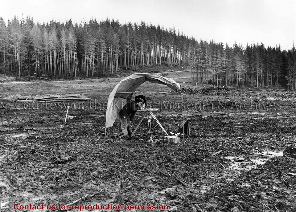
Scope and Content
Printed map of Kitimat from 1959. The old hospital is in place but the Museum isn't. Angle St. is identified as Alger St., and Gwyn St. is Faraday St. Riverlodge Camp is still in place.
Storage Location
Map Cabinet Drawer 7

Photograph of Map of Kitimat

https://collections.kitimatmuseum.ca/en/permalink/description18810
Part Of
Board of School Trustees, School District No. 80 fonds
Description Level
Item
GMD
graphic material
Date Range
ca. 1960
Accession Number
982.91.2
Scope and Content
Photo showing a map of Kitimat labelling the different streets and neighbourhoods as well as the City Centre and Service Centre.
Part Of
Board of School Trustees, School District No. 80 fonds
Description Level
Item
Accession Number
982.91.2
GMD
graphic material
Date Range
ca. 1960
Physical Description
1 photograph: b&w; 17.5 x 25.5 cm
Scope and Content
Photo showing a map of Kitimat labelling the different streets and neighbourhoods as well as the City Centre and Service Centre.
Notes
On back - credit line in red ink, P. 85%, 982.91.1 envelope, white-out applied to bottom edge.
Subject Access
Maps
Storage Location
Photograph Storage
Part Of
R. Keith Jamieson Fonds
Description Level
Item
GMD
cartographic material
Date Range
1952
Accession Number
2007.1.1
Scope and Content
Kitimat Project May 1952 map. Illustrated, shows Alcan site, camps, and animals in a drawn style. Very large.
Part Of
R. Keith Jamieson Fonds
Description Level
Item
Accession Number
2007.1.1
GMD
cartographic material
Date Range
1952
Physical Description
1 map
Scope and Content
Kitimat Project May 1952 map. Illustrated, shows Alcan site, camps, and animals in a drawn style. Very large.
Subject Access
Kitimat-Kemano Project
Storage Location
Archives Bay 1 Shelf 3 Box 20

Aerial Photo of Kitimat Map

https://collections.kitimatmuseum.ca/en/permalink/description9519
Part Of
Max Patzelt fonds
Description Level
Item
GMD
graphic material
Date Range
[ca. Apr 1964]
Accession Number
1998.1.8495
Scope and Content
Photo of an aerial photo map from 1957, surveying the growth and development of the City of Kitimat and the Alcan Aluminum Company Smelter site.
Part Of
Max Patzelt fonds
Creator
Patzelt, Max
Description Level
Item
Accession Number
1998.1.8495
GMD
graphic material
Date Range
[ca. Apr 1964]
Physical Description
1 photograph and 1 negative : b&w
Scope and Content
Photo of an aerial photo map from 1957, surveying the growth and development of the City of Kitimat and the Alcan Aluminum Company Smelter site.
Notes
Old Accession No. 987.26.483 C
Subject Access
Aerial
Kitimat

A Map of The District Municipality of Kitimat

https://collections.kitimatmuseum.ca/en/permalink/description36281
Part Of
Museum Collection
Description Level
Item
GMD
cartographic material
Date Range
1955
Accession Number
2023.25
Scope and Content
A Map of the District Municipality of Kitimat British Columbia. Drawn by G.V. Laurenson for the Hudson's Bay Company. 1st edition. Scale: 40 chains or 1/2 mile to an inch. Map shows Kitimat area map on one side, and close up sections including Service Center, City Centre, Nechako Centre, and Nechako Neighbourhood on the other.
Part Of
Museum Collection
Creator
G.V. Laurenson Hudson's Bay Company
Description Level
Item
Accession Number
2023.25
GMD
cartographic material
Date Range
1955
Physical Description
1 map : 55.5 x 91 cm
Scope and Content
A Map of the District Municipality of Kitimat British Columbia. Drawn by G.V. Laurenson for the Hudson's Bay Company. 1st edition. Scale: 40 chains or 1/2 mile to an inch. Map shows Kitimat area map on one side, and close up sections including Service Center, City Centre, Nechako Centre, and Nechako Neighbourhood on the other.
Storage Location
Map Cabinet Drawer 9

A Map of the District Municipality of Kitimat

https://collections.kitimatmuseum.ca/en/permalink/description29825
Part Of
Sandy Bloomfield Collection
Description Level
Item
GMD
graphic material
Date Range
[May 1955]
Accession Number
2002.3
Scope and Content
Map, of the District Municipality of Kitimat, British Columbia, drawn by G.V. Laurenson, May 1955 for Hudson's Bay Company. 1st. Edition.Map includes Neighborhood 'A' or 'Nechako', Kitimat Service Center, Aluminum Company of Canada Ltd.'s B.C. Project, Nechako Center, Kitimat City Center and a Reference section.
Part Of
Sandy Bloomfield Collection
Description Level
Item
Accession Number
2002.3
GMD
graphic material
Date Range
[May 1955]
Physical Description
Map : colour ; 60 x 95 cm
Scope and Content
Map, of the District Municipality of Kitimat, British Columbia, drawn by G.V. Laurenson, May 1955 for Hudson's Bay Company. 1st. Edition.Map includes Neighborhood 'A' or 'Nechako', Kitimat Service Center, Aluminum Company of Canada Ltd.'s B.C. Project, Nechako Center, Kitimat City Center and a Reference section.
Subject Access
Nechako
Nechako Centre
Alcan Smelters & Chemicals Ltd.
City Centre
service centre
Storage Location
Map Cabinet

Kitimat Trail System 1957 Map

https://collections.kitimatmuseum.ca/en/permalink/description32456
Part Of
Arvid Hardin Collection
Description Level
Item
GMD
cartographic material
Date Range
1957
Accession Number
2009.15.44
Scope and Content
Map of Kitimat trail systems, with information written on the back.
Part Of
Arvid Hardin Collection
Description Level
Item
File Number
File 1
Accession Number
2009.15.44
GMD
cartographic material
Date Range
1957
Custodial History
Donated by Arvid Hardin in 2009
Scope and Content
Map of Kitimat trail systems, with information written on the back.
Storage Location
Box 39

Eurocan Map of Kitimat Tree Farm

https://collections.kitimatmuseum.ca/en/permalink/description36222
Part Of
Dirk Mendel Collection
Description Level
Item
GMD
cartographic material
Accession Number
986.14.3
Scope and Content
Eurocan map of Kitimat Tree Farm. Note on map indicating where miner's pick and trap were found.
Part Of
Dirk Mendel Collection
Description Level
Item
Accession Number
986.14.3
GMD
cartographic material
Physical Description
1 map
Scope and Content
Eurocan map of Kitimat Tree Farm. Note on map indicating where miner's pick and trap were found.
Notes
Map is stored in acquisitions record for 986.14

Map of Kitimat Coast District Range 5

https://collections.kitimatmuseum.ca/en/permalink/description36214
Part Of
Museum Collection
Description Level
Item
GMD
cartographic material
Date Range
1957
Accession Number
2003.51
Part Of
Museum Collection
Creator
British Columbia Department of Lands and Forests
Description Level
Item
Accession Number
2003.51
GMD
cartographic material
Date Range
1957
Physical Description
1 map
Custodial History
Topographical map of Kitimat Coast District Range 5. Edges of map is worn out and looks water damaged or burned.

Map of Job Site of Kitimat Smelter Project

https://collections.kitimatmuseum.ca/en/permalink/description36223
Part Of
Molly Zimmerman fonds
Description Level
Item
GMD
cartographic material
Date Range
1950s
Accession Number
2003.37.22
Scope and Content
Illustrated map of the Job Site of Kitimat Smelter Project.
Part Of
Molly Zimmerman fonds
Description Level
Item
Accession Number
2003.37.22
GMD
cartographic material
Date Range
1950s
Scope and Content
Illustrated map of the Job Site of Kitimat Smelter Project.
Storage Location
Map Cabinet Drawer 6

Topographer at plane table

https://collections.kitimatmuseum.ca/en/permalink/description169
Part Of
Kitimat Museum Website Collection
Description Level
Item
GMD
graphic material
Date Range
November 10, 1953
Accession Number
73.3.4.5
Scope and Content
Photo depicts a topographer standing at a plane table, doing calculations for City Centre.
Part Of
Kitimat Museum Website Collection
Description Level
Item
Item Number
163
Accession Number
73.3.4.5
GMD
graphic material
Date Range
November 10, 1953
Physical Description
1 photograph : b&w
Scope and Content
Photo depicts a topographer standing at a plane table, doing calculations for City Centre.
Notes
Title based on content of photograph. Alcan Collection
Subject Access
Towns
Images

Kitimat Residential Area - Aerial

https://collections.kitimatmuseum.ca/en/permalink/description19473
Part Of
McLoughlin Collection
Description Level
Item
GMD
graphic material
Date Range
1958 Sept
Accession Number
982.33.38
Part Of
McLoughlin Collection
Description Level
Item
Accession Number
982.33.38
Standard number
Photograph of Aerial View of Kildala Neighborhood ; Nechako Neighborhood ; City Centre ; Haisla Bridge ; Kitimat River ; Riverlodge Camp ; Parks and Campgrounds ; Municipal ; Radley Park
GMD
graphic material
Date Range
1958 Sept
Physical Description
1 Photograph print : b&w ; 22.5 x 22.5 cm
Subject Access
Kitimat

Map - Kitimat, Coastal Range 5, Department of Lands and Forests

https://collections.kitimatmuseum.ca/en/permalink/description21300
Part Of
Worboys Collection
Description Level
Item
GMD
graphic material
Date Range
[ca. 1956-1957]
Accession Number
2012.24.3
Scope and Content
Map of Kitimat, Coast District Range 5, Department of Lands and Forests, 1956-1957. Map shows early construction camps, Nechako neighbourhood, Reservations, all topography references.
Part Of
Worboys Collection
Description Level
Item
Accession Number
2012.24.3
GMD
graphic material
Date Range
[ca. 1956-1957]
Physical Description
1 map
Scope and Content
Map of Kitimat, Coast District Range 5, Department of Lands and Forests, 1956-1957. Map shows early construction camps, Nechako neighbourhood, Reservations, all topography references.
Subject Access
Maps
Storage Location
Curator Bay 1 Shelf 2 Box 15

20 records – page 1 of 1.