Photo depicts an aerial view of a portion of the Nechako neighbourhood showing the Hullah prototype area, Pintail and Partridge streets, in the foreground.
Photo depicts an aerial view of a portion of the Nechako neighbourhood showing the Hullah prototype area, Pintail and Partridge streets, in the foreground.
Notes
Title based on content of photograph. District of Kitimat Collection
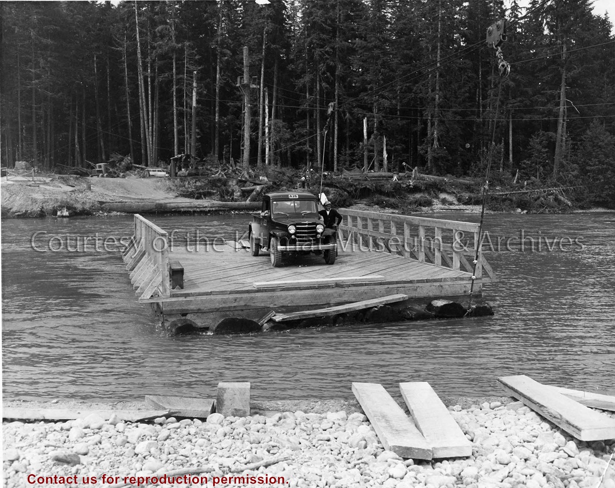
Photo depicts a man standing beside his truck, crossing the Kitimat River aboard a wood construction raft ferry, guard rail on two sides, and guided by a cabling system shown above the river.
Photo depicts a man standing beside his truck, crossing the Kitimat River aboard a wood construction raft ferry, guard rail on two sides, and guided by a cabling system shown above the river.
Notes
Title based on content of photograph. Alcan Collection 73.3.3.29
Photo showing the path to the Kitimat water supply. The water tower can be seen up near the top of a hill in the photo with the path flanked by trees. The pathway is made of a wooden ramp and there is a long hose coming down from the tower with at least two People seen at the towers base.
Photo showing the path to the Kitimat water supply. The water tower can be seen up near the top of a hill in the photo with the path flanked by trees. The pathway is made of a wooden ramp and there is a long hose coming down from the tower with at least two People seen at the towers base.
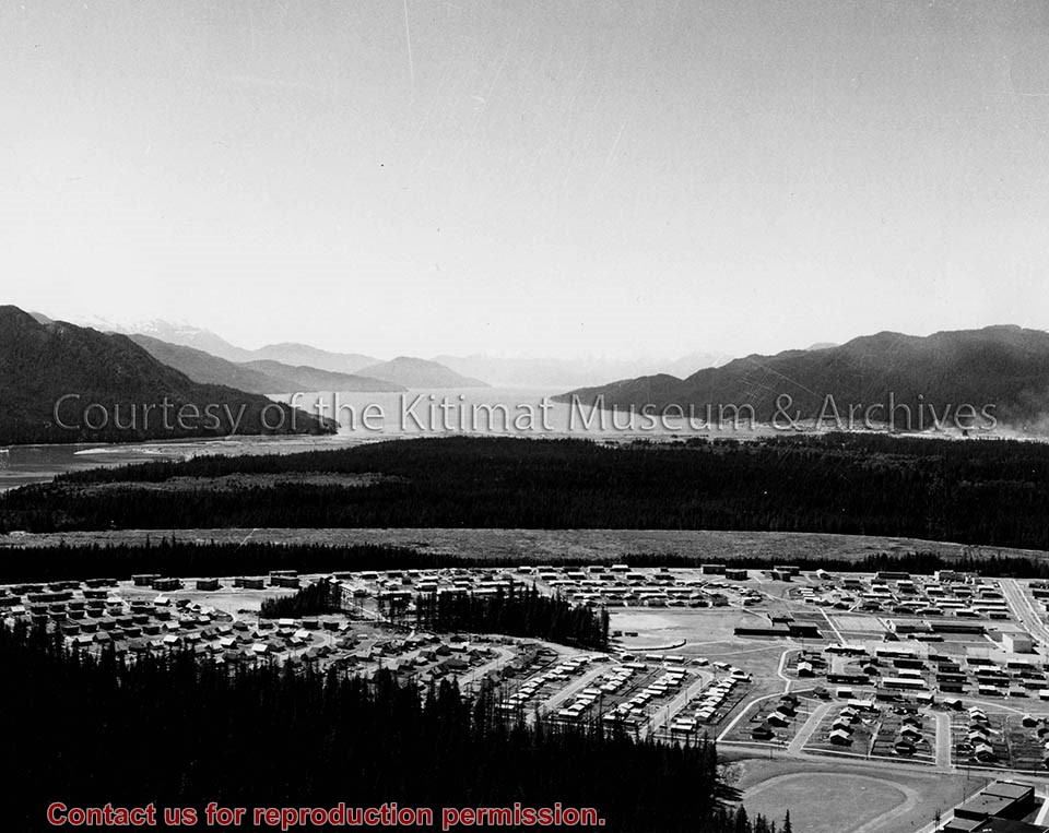
Photo depicts Nechako Neighbourhood, swath of land cleared for Neighbourhood "D", and Douglas Channel in the background, smelter on the right.
Notes
Famed Canadian documentary photographer Malak Karsh was hired in the 1950s by Alcan to take photographs of Arvida and Kitimat. Many were published in Alcan literature and textbooks on Canada. A colourized version of this photograph appears on the cover of the Canadian Geographical Journal, November 1959, Vol. LIX No.5. Northern Sentinel Press Collection