Photograph of Lakelse campsite after slide. Aerial shot above shows the layout of the government campsite and path of the slide through the southern part. Parking units in the lower foreground right are seen to have been relatively undisturbed by the slide when this picture was taken late Thursday afternoon. Damage to new road construction, upper left, is clearly seen.
Photograph of Lakelse campsite after slide. Aerial shot above shows the layout of the government campsite and path of the slide through the southern part. Parking units in the lower foreground right are seen to have been relatively undisturbed by the slide when this picture was taken late Thursday afternoon. Damage to new road construction, upper left, is clearly seen.
Photograph of the Kitimat sandhill by the Kitimat River. Kitimat River is in front, with machinery and sandhill behind. Sandhill is carved away into a sand wall.
Mike (Miecyszlaw) and Nancy Marciniak lived and worked in Kitimat in the 1950s. Their daughter, Nancy Anne, was born here in 1957.
Scope and Content
Photograph of the Kitimat sandhill by the Kitimat River. Kitimat River is in front, with machinery and sandhill behind. Sandhill is carved away into a sand wall.
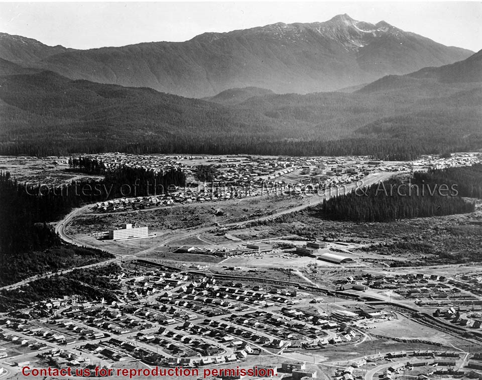
Telephoto depicts the town of Kitimat, an aerial view with Mount Elizabeth in the background, Kildala Neighbourhood in the foreground, and Nechako Neighbourhood "up the hill" in the centre.
Telephoto depicts the town of Kitimat, an aerial view with Mount Elizabeth in the background, Kildala Neighbourhood in the foreground, and Nechako Neighbourhood "up the hill" in the centre.
Notes
Title based on content of photograph. -- Public relations photograph of Kitimat. Fred Busby Collection 2002.27