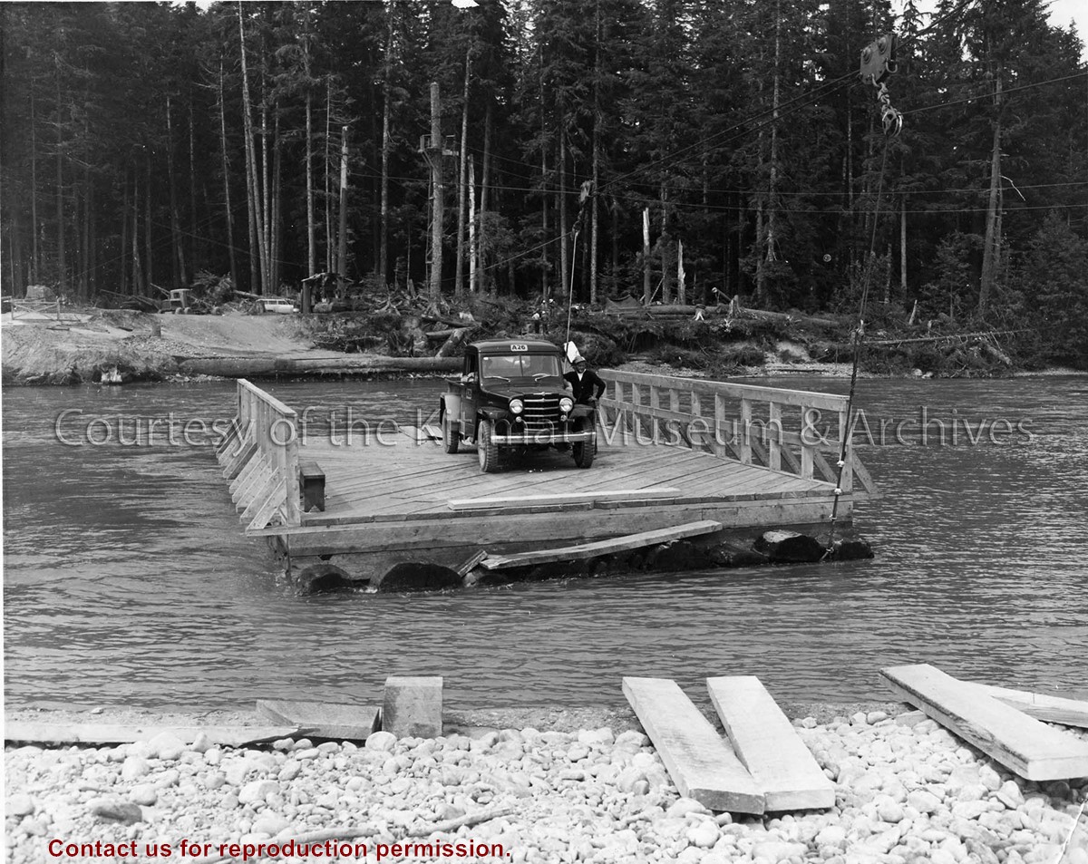
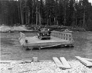
Photo depicts a man standing beside his truck, crossing the Kitimat River aboard a wood construction raft ferry, guard rail on two sides, and guided by a cabling system shown above the river.
Photo depicts a man standing beside his truck, crossing the Kitimat River aboard a wood construction raft ferry, guard rail on two sides, and guided by a cabling system shown above the river.
Notes
Title based on content of photograph. Alcan Collection 73.3.3.29
Aerial view of the Kitimat River Bridge site looking East. The townsite camp can be seen at upper right. The building being erected at left centre on the riverbank is the clubhouse of the Kitimat Rod & Gun.
Aerial view of the Kitimat River Bridge site looking East. The townsite camp can be seen at upper right. The building being erected at left centre on the riverbank is the clubhouse of the Kitimat Rod & Gun.
Photograph of the footbridge over the Kitimat River. People can be seen walking on the bridge. A bus and other vehicles can be seen on the opposite bank.
Photograph of the footbridge over the Kitimat River. People can be seen walking on the bridge. A bus and other vehicles can be seen on the opposite bank.
Photographs of bridge over Kitimat River replacing one taken out by a flood. Bunch of trees and debrees caught up on bottom of bridge. Two men are standing up on the bridge.
Fred DeLory worked for Arvida P.Q. and was transferred to Kitimat at the beginning of 1952. He was the first town engineer.
Scope and Content
Photographs of bridge over Kitimat River replacing one taken out by a flood. Bunch of trees and debrees caught up on bottom of bridge. Two men are standing up on the bridge.
Photographs of Kitamaat village taken from air over the camp. What appears to be a road going over the mountain is actually the clearing for the transmission line going to Kemano 49.6 miles away. Smoke is caused by burning off slack.
Fred DeLory worked for Arvida P.Q. and was transferred to Kitimat at the beginning of 1952. He was the first town engineer.
Scope and Content
Photographs of Kitamaat village taken from air over the camp. What appears to be a road going over the mountain is actually the clearing for the transmission line going to Kemano 49.6 miles away. Smoke is caused by burning off slack.
A photograph of a sign in Kitwanga to a Phil Gaglardi near the Kitwanga Ferry from the Kitwanga Indian Band sayng "Sorry to embarrass you Mr. Gaglardi, you have not paid for this 4 miles Indian Reserve Land"
A photograph of a sign in Kitwanga to a Phil Gaglardi near the Kitwanga Ferry from the Kitwanga Indian Band sayng "Sorry to embarrass you Mr. Gaglardi, you have not paid for this 4 miles Indian Reserve Land"
Black covered book titled "Kitimat Townsite Report". No. A-33 Mr. J.E. Dudley. Contains info about early Kitimat and planning. Inside front cover are some loose pages with town plans.
Bud Powell is a longtime resident of Kitimat and former smeltersite resident. He worked for Alcan.
Custodial History
Donated by Bud Powell.
Scope and Content
Black covered book titled "Kitimat Townsite Report". No. A-33 Mr. J.E. Dudley. Contains info about early Kitimat and planning. Inside front cover are some loose pages with town plans.