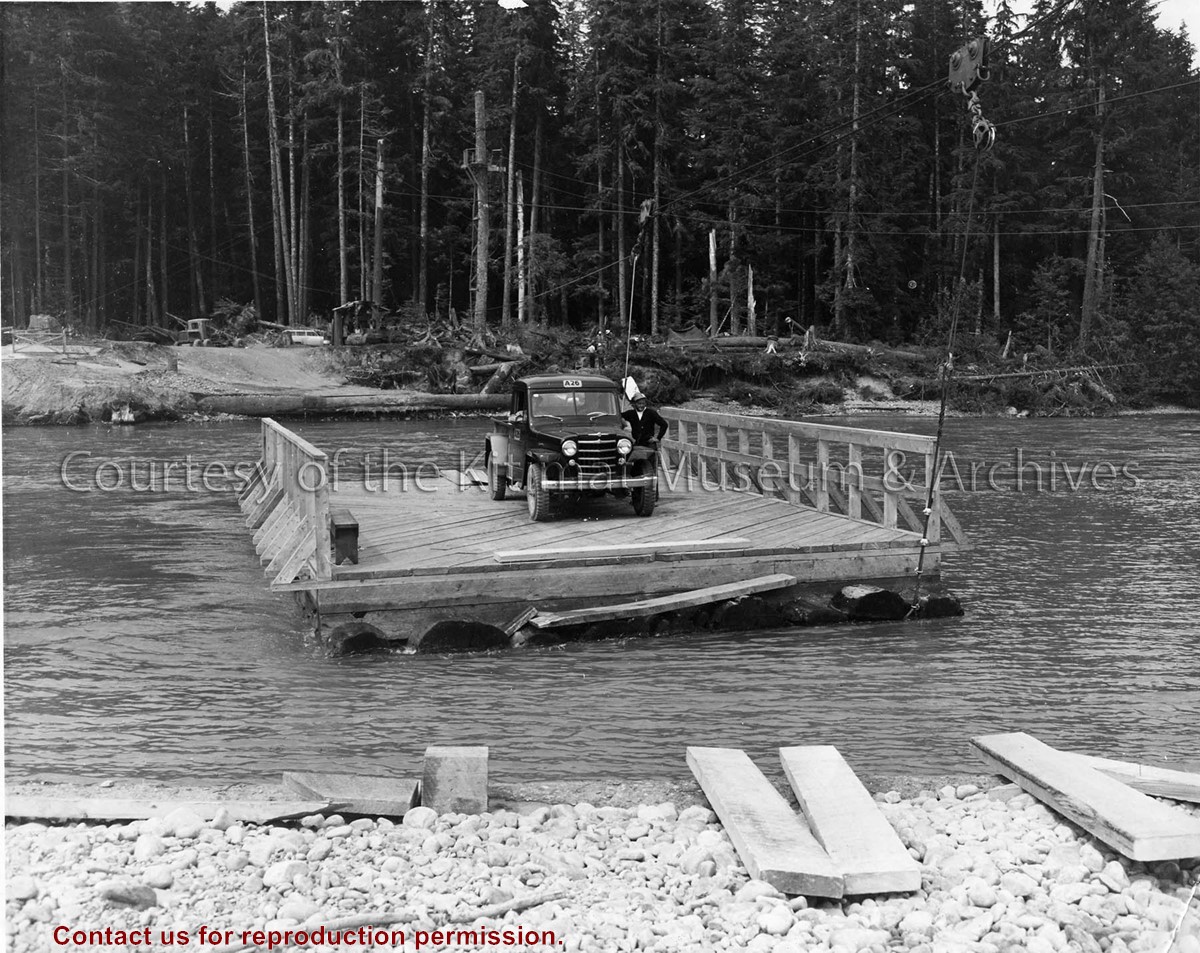
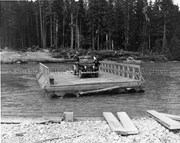
Photo depicts a man standing beside his truck, crossing the Kitimat River aboard a wood construction raft ferry, guard rail on two sides, and guided by a cabling system shown above the river.
Photo depicts a man standing beside his truck, crossing the Kitimat River aboard a wood construction raft ferry, guard rail on two sides, and guided by a cabling system shown above the river.
Notes
Title based on content of photograph. Alcan Collection 73.3.3.29
A photograph of a sign in Kitwanga to a Phil Gaglardi near the Kitwanga Ferry from the Kitwanga Indian Band sayng "Sorry to embarrass you Mr. Gaglardi, you have not paid for this 4 miles Indian Reserve Land"
A photograph of a sign in Kitwanga to a Phil Gaglardi near the Kitwanga Ferry from the Kitwanga Indian Band sayng "Sorry to embarrass you Mr. Gaglardi, you have not paid for this 4 miles Indian Reserve Land"
Photograph of gully crossing #2 showing the clearing contractor placing the dead and diseased trees at the base of the gully to stop any further earth slippage and improve the appearance of the area. Houses visble on hill behind.
Land clearing of Kitimat. All aerials for development.
Custodial History
From the files of Ray Hunstone. Photos from an Alcan binder, have Alcan numbers.
Scope and Content
Photograph of gully crossing #2 showing the clearing contractor placing the dead and diseased trees at the base of the gully to stop any further earth slippage and improve the appearance of the area. Houses visble on hill behind.
Photograph of the equipment pumping grouting between 42" culvert and collapsing 54" culvert at gully crossing No. 3. Men working from above. Behind them up a bit higher are houses and some vehicles.
Donated by Jackie Worboys. Given to the Jackie Mufford Worboys family by Wally Melville.
Scope and Content
Photograph of the equipment pumping grouting between 42" culvert and collapsing 54" culvert at gully crossing No. 3. Men working from above. Behind them up a bit higher are houses and some vehicles.
Photograph of aerial of the Kitimat townsite and Kitimat River. Nechako and Kildala neighbourhoods are above on the left. Douglas Channel is on the right. Below the Kitimat River curves along the bottom. At the very bottom is the sandhill and sandhill operations.
From the years 1953-1958, Mike Kinnear took photos during his school years, until graduation, while working for Fred Ryan Ltd. after school and holidays. Photos for him was a hobby, and he took many photos of the smelter and townsite as it grew around him. Mike also took a number of photos for the Kitimat Northern Sentinel, during the Ken Brumley and Pixie Meldrum years as editors. Mike and his family left Kitimat in 1958, but he spent the best part of 40 years in the photographic field, mainly in the retail/wholesale part of the photo industry.
Custodial History
Donated by Margaret and Mike Kinnear.
Scope and Content
Photograph of aerial of the Kitimat townsite and Kitimat River. Nechako and Kildala neighbourhoods are above on the left. Douglas Channel is on the right. Below the Kitimat River curves along the bottom. At the very bottom is the sandhill and sandhill operations.