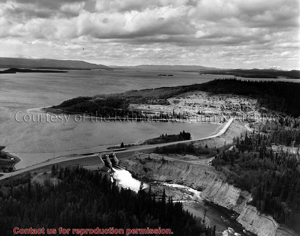
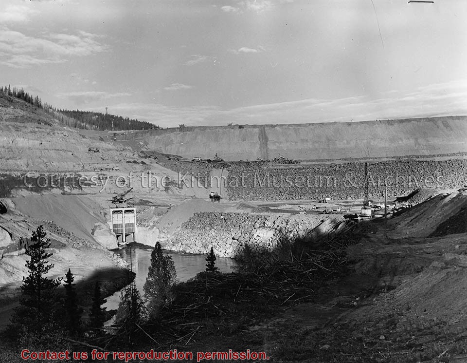
Negatives showing the Nechako Reservoir, the Kenney Dam, & the Skins Lake Spillway which were built to create hydroelectric power to be used by the Alcan aluminum smelter in Kitimat. Also pictured is Des Lake, Alcan barge Tahtsa II at East Tahtsa, a view of the Entiako River as it enters the Nechako Reservoir, an underwater cutting barge, & Eurocan's logging operation at Andrews Bay on Ootsa Lake.
Negatives showing the Nechako Reservoir, the Kenney Dam, & the Skins Lake Spillway which were built to create hydroelectric power to be used by the Alcan aluminum smelter in Kitimat. Also pictured is Des Lake, Alcan barge Tahtsa II at East Tahtsa, a view of the Entiako River as it enters the Nechako Reservoir, an underwater cutting barge, & Eurocan's logging operation at Andrews Bay on Ootsa Lake.
" 'E.T.Kenney kids got together with nieghboring Clarence Michiel students to hamit up for our cameraman on completing the first week of classes. (John Anderson photo.)''Clarence Miechiel school.'."
" 'E.T.Kenney kids got together with nieghboring Clarence Michiel students to hamit up for our cameraman on completing the first week of classes. (John Anderson photo.)''Clarence Miechiel school.'."
Notes
School District - #80 - 1970 - Mount Elizabeth Secondary School Northern Sentinel - (A) Historical (1) School District 380 (a) Mount Elizabeth Secondary School
or (school name)
Photo showing up to 16 of these dynamite sticks were used for each of the explosions it took to blast open the beaver dam. Fuse and cap were inserted at the end of the stick. The fuse burns at the rate of about a foot per minute.
Current: 1960s
-District of Kitimat
-Miscellaneous
Scope and Content
Photo showing up to 16 of these dynamite sticks were used for each of the explosions it took to blast open the beaver dam. Fuse and cap were inserted at the end of the stick. The fuse burns at the rate of about a foot per minute.
Photo showing a TD-24 spreading a layer of alrge stones at the base of Nechako Damn west to the rock fill portion which is laid in first, these layers of various size rock, stone and clay with all slope towards the rock fill at about the degree pitch.
Photo showing a TD-24 spreading a layer of alrge stones at the base of Nechako Damn west to the rock fill portion which is laid in first, these layers of various size rock, stone and clay with all slope towards the rock fill at about the degree pitch.