Aerial view of the intersection of Lahakas and Haisla Boulevards in Kitimat, likely taken from the roof of the General Hospital. The Kildala neighbourhood is visible in the middle background.
Aerial view of the intersection of Lahakas and Haisla Boulevards in Kitimat, likely taken from the roof of the General Hospital. The Kildala neighbourhood is visible in the middle background.
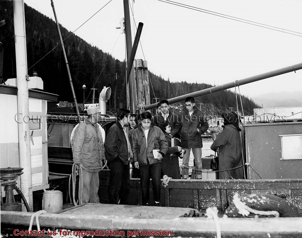
A group of young adults walking off the train in Terrace. There is a lady in front wearing a handkerchief over her hair, and there are three young men just walking out of the train. The conductor is standing just outside the door as the people are walking out.
A group of young adults walking off the train in Terrace. There is a lady in front wearing a handkerchief over her hair, and there are three young men just walking out of the train. The conductor is standing just outside the door as the people are walking out.
Aerial photo of the Alcan aluminum smelter site, and the Douglas Channel. Taken from the north looking south. Note - bottom left corner is a portion of the Anderson Creek construction camp.
Aerial photo of the Alcan aluminum smelter site, and the Douglas Channel. Taken from the north looking south. Note - bottom left corner is a portion of the Anderson Creek construction camp.
Photo depicts an aerial view of Kitimat. Seen is land cleared for Neighbourhood "D" and the Whitesail Neighbourhood under construction, right foreground. The Alcan smelter and channel are in the background.
Photo depicts an aerial view of Kitimat. Seen is land cleared for Neighbourhood "D" and the Whitesail Neighbourhood under construction, right foreground. The Alcan smelter and channel are in the background.
Notes
Title based on content of photograph. -- On the official "Town Plan for Kitimat, B.C." by Stein and Mayer & Whittlesey, Neighbourhood "D", the cleared area in the photo, was to have three elementary schools, and one junior and one senior high school. This neighbourhood was never constructed and was returned to bush.
Aerial photo of the Kitimat river estuary showing Kitimat River, Kitimat Harbor, Minette Bay, and the Alcan company smelter site taken from the southwest looking northeast towards the Kitimat City Centre.
Aerial photo of the Kitimat river estuary showing Kitimat River, Kitimat Harbor, Minette Bay, and the Alcan company smelter site taken from the southwest looking northeast towards the Kitimat City Centre.