Clearing operations, Neighbourhood A (Nechako) caterpillar tractor with boomdragging stumps and logs.
A truck fallen into a ditch can be seen in the forground flipped onto it's side.
Clearing operations, Neighbourhood A (Nechako) caterpillar tractor with boomdragging stumps and logs.
A truck fallen into a ditch can be seen in the forground flipped onto it's side.
Photograph of aerial looking south-east across neighbourhood A with neighbourhood A-II clearing in foreground and Minette Bay in the background. Nechako Centre and School are visible.
Donated by Jackie Worboys. Given to the Jackie Mufford Worboys family by Wally Melville.
Scope and Content
Photograph of aerial looking south-east across neighbourhood A with neighbourhood A-II clearing in foreground and Minette Bay in the background. Nechako Centre and School are visible.
Photograph of aerial view looking west showing C-II clearing in lower left hand corner, low rental housing area and neighbourhood C-I in centre, and new camp site clearing left-centre. Camp is at Riverlodge site. Kitimat River bridge visible behind. Lots of snow on ground.
Donated by Jackie Worboys. Given to the Jackie Mufford Worboys family by Wally Melville.
Scope and Content
Photograph of aerial view looking west showing C-II clearing in lower left hand corner, low rental housing area and neighbourhood C-I in centre, and new camp site clearing left-centre. Camp is at Riverlodge site. Kitimat River bridge visible behind. Lots of snow on ground.
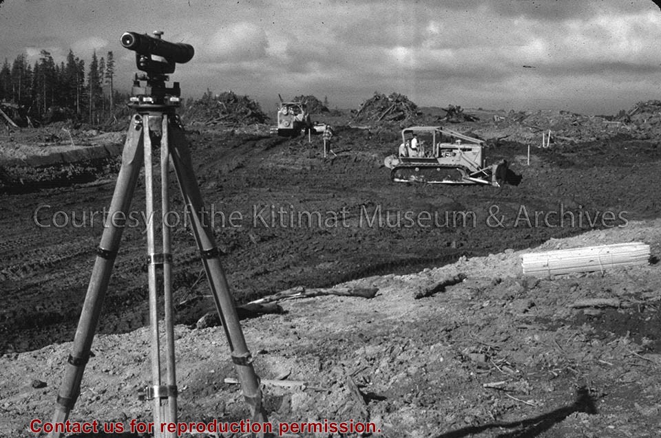
Photograph of land clearing operation in neighbourhood C-II. Sewer line under construction in foreground is part of extension to Sagimat temporary housing. Pipe segments in foreground.
Land clearing of Kitimat. All aerials for development.
Custodial History
From the files of Ray Hunstone. Photos from an Alcan binder, have Alcan numbers.
Scope and Content
Photograph of land clearing operation in neighbourhood C-II. Sewer line under construction in foreground is part of extension to Sagimat temporary housing. Pipe segments in foreground.
Aerial view of Nechako Neighbourhood looking east. looking east. Note clearing for B-III on left side of picture and clearing for City Centre and Neighbourhood D on the right side.
Aerial view of Nechako Neighbourhood looking east. looking east. Note clearing for B-III on left side of picture and clearing for City Centre and Neighbourhood D on the right side.
Photo showing view looking north, west half of Storage Building, portion of hydraulic fill area, dyke protecting portion being stripped at right and centre, area in foreground partially stripped.
Photo showing view looking north, west half of Storage Building, portion of hydraulic fill area, dyke protecting portion being stripped at right and centre, area in foreground partially stripped.
Photograph of looking scross the north east corner of neighbourhood C-1 towards the City Centre. Note the temporary decked logs in the foreground and the permanently decked logs along the edge of the City Centre. Man and machine visible on far right.
Donated by Jackie Worboys. Given to the Jackie Mufford Worboys family by Wally Melville.
Scope and Content
Photograph of looking scross the north east corner of neighbourhood C-1 towards the City Centre. Note the temporary decked logs in the foreground and the permanently decked logs along the edge of the City Centre. Man and machine visible on far right.