Photograph of view of Kitimat terminal wharf #1 looking south from a point on conveyor gallery C1 showing the alumina handling plant, and rail being laid on the wharf deck.
Bill was one of the superintendents with Saguenay Kitimat.
Custodial History
Donated by Joanna Gallacher
Scope and Content
Photograph of view of Kitimat terminal wharf #1 looking south from a point on conveyor gallery C1 showing the alumina handling plant, and rail being laid on the wharf deck.
HIKERS and other outdoorsmen who have been down the Kildala dike road lately may have seen the drilling rig pictured above. The Sentinel spotted it and began to ask questions. The answers led not to oil or gold but to Eurocan Pulp & Paper Co. Ltd. A spokesman in Vancouver disclosed that although engineering and economic studies had been completed on the proposed Emsley Cove site down the channel the economic feasibility of other possible sites were also being throughly investigated. Eurocan personnel, together with the Vancouver firm of Ribley, Klohn and Leonoss Ltd., have been doing seismic and other tests on the site where the rig is shown, above, between Kildala neighborhood and Minette Bay,
--Patzelt Photo."
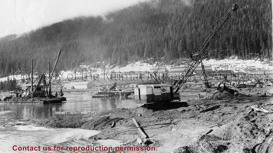
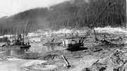
Photo showing view looking toward site of Pernament Wharf from south dike of graving dock, dredge and dragon line excavating channel from graving dock to deep water, truck dumping gravel for foundation blanket into bottom dump scow.
Photo showing view looking toward site of Pernament Wharf from south dike of graving dock, dredge and dragon line excavating channel from graving dock to deep water, truck dumping gravel for foundation blanket into bottom dump scow.
Photograph of view looking north along east boundary of the site of potlines 3 and 4 showing the dredge effluent ditch and the east edge of the hydraulic fill.
Bill was one of the superintendents with Saguenay Kitimat.
Custodial History
Donated by Joanna Gallacher
Scope and Content
Photograph of view looking north along east boundary of the site of potlines 3 and 4 showing the dredge effluent ditch and the east edge of the hydraulic fill.
Photo depicts the dredge and dragline excavating the channel from the dock to deep water, a truck dumping gravel for the foundation blanket into the bottom of a dump scow. The view looks toward the construction site for the permanent wharf from the south dike of the graving dock, crew bunkhouses of Smeltersite in the background.
Photo depicts the dredge and dragline excavating the channel from the dock to deep water, a truck dumping gravel for the foundation blanket into the bottom of a dump scow. The view looks toward the construction site for the permanent wharf from the south dike of the graving dock, crew bunkhouses of Smeltersite in the background.
Notes
Title based on content of photograph. -- Alcan ID No. BC-2-320. Hal Whiting Collection 985.65.211
Photograph of view looking west at bridge site showing Kitimat River at elevation 45. Centre pier of permanent bridge at right with formwork for final concrete pour.
Bill was one of the superintendents with Saguenay Kitimat.
Custodial History
Donated by Joanna Gallacher
Scope and Content
Photograph of view looking west at bridge site showing Kitimat River at elevation 45. Centre pier of permanent bridge at right with formwork for final concrete pour.