Aerial view of the Kitimat River Bridge site looking south showing falsework for steel erection. The building at lower left is the Club House of the Kitimat Rod and Gun Club.
Aerial view of the Kitimat River Bridge site looking south showing falsework for steel erection. The building at lower left is the Club House of the Kitimat Rod and Gun Club.
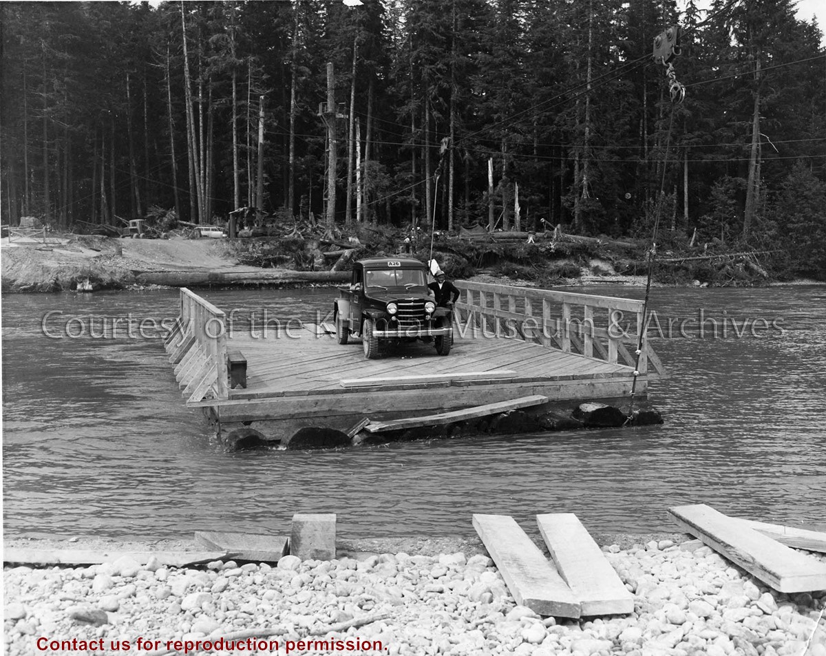
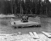
Photo depicts a man standing beside his truck, crossing the Kitimat River aboard a wood construction raft ferry, guard rail on two sides, and guided by a cabling system shown above the river.
Photo depicts a man standing beside his truck, crossing the Kitimat River aboard a wood construction raft ferry, guard rail on two sides, and guided by a cabling system shown above the river.
Notes
Title based on content of photograph. Alcan Collection 73.3.3.29
Photograph showing the kitimat river during winter. A D8 CAT bulldozer can be seen crossing the river with a man in a rowboat alongside. The photo is looking east toward townsite road clearing.
Photograph showing the kitimat river during winter. A D8 CAT bulldozer can be seen crossing the river with a man in a rowboat alongside. The photo is looking east toward townsite road clearing.
Black covered book titled "Kitimat Townsite Report". No. A-33 Mr. J.E. Dudley. Contains info about early Kitimat and planning. Inside front cover are some loose pages with town plans.
Bud Powell is a longtime resident of Kitimat and former smeltersite resident. He worked for Alcan.
Custodial History
Donated by Bud Powell.
Scope and Content
Black covered book titled "Kitimat Townsite Report". No. A-33 Mr. J.E. Dudley. Contains info about early Kitimat and planning. Inside front cover are some loose pages with town plans.
Subdivision plan of part of district lots 6038, 6039 and part of block 29, plan 3435 range 5, Coast District. District Municipality of Kitimat. Plan 4228. November 5, 1961.
Plan of subdivision of parts of D.L. 6046 & west half of D.L. 6045, and parcel. "X" (former block 78 and adjoining road plan 3549) range 5, Coast District. District Municipality of Kitimat. Plan 4639. August 27, 1963.
Plan of portions of block 29 map 3435 district lots 6038, 6039, 6042 & 6043 range 5, Coast District. District Municipality of Kitimat. Plan 3743. November 4, 1957.
Donated by Rick Wozney. Aluminum Company of Canada, Limited (Registered Owner).
Scope and Content
District of Kitimat lot and block plans.
Subdivision plan of part of district lots 6038, 6039 and part of block 29, plan 3435 range 5, Coast District. District Municipality of Kitimat. Plan 4228. November 5, 1961.
Plan of subdivision of parts of D.L. 6046 & west half of D.L. 6045, and parcel. "X" (former block 78 and adjoining road plan 3549) range 5, Coast District. District Municipality of Kitimat. Plan 4639. August 27, 1963.
Plan of portions of block 29 map 3435 district lots 6038, 6039, 6042 & 6043 range 5, Coast District. District Municipality of Kitimat. Plan 3743. November 4, 1957.
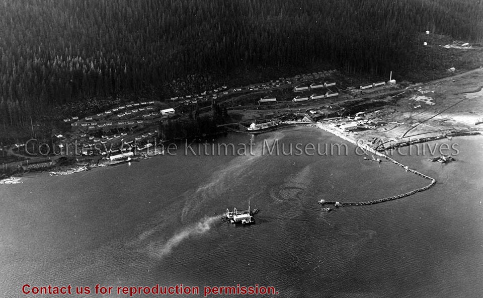
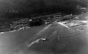
Photo depicts an aerial view of the smeltersite main camp showing married quarters, sternwheeler Delta King, hydraulic fill in progress, recreation building, hospital, power plant, sawmill and water tank.
Photo depicts an aerial view of the smeltersite main camp showing married quarters, sternwheeler Delta King, hydraulic fill in progress, recreation building, hospital, power plant, sawmill and water tank.
Notes
Title based on content of photograph. -- Alcan ID Numbers BC-2-243 and ACM-24311. Alcan Collection 78.11.32
Photo depicts an aerial view of a portion of the Nechako neighbourhood showing the Hullah prototype area, Pintail and Partridge streets, in the foreground.
Photo depicts an aerial view of a portion of the Nechako neighbourhood showing the Hullah prototype area, Pintail and Partridge streets, in the foreground.
Notes
Title based on content of photograph. District of Kitimat Collection
Photographs of early Kitimat and Alcan smelter. Souvenir photobook with five photos.
Townsite with Mount Elizabeth in background. Smoke is visible beyond townsite in the forest. May 15, 1956.
Townsite with sandhill visible in background. May 15, 1956.
Main Road - Motel - Townsite. View of road leading from service centre into town. Kildala area cleared but not much is built. Kitimat River bridge visible at bottom. Aug 1955.
Kitimat Valley. View of Alcan site, hospital beach, and pier. Looking north.
Smeltersite. View of Alcan smelter and smeltersite.
Donated by Carol Larson. Originally belonged to her mother, Lydia Strecheniuk.
Scope and Content
Photographs of early Kitimat and Alcan smelter. Souvenir photobook with five photos.
Townsite with Mount Elizabeth in background. Smoke is visible beyond townsite in the forest. May 15, 1956.
Townsite with sandhill visible in background. May 15, 1956.
Main Road - Motel - Townsite. View of road leading from service centre into town. Kildala area cleared but not much is built. Kitimat River bridge visible at bottom. Aug 1955.
Kitimat Valley. View of Alcan site, hospital beach, and pier. Looking north.
Smeltersite. View of Alcan smelter and smeltersite.
Photograph of the backside view of some Kitimat homes. Oriole Street? There is a sidewalk leading to the street on the right with a person walking on the grass to the left of it. Some newly planted trees are in the grass.
Alice Dicker's father, Benard, came to Canada to work in 1955. He was a forman D-shift for Alcan. He married Anna in 1959. Alice and her sister Claudia were born in Kitimat and the family lived here until 1969, at which time they returned to Germany.
Scope and Content
Photograph of the backside view of some Kitimat homes. Oriole Street? There is a sidewalk leading to the street on the right with a person walking on the grass to the left of it. Some newly planted trees are in the grass.