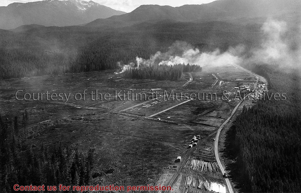
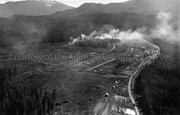
Photograph of looking east showing the clearing operations north of Haisla Boulevard. Note falling operations in the Hospital site. Cranes in cleared area, and vehicles on the road to the right. Smokes visible in center.
Photos belonged to Raymond Stanyer who worked in Kitimat, and were donated by his wife, Pat Stanyer
Scope and Content
Photograph of looking east showing the clearing operations north of Haisla Boulevard. Note falling operations in the Hospital site. Cranes in cleared area, and vehicles on the road to the right. Smokes visible in center.
Photograph of the clearing operations north of Haisla boulevard. Falling operations in the hospital site. Smoke in middle and cars in the road to the right.
Land clearing of Kitimat. All aerials for development.
Custodial History
From the files of Ray Hunstone. Photos from an Alcan binder, have Alcan numbers.
Scope and Content
Photograph of the clearing operations north of Haisla boulevard. Falling operations in the hospital site. Smoke in middle and cars in the road to the right.
Photograph of land clearing operation in neighbourhood C-II. Sewer line under construction in foreground is part of extension to Sagimat temporary housing. Pipe segments in foreground.
Land clearing of Kitimat. All aerials for development.
Custodial History
From the files of Ray Hunstone. Photos from an Alcan binder, have Alcan numbers.
Scope and Content
Photograph of land clearing operation in neighbourhood C-II. Sewer line under construction in foreground is part of extension to Sagimat temporary housing. Pipe segments in foreground.
Photograph of aerial looking south-east across neighbourhood A with neighbourhood A-II clearing in foreground and Minette Bay in the background. Nechako Centre and School are visible.
Donated by Jackie Worboys. Given to the Jackie Mufford Worboys family by Wally Melville.
Scope and Content
Photograph of aerial looking south-east across neighbourhood A with neighbourhood A-II clearing in foreground and Minette Bay in the background. Nechako Centre and School are visible.
Aerial view of Nechako Neighbourhood looking east. looking east. Note clearing for B-III on left side of picture and clearing for City Centre and Neighbourhood D on the right side.
Aerial view of Nechako Neighbourhood looking east. looking east. Note clearing for B-III on left side of picture and clearing for City Centre and Neighbourhood D on the right side.
Photograph of aerial view looking south-west across Teal and Swallow Streets towards the Nechako Centre School and commercial buildings in neighbourhood A-I. Many houses still under construction. Portables can be seen outside Nechako School.
Donated by Jackie Worboys. Given to the Jackie Mufford Worboys family by Wally Melville.
Scope and Content
Photograph of aerial view looking south-west across Teal and Swallow Streets towards the Nechako Centre School and commercial buildings in neighbourhood A-I. Many houses still under construction. Portables can be seen outside Nechako School.