Aerial view of the Kitimat River Bridge site looking East. The townsite camp can be seen at upper right. The building being erected at left centre on the riverbank is the clubhouse of the Kitimat Rod & Gun.
Aerial view of the Kitimat River Bridge site looking East. The townsite camp can be seen at upper right. The building being erected at left centre on the riverbank is the clubhouse of the Kitimat Rod & Gun.
Photograph of Aerial View of Service Centre ; Kildala Neighborhood ; Nechako Neighborhood ; City Centre ; Kitimat General Hospital ; Haisla Bridge ; Parks and Campgrounds ; Municipal ; Radley Park
Photograph of Aerial View of Service Centre ; Kildala Neighborhood ; Nechako Neighborhood ; City Centre ; Kitimat General Hospital ; Haisla Bridge ; Parks and Campgrounds ; Municipal ; Radley Park
Photograph of aerial view looking northwest across Kitimat townsite. B-I & B-II clearing in right hand side of picture. Site of watertowers? visible on far right.
Photos belonged to Raymond Stanyer who worked in Kitimat, and were donated by his wife, Pat Stanyer
Scope and Content
Photograph of aerial view looking northwest across Kitimat townsite. B-I & B-II clearing in right hand side of picture. Site of watertowers? visible on far right.
Large aerial view of Kitimat and the head of the Douglas Channel in 1964.
Notes
Approximate scale 1 inch to 320 feet. Aerial photography flown 30 June 1964 by Hunting Survey Corporation Limited for the Aluminum Company of Canada Limited.
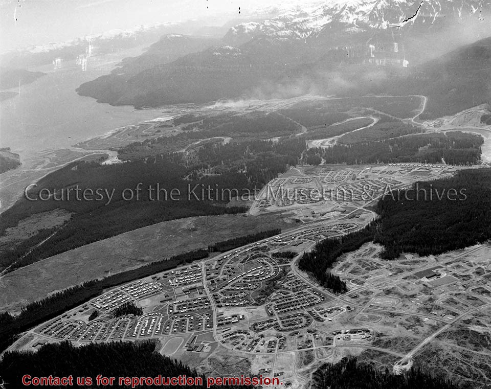
Photo depicts an aerial view of Kitimat, seen is land cleared for Neighbourhood "D" and the Whitesail neighbourhood under construction, right foreground. The Alcan smelter and channel are in the background.
Photo depicts an aerial view of Kitimat, seen is land cleared for Neighbourhood "D" and the Whitesail neighbourhood under construction, right foreground. The Alcan smelter and channel are in the background.
Notes
Title based on content of photograph. Max Patzelt Collection - 1998.1.8351
Photograph of aerial view of Kitimat townsite, 1975. Nechako, Kildala, and in progress Whitesail, and neighbourhood D clearing sites visible. Alcan and Eurcan sites also visible on right side.
Photos donated by Joan Smith for Anglican Church 50th Anniversary. Donated in April 2003.
Scope and Content
Photograph of aerial view of Kitimat townsite, 1975. Nechako, Kildala, and in progress Whitesail, and neighbourhood D clearing sites visible. Alcan and Eurcan sites also visible on right side.