Photo depicts an aerial view of a portion of the Nechako neighbourhood showing the Hullah prototype area, Pintail and Partridge streets, in the foreground.
Photo depicts an aerial view of a portion of the Nechako neighbourhood showing the Hullah prototype area, Pintail and Partridge streets, in the foreground.
Notes
Title based on content of photograph. District of Kitimat Collection
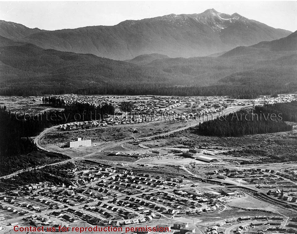
Photo depicts an aerial view of Kitimat, seen is land cleared for Neighbourhood "D" and the Whitesail neighbourhood under construction, right foreground. The Alcan smelter and channel are in the background.
Photo depicts an aerial view of Kitimat, seen is land cleared for Neighbourhood "D" and the Whitesail neighbourhood under construction, right foreground. The Alcan smelter and channel are in the background.
Notes
Title based on content of photograph. Max Patzelt Collection - 1998.1.8351
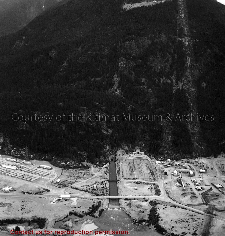
Photo depicts an aerial view of the powerhouse switchyard and entrance up to the 1600' level. The wide clearing on the right is the tram right-of-way. The powerhouse tailrace tunnel and channel and the access tunnel portal are in the centre, and the construction camp is on the left. Alcan Collection
Photo depicts an aerial view of the powerhouse switchyard and entrance up to the 1600' level. The wide clearing on the right is the tram right-of-way. The powerhouse tailrace tunnel and channel and the access tunnel portal are in the centre, and the construction camp is on the left. Alcan Collection
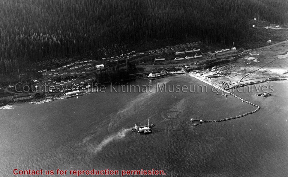
Photo depicts an aerial view of the smeltersite main camp showing married quarters, sternwheeler Delta King, hydraulic fill in progress, recreation building, hospital, power plant, sawmill and water tank.
Photo depicts an aerial view of the smeltersite main camp showing married quarters, sternwheeler Delta King, hydraulic fill in progress, recreation building, hospital, power plant, sawmill and water tank.
Notes
Title based on content of photograph. -- Alcan ID Numbers BC-2-243 and ACM-24311. Alcan Collection 78.11.32
Photo depicts an aerial view looking northwest of Smeltersite housing, the hospital on the beach, the school in the centre, and the seaplane landing ramp.
Photo depicts an aerial view looking northwest of Smeltersite housing, the hospital on the beach, the school in the centre, and the seaplane landing ramp.
Notes
Title based on content of photograph. -- Alcan ID No. J-43-1837. Kitimat Heritage Advisory Commission Collection. KMA No. P00209.jpg
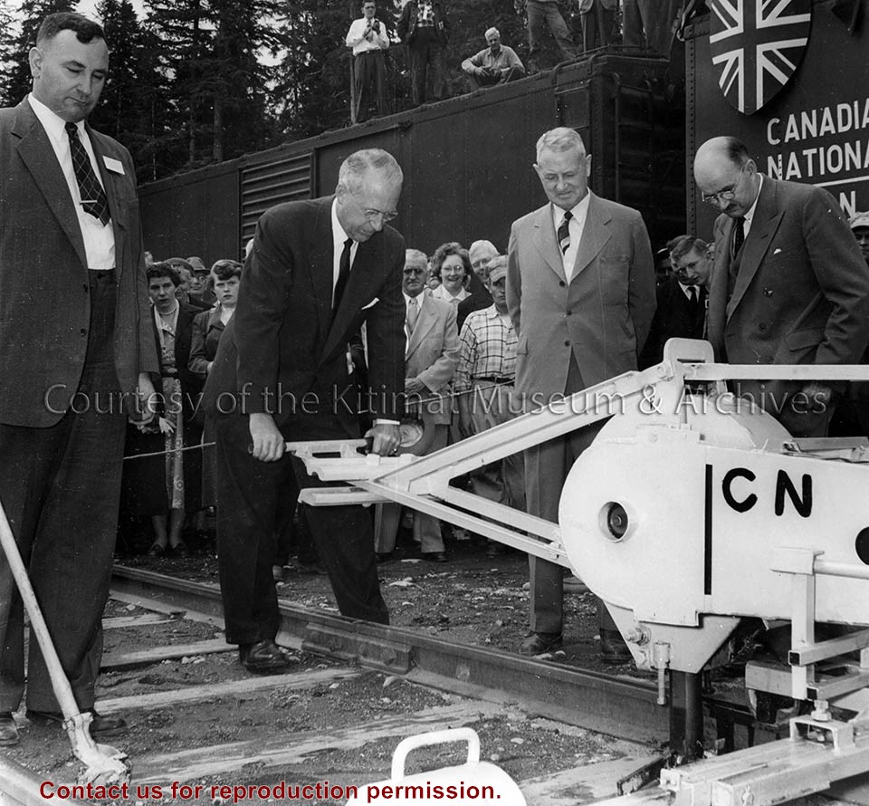
Photo depicts the Last Spike Ceremony for the Canadian National Railway Terrace to Kitimat line. From left is Duncan K. Kerr, Vice President of Associated Boards of Trade of B.C.; S.F. Dingle, Vice President of C.N.R, seen here driving in the aluminum spike.; Major J.L. Charles, Chief Engineer, C.N.R. Western Region; and Percy E. Radley, Alcan Project Manager.
Photo depicts the Last Spike Ceremony for the Canadian National Railway Terrace to Kitimat line. From left is Duncan K. Kerr, Vice President of Associated Boards of Trade of B.C.; S.F. Dingle, Vice President of C.N.R, seen here driving in the aluminum spike.; Major J.L. Charles, Chief Engineer, C.N.R. Western Region; and Percy E. Radley, Alcan Project Manager.
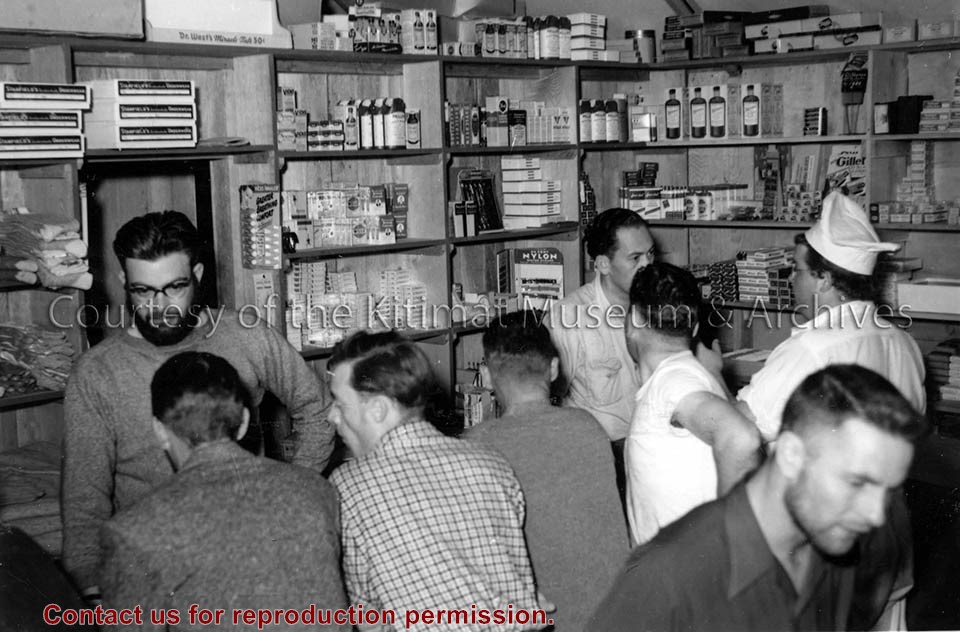
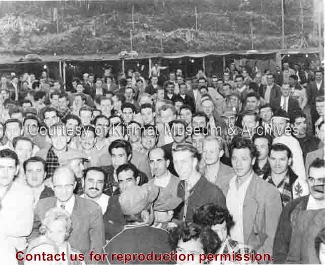
Photo depicts a crowd of mostly men gathered to watch Peggy Burbidge crowned Miss Kitimat at the Elk's Smeltersite Carnival on Dominion Day. Don Stewart, Kitamaat, Haisla Nation, in the crowd (lower left of centre).
Photo depicts a crowd of mostly men gathered to watch Peggy Burbidge crowned Miss Kitimat at the Elk's Smeltersite Carnival on Dominion Day. Don Stewart, Kitamaat, Haisla Nation, in the crowd (lower left of centre).
Notes
Title based on content of photograph. Northern Sentinel Press Collection
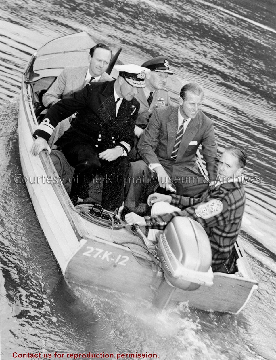
Photo depicts H.R.H. Duke of Edinburgh, Prince Philip, leaving Kitimat by launch to embark on an R.C.A.F. Canso. Four other men accompany the Duke in the boat.
Photo depicts H.R.H. Duke of Edinburgh, Prince Philip, leaving Kitimat by launch to embark on an R.C.A.F. Canso. Four other men accompany the Duke in the boat.
Notes
Title based on content of photograph. -- Alcan ID No. BC-2-1119. Klaus Mueller Collection
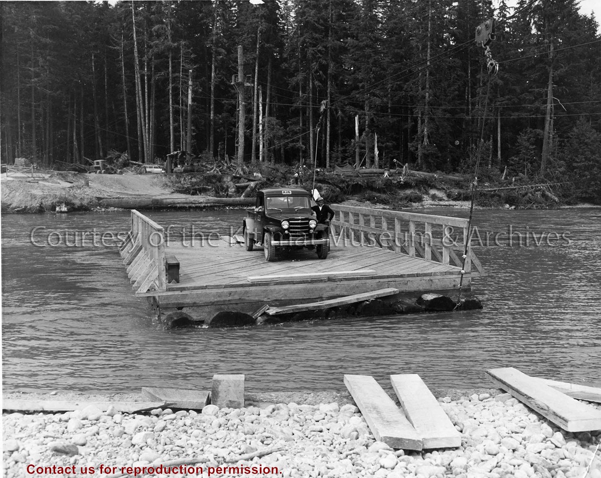
Photo depicts a man standing beside his truck, crossing the Kitimat River aboard a wood construction raft ferry, guard rail on two sides, and guided by a cabling system shown above the river.
Photo depicts a man standing beside his truck, crossing the Kitimat River aboard a wood construction raft ferry, guard rail on two sides, and guided by a cabling system shown above the river.
Notes
Title based on content of photograph. Alcan Collection 73.3.3.29
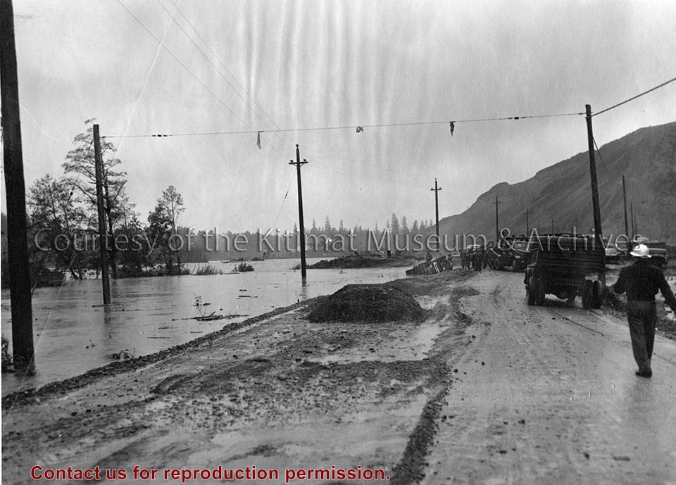
Photo depicts high water conditions of Kitimat River at the south end of Service Centre. Near the water's edge in the background is a truck that has overturned.
Photo depicts high water conditions of Kitimat River at the south end of Service Centre. Near the water's edge in the background is a truck that has overturned.
Notes
Title based on content of photograph. -- Alcan ID No. J-2-183. -- Alcan Public Relations Department ID No. ICT 349-1. Photograph taken at 2:30 p.m. Truck overturned when the road gave way. River elevation was 50.45 feet and rose to a maximum of 51.1 feet at 6:30 p.m. Alcan Collection 73.3.6.13
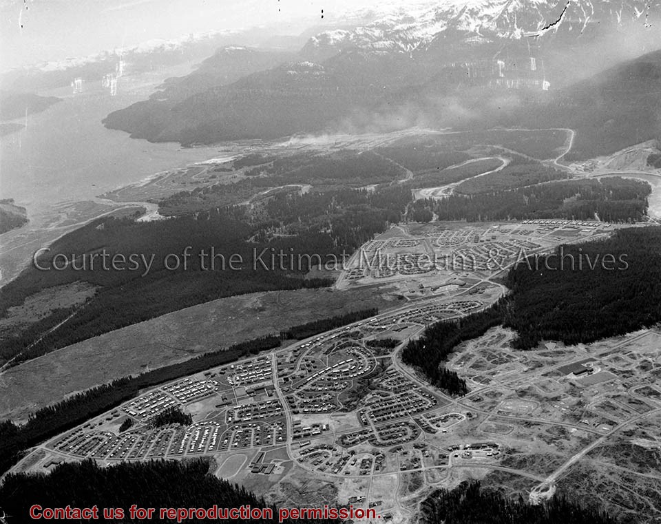
Telephoto depicts the town of Kitimat, an aerial view with Mount Elizabeth in the background, Kildala Neighbourhood in the foreground, and Nechako Neighbourhood "up the hill" in the centre.
Telephoto depicts the town of Kitimat, an aerial view with Mount Elizabeth in the background, Kildala Neighbourhood in the foreground, and Nechako Neighbourhood "up the hill" in the centre.
Notes
Title based on content of photograph. -- Public relations photograph of Kitimat. Fred Busby Collection 2002.27