Photograph of an aerial view the the Alcan plant and Kitimat River Delta. Alcan plant is visible above while the delta is below.
Notes
Back of photo has 2 dates, Jan 23 1985 and Jan 23 1986. The 1986 date is a sticker add on, while the 1985 date is stamped on. The 1985 date is believed to be correct.
Photograph of an aerial view of the Eurocan, Ocelot, and Alcan docks, as well as the Alcan plant. Kitimat River estuary visible on bottom right.
Notes
Back of photo has 2 dates, Jan 23 1985 and Jan 23 1986. The 1986 date is a sticker add on, while the 1985 date is stamped on. The 1985 date is believed to be correct.
Photograph of an aerial view the Ocelot Methanol Plant. Smoke is visible coming from the facility. On the top right Eurocan can be seen, and on the top left is Alcan. Kitimat River below.
Photograph of an aerial view the Ocelot Methanol Plant. Smoke is visible coming from the facility. On the top right Eurocan can be seen, and on the top left is Alcan. Kitimat River below.
Notes
Back of photo has 2 dates, Jan 23 1985 and Jan 23 1986. The 1986 date is a sticker add on, while the 1985 date is stamped on. The 1985 date is believed to be correct.
Aerial view looking north at the plant site, with H.M.C.S. Sioux at the wharf. Tide elevation is approximately 2.5 feet, and the extent of the dredge cut in the harbour can be clearly seen.
In Klaus Mueller's possession when Engineering Depart. was dismantled.
Scope and Content
Aerial view looking north at the plant site, with H.M.C.S. Sioux at the wharf. Tide elevation is approximately 2.5 feet, and the extent of the dredge cut in the harbour can be clearly seen.
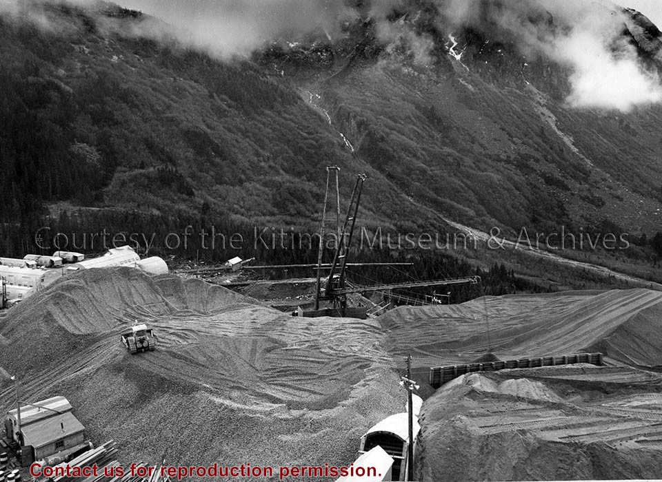
Photo depicts the aggregate stockpile at Horetzky, being built up to a total of 120,000 cubic yards for the power tunnel lining. View is looking south from the top of the batch plant.
Photo depicts the aggregate stockpile at Horetzky, being built up to a total of 120,000 cubic yards for the power tunnel lining. View is looking south from the top of the batch plant.