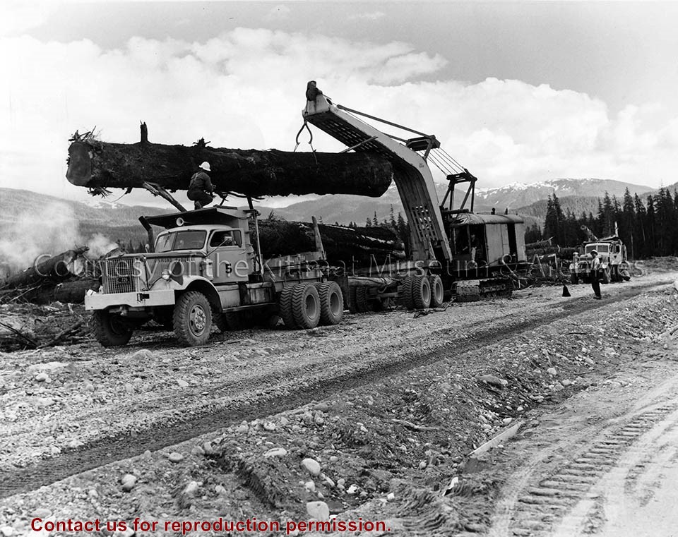
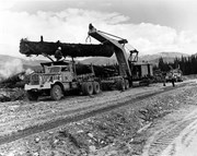
Photograph of neighbourhood C-II showing heel boom loading logs for Minette Bay. Man standing on road on right, and another man standing on vehicle helping with log loading.
Land clearing of Kitimat. All aerials for development.
Custodial History
From the files of Ray Hunstone. Photos from an Alcan binder, have Alcan numbers.
Scope and Content
Photograph of neighbourhood C-II showing heel boom loading logs for Minette Bay. Man standing on road on right, and another man standing on vehicle helping with log loading.
Photograph of aerial picture looking south-east across Kitimat Townsite showing falling in neighbourhood B-IV in the foreground and Minette Bay in the background.
Donated by Jackie Worboys. Given to the Jackie Mufford Worboys family by Wally Melville.
Scope and Content
Photograph of aerial picture looking south-east across Kitimat Townsite showing falling in neighbourhood B-IV in the foreground and Minette Bay in the background.
Photograph of view showing the house erection in neighbourhood A-IV by N.W. Hullah Construction. Framework and sides being built. Building material piled up around. Men visible working.
Donated by Jackie Worboys. Given to the Jackie Mufford Worboys family by Wally Melville.
Scope and Content
Photograph of view showing the house erection in neighbourhood A-IV by N.W. Hullah Construction. Framework and sides being built. Building material piled up around. Men visible working.
Photograph of K-3 school in neighbourhood A-IV. Some parts still under construction. Truck parked outside towards the left. Snow visible on the ground.
Donated by Jackie Worboys. Given to the Jackie Mufford Worboys family by Wally Melville.
Scope and Content
Photograph of K-3 school in neighbourhood A-IV. Some parts still under construction. Truck parked outside towards the left. Snow visible on the ground.
Photograph of Nechako and Whitesail neighbourhood development. Raley, Swannell, Finch, Fulmar, Eagle, and Egret streets visible. Cormorant neighbourhood and Kildala visible in background.
Photos belonged to Raymond Stanyer who worked in Kitimat, and were donated by his wife, Pat Stanyer
Scope and Content
Photograph of Nechako and Whitesail neighbourhood development. Raley, Swannell, Finch, Fulmar, Eagle, and Egret streets visible. Cormorant neighbourhood and Kildala visible in background.
Photograph of aerial view of neighbourhood C. Note debris piles and logs in area C-II in the foreground. Kitlope, Kootney, Capilano, snd Babine streets visible with completed homes.
Land clearing of Kitimat. All aerials for development.
Custodial History
From the files of Ray Hunstone. Photos from an Alcan binder, have Alcan numbers.
Scope and Content
Photograph of aerial view of neighbourhood C. Note debris piles and logs in area C-II in the foreground. Kitlope, Kootney, Capilano, snd Babine streets visible with completed homes.
Photograph of looking northeast across part of neighbourhood 'C' towards Kitimat river bridge. Burning taking place in clearing for Riverlodge development. Winter.
Land clearing of Kitimat. All aerials for development.
Custodial History
From the files of Ray Hunstone. Photos from an Alcan binder, have Alcan numbers.
Scope and Content
Photograph of looking northeast across part of neighbourhood 'C' towards Kitimat river bridge. Burning taking place in clearing for Riverlodge development. Winter.