Photo showing the path to the Kitimat water supply. The water tower can be seen up near the top of a hill in the photo with the path flanked by trees. The pathway is made of a wooden ramp and there is a long hose coming down from the tower with at least two People seen at the towers base.
Photo showing the path to the Kitimat water supply. The water tower can be seen up near the top of a hill in the photo with the path flanked by trees. The pathway is made of a wooden ramp and there is a long hose coming down from the tower with at least two People seen at the towers base.
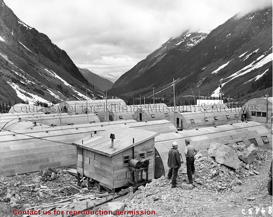
Photograph of panoramic view. Anderson Hill Trailer Camp and Anderson Creek Camp were two seperate places. In the panoramic view Anderson Creek Camp has barracks - located in the left background. Anderson Hill Trailer Camp is located in the foreground - all the way accross the panoramic view. In the middle is Anderson Bridge.
Photograph of panoramic view. Anderson Hill Trailer Camp and Anderson Creek Camp were two seperate places. In the panoramic view Anderson Creek Camp has barracks - located in the left background. Anderson Hill Trailer Camp is located in the foreground - all the way accross the panoramic view. In the middle is Anderson Bridge.
7 photograph prints : color ; 12.5 x 18cm
1 photograph print : color ; 13 x 15cm
2 photograph prints : color ; 8 x 11.5cm
1 photograph print : color ; 6 x 11cm
1 photograph print : color ; 4 x 4cm
1 photograph print : color ; 12.5 x 9cm
Custodial History
Photographs taken by Gisela Mendel in her role as museum curator.
Scope and Content
Images taken from atop Clague Mountain looking down on Kitimat.
Notes
71.75.4 and 71.75.4.0 to 13 (Missing 1, 4, 5, 6, 7, 9)