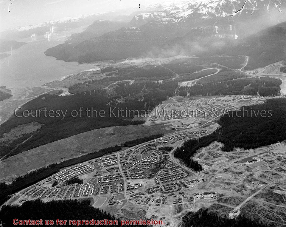
Photo depicts an aerial view of Kitimat, seen is land cleared for Neighbourhood "D" and the Whitesail neighbourhood under construction, right foreground. The Alcan smelter and channel are in the background.
Photo depicts an aerial view of Kitimat, seen is land cleared for Neighbourhood "D" and the Whitesail neighbourhood under construction, right foreground. The Alcan smelter and channel are in the background.
Notes
Title based on content of photograph. Max Patzelt Collection - 1998.1.8351
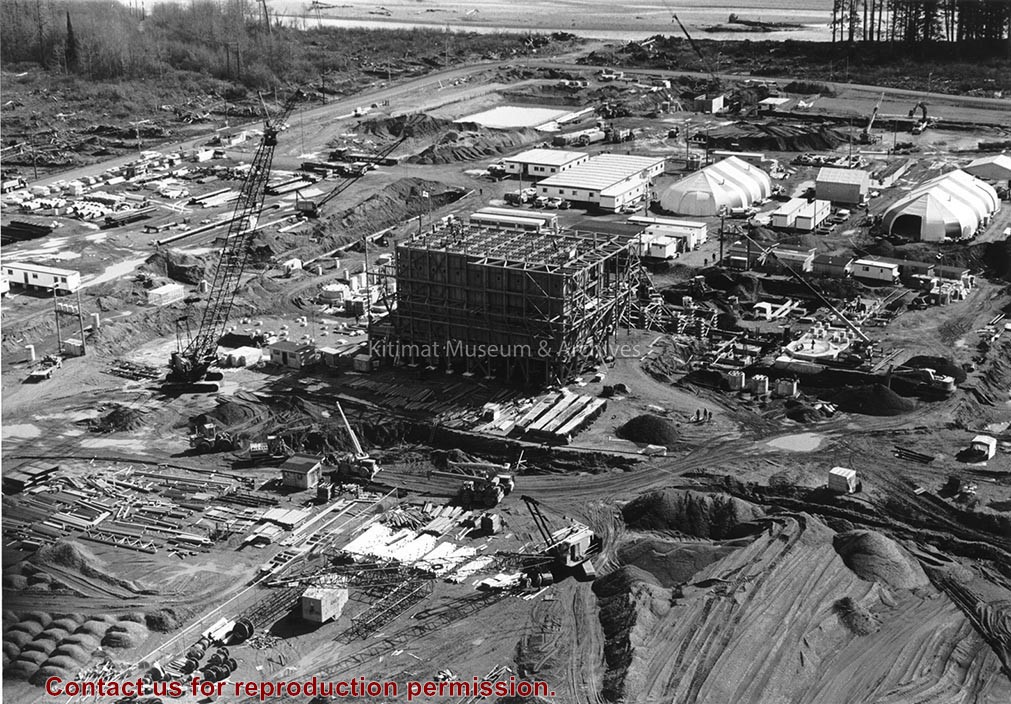
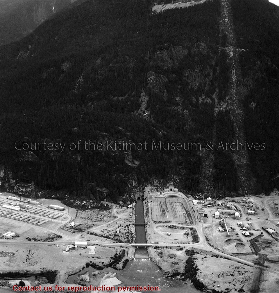
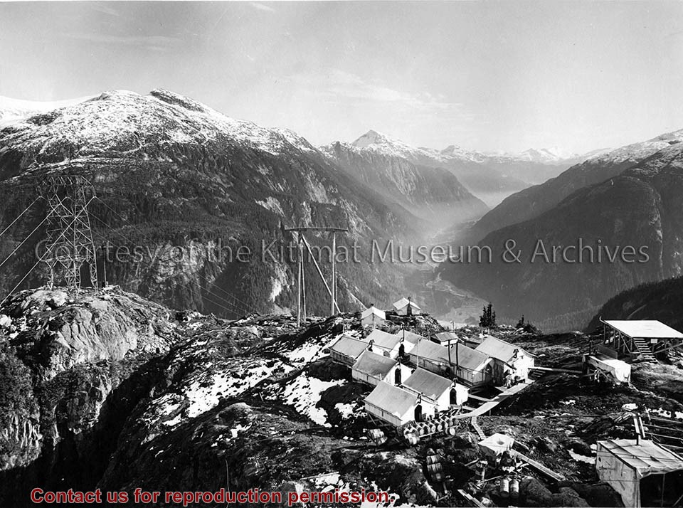
Photo depicts an aerial view of the powerhouse switchyard and entrance up to the 1600' level. The wide clearing on the right is the tram right-of-way. The powerhouse tailrace tunnel and channel and the access tunnel portal are in the centre, and the construction camp is on the left. Alcan Collection
Photo depicts an aerial view of the powerhouse switchyard and entrance up to the 1600' level. The wide clearing on the right is the tram right-of-way. The powerhouse tailrace tunnel and channel and the access tunnel portal are in the centre, and the construction camp is on the left. Alcan Collection
Photo depicts an aerial view looking northwest of Smeltersite housing, the hospital on the beach, the school in the centre, and the seaplane landing ramp.
Photo depicts an aerial view looking northwest of Smeltersite housing, the hospital on the beach, the school in the centre, and the seaplane landing ramp.
Notes
Title based on content of photograph. -- Alcan ID No. J-43-1837. Kitimat Heritage Advisory Commission Collection. KMA No. P00209.jpg
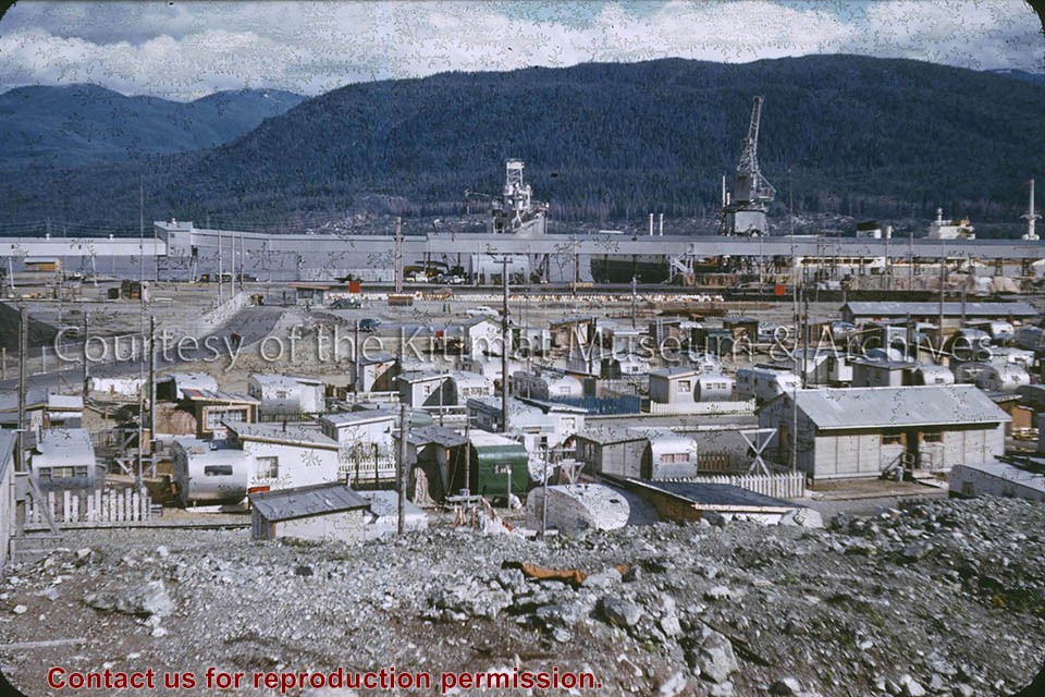
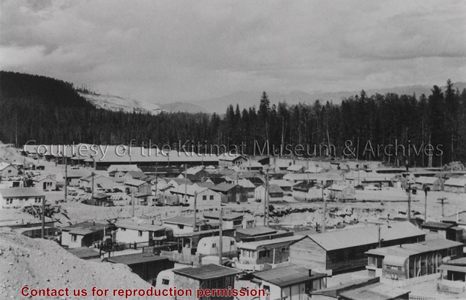
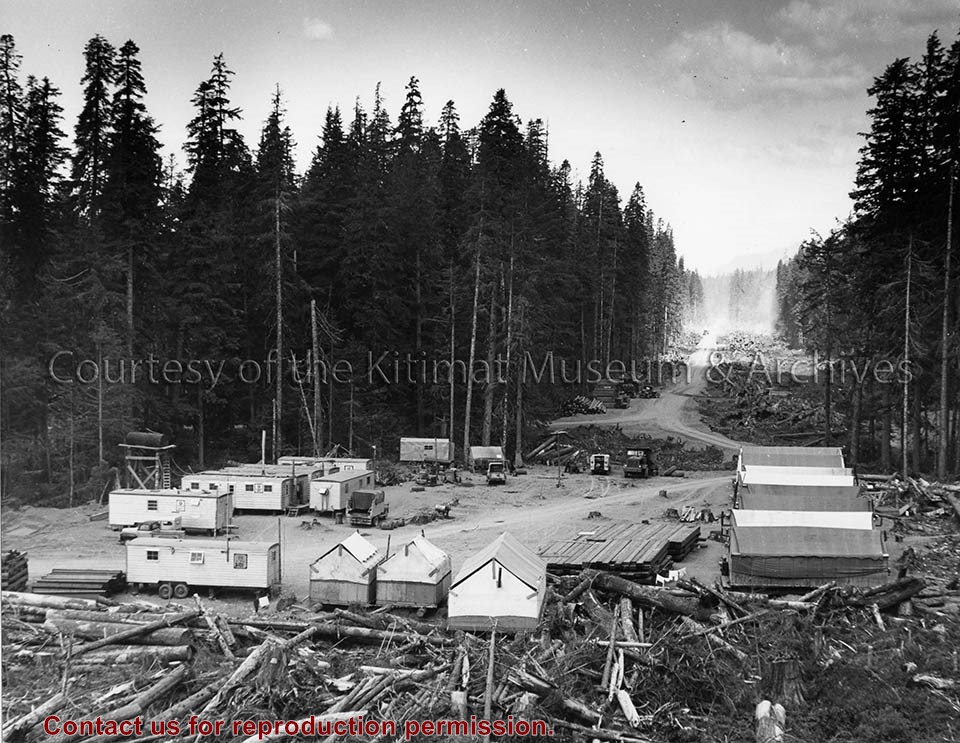
Photo depicts buildings at Anderson Hill Camp. Trailers and wash houses are in the foreground. The men's bunkhouses of Anderson Creek Camp are in the background.
Photo depicts buildings at Anderson Hill Camp. Trailers and wash houses are in the foreground. The men's bunkhouses of Anderson Creek Camp are in the background.
Notes
Title based on content of photograph. John Manders Collection
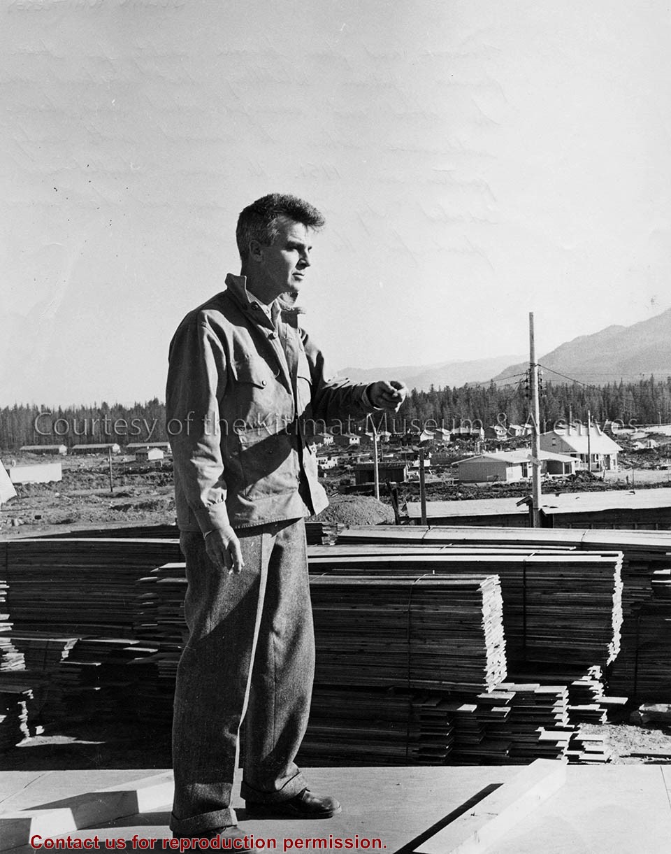
Photo showing Julian Whittlesey standing, left arm lifted slightly, outdoors in City Centre with building materials and Kildala neighbourhood in the background.
Northern Sentinel: Box #4: (A) Historical (1) District of Kitimat (a) Town Planning (i) Mayer, Whittlesey and Glass, New York (ii) Resident Planning Engineer
Scope and Content
Photo showing Julian Whittlesey standing, left arm lifted slightly, outdoors in City Centre with building materials and Kildala neighbourhood in the background.
Notes
Northern Sentinel caption - "Visions and plans become reality for town planner Julian Whittlesey last weekend when he stood and surveyed what was dense wilderness when he arrived with early parties in 1951. He was "thrilled and excited" by what he saw and has more plans for the future."
Photo depicts an aerial view of a portion of the Nechako neighbourhood showing the Hullah prototype area, Pintail and Partridge streets, in the foreground.
Photo depicts an aerial view of a portion of the Nechako neighbourhood showing the Hullah prototype area, Pintail and Partridge streets, in the foreground.
Notes
Title based on content of photograph. District of Kitimat Collection
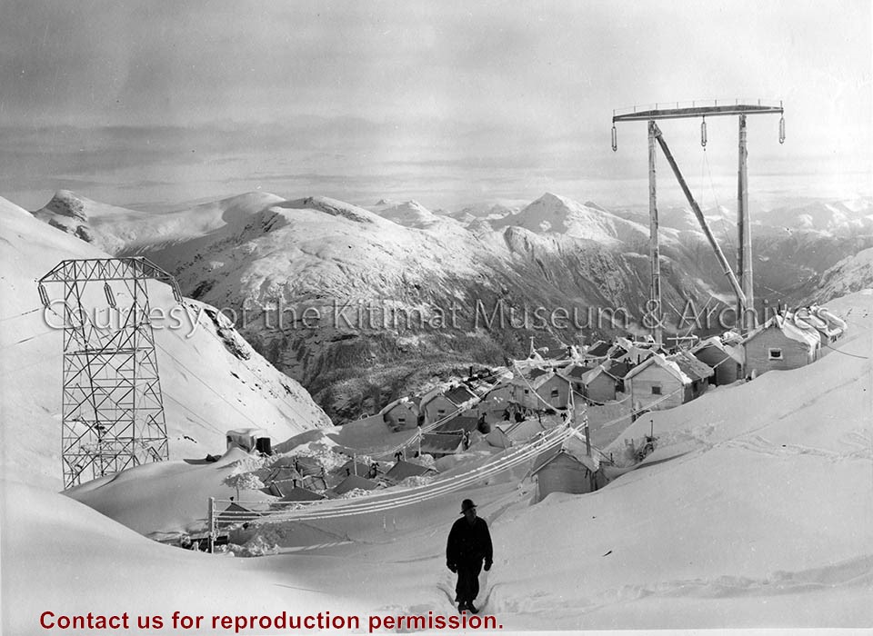
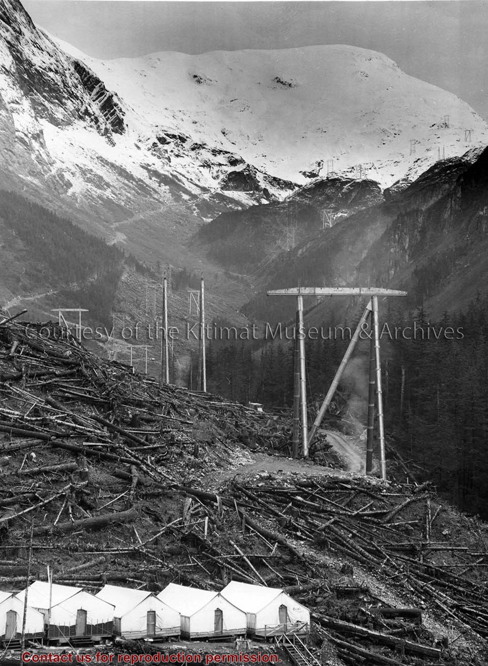
Photo depicts a general view showing Camp No. 11 with towers No. 114R and 115L. Superintendent Bill Richards is in the foreground walking away from the camp towards the photographer. View is looking towards Kemano.
Photo depicts a general view showing Camp No. 11 with towers No. 114R and 115L. Superintendent Bill Richards is in the foreground walking away from the camp towards the photographer. View is looking towards Kemano.
Notes
Title based on content of photograph. -- Alcan ID No. KR-1423. Alcan Collection