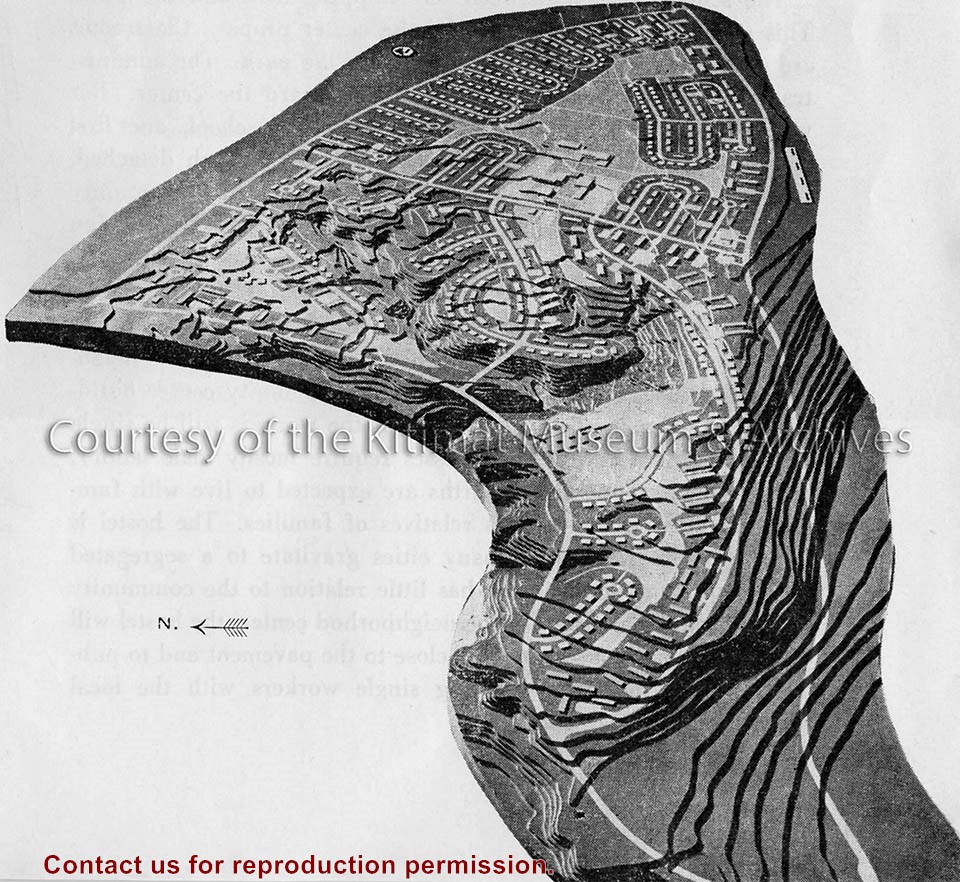
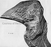
Black covered book titled "Kitimat Townsite Report". No. A-33 Mr. J.E. Dudley. Contains info about early Kitimat and planning. Inside front cover are some loose pages with town plans.
Bud Powell is a longtime resident of Kitimat and former smeltersite resident. He worked for Alcan.
Custodial History
Donated by Bud Powell.
Scope and Content
Black covered book titled "Kitimat Townsite Report". No. A-33 Mr. J.E. Dudley. Contains info about early Kitimat and planning. Inside front cover are some loose pages with town plans.
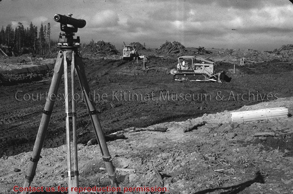
Edwin Charles Bateman (Ted) was a Commando in WWII, and later enjoyed his hobbies of cycle racing, ballroom dancing, and photography. He lived in Toronto, LA, and finally Vancouver in the early 50s. After arriving in vancouver he was offered a job as an assistant surveyor in Kitimat. He was subsequently offered a job as a lineman with what became BC Tel.
Custodial History
Judith Saunders
Scope and Content
Photograph of aerial view of townsite clearing and Haisla bridge.
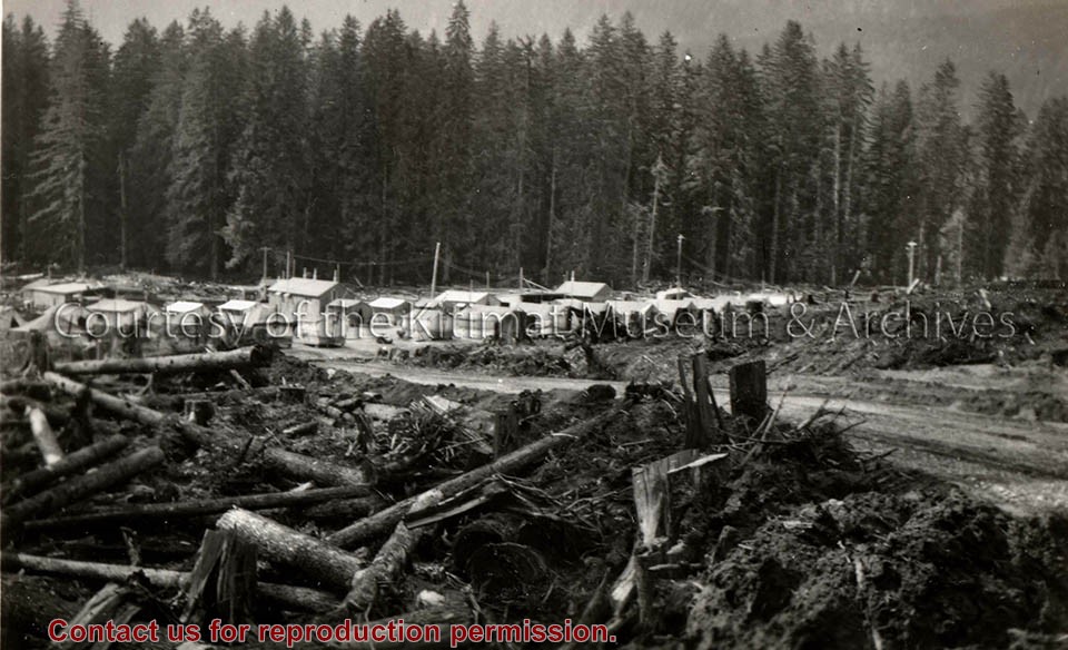
Edwin Charles Bateman (Ted) was a Commando in WWII, and later enjoyed his hobbies of cycle racing, ballroom dancing, and photography. He lived in Toronto, LA, and finally Vancouver in the early 50s. After arriving in vancouver he was offered a job as an assistant surveyor in Kitimat. He was subsequently offered a job as a lineman with what became BC Tel.
Custodial History
Judith Saunders
Scope and Content
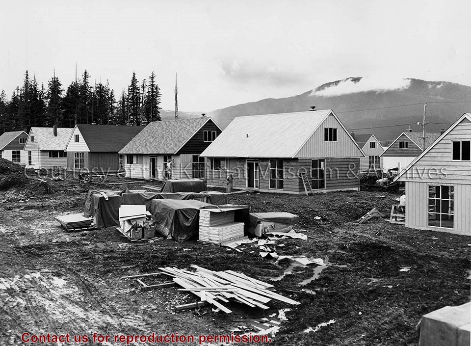
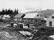
Photograph of aerial view of townsite clearing. Built homes can be seen.
Floor plan created for the Kitimat Hudson's Bay store. The Hudson's Bay Company operated in Kitimat - first at Smeltersite, then in City Centre - since August 18, 1952. The City Centre store opened on December 12, 1956 and closed on June 15, 1985.
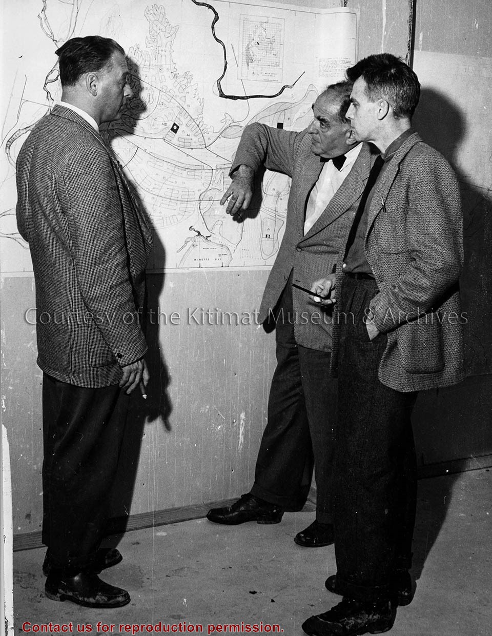
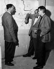
Photo depicts three men examining a map. From left is Alcan's Chief Planner James Dudley from Vancouver; Town Planner Albert Mayer; Julian Whittlesey of New York.
Photo depicts three men examining a map. From left is Alcan's Chief Planner James Dudley from Vancouver; Town Planner Albert Mayer; Julian Whittlesey of New York.
Photographs of early Kitimat and Alcan smelter. Souvenir photobook with five photos.
Townsite with Mount Elizabeth in background. Smoke is visible beyond townsite in the forest. May 15, 1956.
Townsite with sandhill visible in background. May 15, 1956.
Main Road - Motel - Townsite. View of road leading from service centre into town. Kildala area cleared but not much is built. Kitimat River bridge visible at bottom. Aug 1955.
Kitimat Valley. View of Alcan site, hospital beach, and pier. Looking north.
Smeltersite. View of Alcan smelter and smeltersite.
Donated by Carol Larson. Originally belonged to her mother, Lydia Strecheniuk.
Scope and Content
Photographs of early Kitimat and Alcan smelter. Souvenir photobook with five photos.
Townsite with Mount Elizabeth in background. Smoke is visible beyond townsite in the forest. May 15, 1956.
Townsite with sandhill visible in background. May 15, 1956.
Main Road - Motel - Townsite. View of road leading from service centre into town. Kildala area cleared but not much is built. Kitimat River bridge visible at bottom. Aug 1955.
Kitimat Valley. View of Alcan site, hospital beach, and pier. Looking north.
Smeltersite. View of Alcan smelter and smeltersite.
Subdivision plan of part of district lots 6038, 6039 and part of block 29, plan 3435 range 5, Coast District. District Municipality of Kitimat. Plan 4228. November 5, 1961.
Plan of subdivision of parts of D.L. 6046 & west half of D.L. 6045, and parcel. "X" (former block 78 and adjoining road plan 3549) range 5, Coast District. District Municipality of Kitimat. Plan 4639. August 27, 1963.
Plan of portions of block 29 map 3435 district lots 6038, 6039, 6042 & 6043 range 5, Coast District. District Municipality of Kitimat. Plan 3743. November 4, 1957.
Donated by Rick Wozney. Aluminum Company of Canada, Limited (Registered Owner).
Scope and Content
District of Kitimat lot and block plans.
Subdivision plan of part of district lots 6038, 6039 and part of block 29, plan 3435 range 5, Coast District. District Municipality of Kitimat. Plan 4228. November 5, 1961.
Plan of subdivision of parts of D.L. 6046 & west half of D.L. 6045, and parcel. "X" (former block 78 and adjoining road plan 3549) range 5, Coast District. District Municipality of Kitimat. Plan 4639. August 27, 1963.
Plan of portions of block 29 map 3435 district lots 6038, 6039, 6042 & 6043 range 5, Coast District. District Municipality of Kitimat. Plan 3743. November 4, 1957.